
J. L. BELL is a Massachusetts writer who specializes in (among other things) the start of the American Revolution in and around Boston. He is particularly interested in the experiences of children in 1765-75. He has published scholarly papers and popular articles for both children and adults. He was consultant for an episode of History Detectives, and contributed to a display at Minute Man National Historic Park.

Subscribe thru Follow.it


•••••••••••••••••


Showing posts with label William Price. Show all posts

Friday, January 06, 2023

Boston’s Other Gilded Grasshopper

In 1743, William Price published a view of Boston from the harbor, showing the town’s many wharves and steeples.

We can see a digital copy of the Boston Public Library’s copy of Price’s print through Digital Commonwealth.

Harvard offers a crisper and more zoomable image scanned from a facsimile of the print published in the mid-1800s. That’s the source of the detail shown here.

This edifice with a weathervane wasn’t a church or civic building. It was the airy summerhouse in the back yard of merchant Peter Faneuil on Pemberton Hill, across the street from the burying ground beside King’s Chapel.

Eliza S. M. Quincy recalled the form of the weathervane in her memoir:
The crest of the former owner,—a grasshopper,—similar to the vane of Faneuil Hall, yet glittered on a summer-house in the garden, which commanded a view only inferior to that from Beacon Hill.
A few years before Quincy’s memoir was published posthumously, Lucius M. Sargent made a preemptive correction:
A grasshopper was not the crest of Peter Faneuil’s arms. I formerly supposed it was; for a gilded grasshopper, as half the world knows, is the vane upon the cupola of Faneuil Hall; and a gilded grasshopper, as many of us well remember, whirled about, of yore, upon the little spire, that rose above the summer house, appurtenant to the mansion, where Peter Faneuil lived, and died. . . .

The selection of a grasshopper, for a vane, was made, in imitation of…the very same thing, upon the pinnacle of the Royal Exchange, in London.
Nobody seems sure about whether the grasshopper weathervane on the Faneuils’ summerhouse came before or after the one on top of Faneuil Hall. But it’s clear there were two. 

The Faneuil Hall grasshopper, made by metalworker Shem Drowne, is still up there, having survived storms, remodeling, thefts, and other indignities.

As for the Faneuil mansion and summerhouse, they were torn down in the 1830s as the area was redeveloped into Pemberton Square. (George Loring Brown painted the house at that time, but that image doesn’t include the summerhouse.) That neighborhood is now largely covered by the Center Plaza building across from Government Center.

The summerhouse weathervane disappeared with the buildings. But has it just hopped back into sight?

TOMORROW: Grasshopper for sale.

Friday, May 27, 2022

Maps to Explore from Your Desk

The Leventhal Map and Education Center at the Boston Public Library is offering an “Unrest in Boston 1765–1776” collection of digital images from its collection for educators in grades 3 through 8.

The maps to explore are:
  • William Price’s 1769 update of John Bonner’s 1722 map of the town, showing just the Shawmut peninsula. (I have a print of this on my wall.)
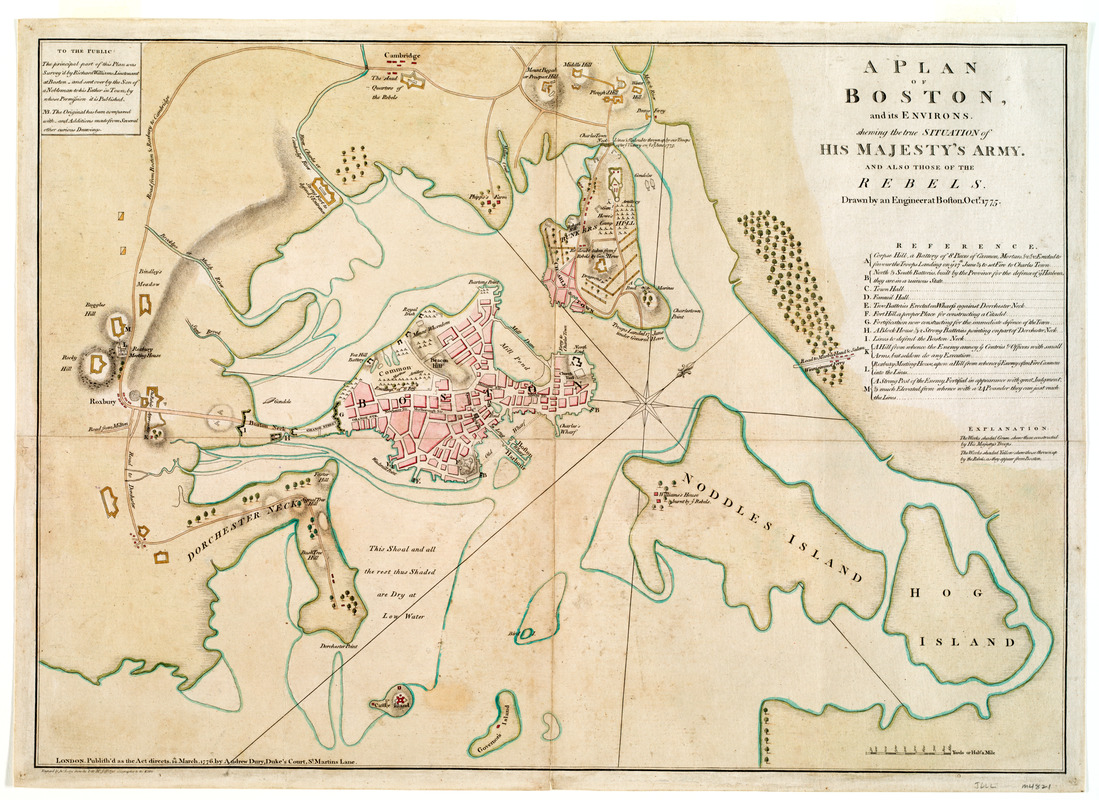
  • Lt. Richard Williams’s map of wartime Boston, the provincial siege lines, and the inner harbor.
  • London publishers Robert Sayer and John Bennett’s “Seat of War, in New England” map of eastern Massachusetts, featuring a little train of figures escorting Gen. George Washington toward Boston.
  • Boston native Isaac de Costa’s map of eastern Massachusetts showing locations from the Battle of Lexington and Concord, including provincial cannon in the countryside.
These maps come with geographic inquiries, supporting documents, and questions for class discussions.

I noted that the overview starts, “Colonial Boston was a flourishing city of 20,000 by the 1760s.” In fact, the 1765 census found 15,520 people in Boston. The surrounding towns, now incorporated into the city, added more people to the area, as did the short-term population of sailors and (at times) soldiers. But this essay makes clear that it counts those soldiers as separate from the town inhabitants.

That census figure is significant not just because of accuracy but also because it hadn’t changed much in decades. Boston was stuck at about 16,000 people while Philadelphia and New York grew larger. What once was Britain’s biggest and busiest port in North America became number three. A frustrating stagnation might have been one reason Bostonians were so easily worked up about imperial taxes in the 1760s.

Before leaving the Leventhal Center, I want to highlight another digitized item from the same decade: This map of the travels of the Qianlong Emperor of China in the fall of 1778.

As an object, this diagram of the imperial route unfolds into an image nearly twenty feet long. (It’s appropriate, therefore, that the interactive feature demands a screen of a certain size before it will show you anything.) The digital presentation comes with helpful explanations by Prof. Anne-Sophie Pratte.

Monday, March 08, 2010

Old and New Views of Colonial Boston

I wish I had the tech and the knowledge to appreciate Charlie Frye’s Historical GIS: Boston 1775. Last year he posted his work at ESRI Mapping Center and explained:

One of the projects I undertook was to create a GIS of Boston in 1775, using only maps published from that period. I eventually included some later source material of reliable historical character to flush out locations for specific or notorious events, structures, and so on. My goal was to create an inventory and therefore as complete a picture as possible of Boston’s environs in 1775. Not only that, I wanted to be able to cite every feature, making it possible to create a map that was in essence a spatial argument for what I think was in Boston in the year 1775.
There’s also a discussion group on using GIS technology to illuminate the Revolutionary War.

I was able to enjoy the Harvard Map Collection’s image of William Price’s panoramic picture of Boston a few decades before the war. The Image Delivery Service page lets you zoom, pan, and (though it’s not really helpful with this view) twirl the image.

But don’t assume that the panorama Price created is entirely accurate. In New England Prospect, Peter Benes notes that Price included church towers that we know hadn’t been built yet. That’s the magic of drawing, after all.