
J. L. BELL is a Massachusetts writer who specializes in (among other things) the start of the American Revolution in and around Boston. He is particularly interested in the experiences of children in 1765-75. He has published scholarly papers and popular articles for both children and adults. He was consultant for an episode of History Detectives, and contributed to a display at Minute Man National Historic Park.

Subscribe thru Follow.it


•••••••••••••••••


Showing posts with label geography. Show all posts

Tuesday, June 23, 2026

The Significance of Breed’s Hill Instead of Bunker’s

For one last posting on the label “Breed’s Hill,” I’ll share some thoughts on whether that label matters.

These days, it’s mostly useful as a fact that people (mostly of the male variety, to be frank) deploy to show they know more than average: ‘Well, actually, the Battle of Bunker Hill was fought on Breed’s Hill.”

Which is true, though:
Even more trenchant, what difference did that name make to the outcome of the battle? How did the “Breed’s Hill” label affect the seizure of the Charlestown peninsula? Or the deaths or wounding of nearly 1,500 men?

Well, actually, there’s an argument that Col. William Prescott’s insistence on fortifying Breed’s Hill before Bunker’s Hill, as he understood his orders to specify, did shape the outcome of the battle. Could the provincials have prevailed if they’d had a strong fallback position?

I’m dubious. The goal of the Massachusetts command—the committee of safety, Gen. Artemas Ward, and his council of war—was to keep the British army from seizing the Charlestown and Dorchester peninsulas, as intelligence said the Crown would soon try to do. The New England army’s countermeasure was to seize those positions first.

The real challenge, as Gen. John Thomas indicated from Roxbury, was holding those positions against a British counter-countermeasure. Thomas didn’t think that was feasible and declined to go onto Dorchester Heights that June.

The geography of Charlestown was more welcoming for such an advance from the mainland, but it doesn’t look like the New England army was truly prepared to hold that ground. With only a couple of days to get organized, the provincials didn’t have all the tools, artillery, and reinforcements lined up to fortify and stay on those high points. We see that from the limited support the front-line troops got during the battle.

Even beyond that, the crucial problem for the New England army turned out to be gunpowder. That would have been a problem no matter which hill they fortified.

To be fair to Gen. Ward, he was worried about a possible second British advance in Roxbury or elsewhere along the siege lines. He couldn’t throw all the provincial resources into Charlestown. But the Continental operation to fortify Dorchester Heights in March 1776 shows how effective preparation could overcome adverse conditions.

I even wonder if fortifying Bunker’s Hill might have changed the British commanders’ thinking in a way that would have produced a worse outcome for the provincials. Gen. William Howe saw a small redoubt on a relatively short hill that was close enough for cannon to reach Boston and thus worth cleaning out. He focused on that spot, with disastrous results.

If Howe had seen fortifications on Bunker’s Hill also or instead, he might have decided on a more cautious strategy, focused on cutting the provincials off at the neck. That might have produced many more rebel casualties and fewer British ones. The New Englanders could have ended the day more dismayed, the regulars more chuffed, with a consequent effect on the larger siege.

Monday, June 22, 2026

“Orders to march to Breeds Hill in Charlestown”

As I quoted yesterday, in July 1775 the Massachusetts Provincial Congress officially deemed the provincial fortification of Breed’s Hill in Charlestown to have been done “by some Mistake.”

Nine months later, Dr. Cotton Tufts echoed that assessment in a letter to John Adams: “Could a greater Blunder have been committed than that of Breeds Hill. Yet it finally has operated to our Advantage and trust will continue to do so.”

By then, New Englanders had decided that the Battle of Bunker Hill had worked out well because, even though they’d suffered hundreds of casualties and lost territory, the cost for the British army was catastrophic.

Who had made that fateful mistake? The report used the passive voice to avoid naming names, but everyone knew the battlefield commanders who’d overseen the building of the redoubt were Col. William Prescott, Connecticut general Israel Putnam, and Massachusetts colonel Richard Gridley of the artillery.

And the rumor I quoted here absolved Gridley, saying one of the top two infantry officers had insisted on Breed’s Hill. Or, to be exact, either Prescott or Putnam had insisted on digging the redoubt there before fortifying a fallback position on Bunker’s Hill, as the other two men thought wise.

Adams followed up the report from Massachusetts with some questions from Philadelphia. On 25 August, Prescott wrote back: “On the 16 June in the Evening I received Orders to march to Breeds Hill in Charlestown. . . . We arrived at the Spot, the Lines were drawn by the Enginier and we began the Intrenchmant…”

No written orders survive. If Gen. Artemas Ward and his council of war did indeed use the name “Breed’s Hill,” that would be our earliest confirmed example of that label, before the newspapers accounts I quoted here. But it’s also possible Prescott wrote “Breed’s Hill” in hindsight to reflect his understanding of those orders.

Prescott’s letter criticized some other officers. Gridley “the Enginier forsook me.” His “Field Officers being indisposed could render me but Little Service.” That makes it notable that Prescott didn’t complain about Putnam overruling his judgment and insisting on fortifying Breed’s Hill first. It thus seems clear that Prescott had been the officer sticking to that course.

Prescott didn’t take that position (figuratively and literally) because he deemed it more strategic for attacking Boston, as some analysts have argued. He declared that he was following instructions from his superiors. Perhaps those orders included some ambiguous term like “Charlestown Hill.” The memory of such a command probably empowered Prescott to convince Gridley to draw the entrenchment lines despite his and Putnam’s concerns—because that’s what they understood the council of war had told them to do.

TOMORROW: Why that mattered.

Sunday, June 21, 2026

“The detachment marched upon this design to Breed’s hill”

After the British army drove provincial troops off the Charlestown peninsula on 17 June 1775, the Massachusetts committee of safety proposed an inquiry into what happened.

Nominally the committee wanted to respond to statements from Gen. Thomas Gage. But I’m pretty sure those politicians were also wondering what factors led to losing the Battle of Bunker Hill.

On 6 July the committee urged the Massachusetts Provincial Congress to form a committee to write this report. The next day, the congress handed that responsibility back to the committee of safety.

The committee then commissioned three Patriot clergymen—the Rev. Peter Thacher (1752–1802, shown here), William Gordon, and Samuel Cooper—to produce the report. Thacher’s draft was published by the American Antiquarian Society. The final report, dated 25 July, appears in the Adams Papers.

The report says that the New England commanders’ plan was to fortify Bunker’s Hill, near the Charlestown neck:
Genl. Gage had issued Orders for a Party of Troops under his Command, to post themselves on Bunkers Hill, a Promontory just at the Entrance of the Peninsula of Charlestown; upon which it was determined, with the Advice of this Committee, to send a Party who might erect some Fortifications upon said Hill and defeat this Design of our Enemies.
But that’s not what happened.

Thacher’s draft is transcribed as:
about 9 o clock in the evening the detachment marched upon this design to Breed’s hill situated on the further part of the peninsula next to Boston, for by a mistake of orders this hill was marked out for the entrenchment instead of the other hill.
Thacher initially finished that sentence to “the hill behind, Bunkers,” a perspective that conflicted with his earlier “the further part of the peninsula.” And should “next to” be “west of,” as in the final report?

After editing for clarity and brevity, the final language was:
just before 9 oClock they left Cambridge, and proceeded to Breeds Hill, situated on the further Part of the Peninsula West of Boston, for by some Mistake this Hill was marked out for the Entrenchment instead of the other…
That report thus officially distinguished between Bunker’s Hill and Breed’s Hill. As laid out in previous postings, the term “Breed’s Hill” hadn’t appeared in print until shortly after the battle. This report deemed that distinction significant—indeed, a matter of life and death.

Thus, the name “Breed’s Hill” for that part of Charlestown’s geography was solidified by the battle fought there and the need to discuss it. Before June 1775, that might have been the local name, or one of the local names, but it wasn’t on any map, any official document, or any known letter. By the end of July, the “mistake” about Breed’s Hill was on its way to being notorious.

TOMORROW: What difference does it make? 

Saturday, June 20, 2026

“The engineer and two generals went on to the hill”

engraved portrait of Israel PutnamYesterday I quoted Samuel Gray’s 11 July 1775 description of the Battle of Bunker Hill, based on what he called “my own knowledge.”

Gray wasn’t in the battle—he was probably behind the lines in Roxbury—but he could describe the terrain and basic action.

Gray then went on to share a rumor that must have been going around the provincial camps, specifying that this wasn’t first-hand knowledge:

I am informed that, in a council of war, it was determined to intrench on Charlestown Hill and on Dorchester Hill the same night, but not till we were so supplied with powder, &c., as to be able to defend the posts we might take, and annoy the enemy; that on Friday a resolution was suddenly taken to intrench the night following, without any further council thereon; that the engineer and two generals went on to the hill at night and reconnoitered the ground; that one general and the engineer were of opinion we ought not to intrench on Charlestown Hill till we had thrown up some works on the north and south ends of Bunker Hill, to cover our men in their retreat, if that should happen, but on the pressing importunity of the other general officer, it was consented to begin as was done.
Gray didn’t name names. But “the engineer” was Richard Gridley, commander of the artillery regiment. The “two generals” were William Prescott (actually a colonel) of Groton and Israel Putnam from Connecticut (shown above).

A fair amount of ink has flowed out debating whether Prescott or Putnam was responsible for building the redoubt on Breed’s Hill (Gray’s “Charlestown Hill”) before fortifying portions of the taller Bunker’s Hill.

Some authors have written Putnam made that call, based on his higher rank; his image as fearless, aggressive fighter; and a conviction that he was in command of the provincial troops during that battle.

Others point out that Prescott oversaw the building of the redoubt and then its defense while Putnam was more focused on Bunker’s Hill, trying to get men to fortify there.

And of course there’s the possibility that Gray’s information was incorrect, that Gridley, Putnam, and Prescott did discuss where to fortify but didn’t divide so neatly, at least on that night.

This letter confirms that in the weeks after the battle people were asking why the provincials positioned themselves as they did. Because that was turning out to be a very big deal.

TOMORROW: Mistakes were made?

Friday, June 19, 2026

“Intrenched on the southerly part of Charlestown Hill”

In his History of the Siege of Boston, Richard Frothingham published a letter about the Battle of Bunker Hill written by Samuel Gray in Roxbury on 12 July 1775.

That letter was addressed to a “Mr. Dyer.” I agree with Bernard Knollenberg’s guess that Samuel Gray was from Windham, Connecticut, probably the man born in 1751 who served as a Continental Army commissary, and “Mr. Dyer” was his uncle Eliphalet Dyer, or another maternal relation.

Gray provided an account of the battle that gives us a different name for where the provincials dug their redoubt:
Friday night, after the 16th of June, a large part of the Continental army intrenched on the southerly part of Charlestown Hill, on the height toward Charles River. North of this hill lies Bunker Hill, adjoining East or Mystic River. Between these two is a valley. North of Bunker Hill is a low, flat, narrow neck of land, the only avenue to the hill and town. The low neck and the valley (both which must be passed in advancing to or retreating from the intrenchment) are exposed to a cross fire from the ships and floating batteries on each side, and the valley to the fire of the battery on Copps Hill, in Boston.

About sunrise, the 17th, our intrenchment was discovered, and a heavy fire immediately began from the ships and batteries, which continued with very little cessation till about one o’clock, when a large party of the ministerial troops landed on a point of land S. E. from the intrenchment, about 4 o’clock. The savages set fire to the town, beginning with the meeting-house. A heavy fire from the cannon and musketry was kept up on both sides till about five o’clock, when our men retreated:…
Gray thus referred the high spot above the Charlestown waterfront as “Charlestown Hill,” different from “Bunker Hill” to the north. And he apparently thought Dyer would recognize those designations.

I haven’t found “Charlestown Hill” in any newspaper, but some other eighteenth-century sources use the term:
  • Isaac Winslow, 10 July: “We were alarmed by the firing of guns the morning of the seventeenth of last month and found the country people had erected a work on Charlestown Hill.”
  • James Jeffry, 7 July, in Québec: “This day four or five topsail vessels arrived, a transport or two from Boston. The report off the Capt. of one of the transports is that the battle was at Charlestown hill; that a party of Provincials were on the evg. of the 17th. entrenching themselves there & a party of the Regulars were sent out to dislodge them.”
  • William Cooper, 3 Jan 1776 letter: “an attested Copy of the account of the Battle on Charlestown Hill”
But of course that nomenclature isn’t entirely clear for us. Decades earlier, Judge Samuel Sewall wrote in his diary on 5 Oct 1709, “As came homeward went over Charlestown Hill on the Neck of Land; and came into the Rode again by Mr Emerson’s.” That appears to use the same term to refer to Bunker’s Hill.

And in a 26 Jan 1776 letter from Boston, Lt. William Carter twice used “Charles-Town Hill” to mean Bunker’s Hill since he was writing about the promontory that the British army had fortified against the Continentals.

At the very least, these sources offer more evidence that “Breed’s Hill” hadn’t yet solidified as the name of the place where the provincials built their redoubt.

TOMORROW: The choice.

Thursday, June 18, 2026

“Breed’s Hill, about half a mile from the ferry”

Yesterday I started to dig into a recent social-media post by the City of Boston Archaeology Department about when the term “Breed’s Hill” arose.

The department has used claims from Charlestown residents seeking compensation for their damaged property in 1776 to produce a terrific website about the town one year earlier, just before it was destroyed in battle.

It looks like those locals didn’t label the height where the provincials dug their redoubt as “Breed’s Hill.”

The social-media posting went on to say: “It’s possible some may have called it Breed's at the time, but deeds & other official documents do not start using that name until the 1790s, long after the battle.”

Outside of legal documents, however, we do have examples of people describing the provincial redoubt as having been on “Breed’s Hill” very soon after the battle on 17 June 1775. Examples include:
  • Letter from Isaac Lothrop, delegate to the Massachusetts Provincial Congress from Plymouth, 22 June 1775, copied by Thaddeus Burr and published in Rivington’s New-York Gazetteer on 29 June: “took possession of Breed’s hill, about half a mile from the ferry”
  • Extract of a letter from Hartford, 23 June 1775, printed in the 28 June Pennsylvania Journal: “The Provincials were entrenched at Breed’s Hill, & were there first attacked;…the Regulars are entrenched at Bunker’s Hill”
  • Extract of a letter from Cambridge dated 12 or 21 or 22 July 1775 [the scan is blurry], printed in John Pinkney’s Virginia Gazette on 3 August: “The Enemy are situated on Bunker’s and Breed’s hills, both on the peninsula . . . every man in Boston, and at Bunker’s and Breed’s Hill must fall”
Thus, by the summer of 1775 some people were making a distinction between Breed’s Hill, center of the fighting on 17 June, and Bunker’s Hill, fortified afterward by the British army. None of those correspondents were from Charlestown, though. 

It’s notable that no newspaper in Boston or elsewhere mentioned Breed’s Hill by that name before the battle. There are some mentions of the Breed family of Charlestown, and of Samuel Swan, who owned part of the hill, sold wine, and hired out a horse. But the hill didn’t attract journalistic attention.

For that matter, neither did Bunker’s Hill. Not until war broke out and the British column ended their march there on the night of 19 Apr 1775. Then the newspapers referred to “Bunker’s Hill.”

But as to whether everyone agreed that that label did or didn’t also include what people would soon write about as “Breed’s Hill” is foggy.

TOMORROW: An alternative name.

Wednesday, June 17, 2026

“Ye pasture where ye fight was in June”

On this anniversary of the Battle of Bunker Hill, I’m taking note of a document the City of Boston Archaeology Department recently highlighted which touches on the term “Breed’s Hill.”

The department’s social media stated:
Samuel Swan, who owned the pasture where the battle took place, wrote in his claim for damages, “the Pasture where the fight was in June & pasture on Bunker’s Hill, breastwork on it & the ground almost all cut up within the breastwork.” The actual owner of the hill calls it Bunker’s Hill.
I was excited by this finding and was planning to simply pass on the news. But on digging down to the documents I’m not convinced.

The problem is that Samuel Swan owned three pastures on the Charlestown peninsula, according to his claim in March 1776. One was on the hill where the provincials built their redoubt, the focus of the 17 June battle. Swan’s larger tracts were to the west, near the neck. We can see all three on the map of 1775 Charlestown real estate that the department has created.

The department has shared a scan of Samuel Swan’s document about his pastures. I wish the wording, punctuation, and difference between “ye” and “&” were clearer, but I think it says:
Swans Act. of Trees Apple, Loacust, Button wood Pair [pear] in my 3 pastures. 250 at Least my son sett 200 Loacust & Aple trees—

Stone Walls [of ye?] 3 pastures Great part took away. all ye Rales Gone. ye Ground Cutt Great part of it ye pasture where ye fight was in June. ye pasture on Bunker hill Brest work on it & ye Ground almost all Cutt up within ye Brest work ye Loer part ye other Pasture Cutt up not much ye Well wholly Filled up—
It looks to me like Swan was distinguishing between “ye pasture where ye fight was in June” and “ye pasture on Bunker hill Brest work on it.” I think the latter phrase referred to the large fortification that the Royal Engineers built on Bunker’s Hill rather than to the provincials’ redoubt.

(As for Swan’s “other Pasture,” that sustained less damage because it was on lower ground, so neither the provincials nor the regulars built works there.)

By my reading of his claim, Swan referred to the promontory near the neck as “Bunker hill” and didn’t name the hill where the monument now stands at all.

TOMORROW: Words, not deeds.

Tuesday, May 26, 2026

“Environmental History & the War of Independence” in Boston, 27 May

David Hsiung is the Dr. Charles R. and Shirley A. Knox Professor of History at Juniata College in Pennsylvania.

For several years he’s been working on the problem of how the enviroment affected the American Revolution, how the Revolution affected the environment, and how it’s possible to study those interactions with the data we have.

That is, of course, a huge topic, so part of the historiographical challenge is, I’m sure, to narrow down and define the questions in a manageable way. In the meantime, I’ve been enjoying his articles and lectures, which always open my eyes to new ways of seeing this history.

On Wednesday, 27 May, David Hsiung will be at the Massachusetts Historical Society for a conversation with Joyce A. Chaplin of Harvard, author most recently of The Franklin Stove: An Unintended American Revolution.

The description of “Curious & Complex Connections: Environmental History & the War of Independence” says:
Many of us give only a moment’s thought about the environment when considering the War of Independence: the slope of Breed’s Hill, the ice-choked Delaware River, and diseases such as smallpox. But what might we gain by connecting biology, ecology, and geology to the thinking and actions of soldiers and civilians? Rebels and British soldiers acquired and used energy in the form of food, fuel, and work animals, which shaped people’s lives, the course of the war, and the direction of environmental change.
This is a hybrid event starting at 6 P.M., with a reception in the preceding half-hour for people attending in person. Attendance costs $10, but is free to M.H.S. members and Card to Culture participants. Listening in online is free. Register for either form of access through this page.

Folks can also take in these talks from Prof. Hsiung:

Thursday, February 12, 2026

“Cast away upon the Isle of Sable”

There are a lot of unanswered questions about the disappearance of Capt. Thomas Parsons, his ship, and his crew in early 1772.

As colonial newspapers show, shipwrecks happened all the time. The rocky shores of Nova Scotia were notorious for their dangers.

For example, on 16 Sept 1773, the Massachusetts Spy ran this report from John Callahan, just arrived from London:
Capt. Callahan, last Thursday se’nnight, went on shore at Cape Sable, where he saw the Wreck of a Snow, New-England built, Pink Stern, called the Kitty, loaded with Lumber, had all her Cargo on board, but her Sails, Rigging and Crew gone.
That might seem mysterious, even suspicious. But back on 10 May the Boston Post-Boy had reported:
A Fisherman, who arrived here last Week, informs, that the Snow Katy, Capt. Major, from this Port for Newfoundland, is cast away upon the Isle of Sable: The Vessel and Cargo is entirely lost; the Captain and Mate, with great Difficulty saved their Lives, and the Remainder of the Crew, (five in Number) perished.
In the case of Capt. Parsons’s schooner, within a year New Englanders suspected he’d met with foul play. What led them to that conclusion? Unfortunately, our sources don’t say.

Those sources do raise some geographic questions about this voyage. One is why, if Capt. Parsons was heading from Newburyport to the Caribbean, he’d ended up far north. Perhaps that was a way of catching trade winds. Perhaps a storm had pushed his ship off course. Perhaps people didn’t remember his destination accurately. Or perhaps Parsons’s ship was returning from the islands and overshot Cape Cod because of weather.

The March 1773 news item quoted here said a schooner had been lost “near Cape-Sable,” which is the southernmost corner of the Nova Scotia peninsula. In Newburyport people came to believe Parsons had met his fate at “St. Mary’s,” which must mean St. Mary Bay’s at the westernmost corner. Was that close enough to count as “near Cape-Sable” to a New Englander?

Yet another mystery: Near the mouth of St. Mary’s Bay sits the village of Comeauville, where Basile Boudrot was granted 300 acres in May 1772. That was three months after Capt. Parsons reportedly left Newburyport, and in that season Boudrot was supposedly busy digging up buried money. Yet somehow the people of New England came to believe that Basile Boudrot was responsible for the death of Capt. Parsons and his crew.

TOMORROW: Spotting the culprit?

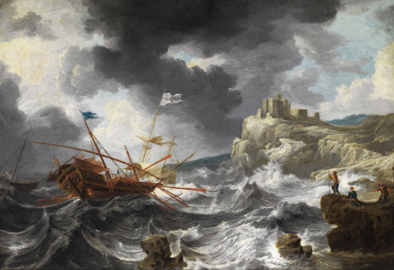
[The picture above is Bonaventura Peeters’s “Shipwreck,” ca. 1652, courtesy of the Journal of Historians of Netherlandish Art.]

Tuesday, August 05, 2025

“On the Alarm being given…”

The Massachusetts Patriots weren’t the only folks building an alarm system over the winter of 1774–75.

On 30 December, Gen. Thomas Gage set out this plan for his garrison in case they were attacked from the countryside:
The Alarm Guns Will be Posted at the Artillery Barracks, the Common & the Lines, the Alarm given at either of those places, is to be repeated at all the rest, by firing three Rounds each.

On the Alarm being given the 52d Regt. is immediately to Reinforce the Lines, leaving a Captain & 50 at the Neck, The 5th Regt. will draw up between the Neck Guard & the Liberty Tree.

The 4th or Kings own Regt. will Reinforce the Magazine Guard with a Captain & 50 and with the Remainder draw up under Bartons Point.

The 43d Regt. will join the Marines & together defend the Passage between Bartons Point & Charles Town Ferry.

The 47th Regt. will draw up in Hanover Street securing both the Bridges over Mill Creek.

The 59th Regt. will draw up in the Front of the Court House.

The 3 Companies of the 18th Regt. joined by those of the 65th Regt. the 10th 23d & 38th Regts will draw up in the Street between the Generals House & Liberty Tree.

Majors [William] Martins Company of the Royal Regt. of Artillery will move with expedition to the Lines, Reinforcing the Neck with one Commission’d Officer 2 Non Commission’d & 12 Men the Remainder of the Royal Regt. of Artillery will get their Guns in order & wait for orders.

If any Alarm happens in the Night, the Troops will March to their Post without Loading, & on no Account to Load their Firelocks, it is forbid under the Severest Penalty to fire in the Night, even if the Troops should be fired upon, but they are to Oppose & Route any body that shall dare to Attack them (with their Bayonetts) And the greatest care will be taken that the Countersign is well known to all the Corps & Small Parties, Advanced, that in case of meeting they should know their friends & not Attack each other in the Night thro’ Mistake.

The Officers Commanding Regts will Reconoiter the Streets leading from their Quarters, to their Respective Alarm Posts. & fix upon the Streets they intend passing thro’, each taking a different Route.
Bartons Point was the northwest tip of the town, sticking out into the Charles River. It’s striking that the army adopted the designation “Liberty Tree” for the big elm in the South End, despite its political origin.

Gen. Gage’s plan was never implemented, of course. On 20 Apr 1775, he stated: ”All former Orders Respecting Alarm Posts to be Cancel’d, & the Regts. to form in their Barracks.”

Saturday, July 05, 2025

“Siege and Liberation of Boston,” 7–8 Aug.

Registration is open for the third Pursuit of History Weekend that I’ve helped to program, this one on “The Siege and Liberation of Boston” on 7–8 August.

Organized with the folks who manage History Camp, these sessions are designed to offer in-depth looks at developments 250 years ago through expert speakers and visits to the actual sites where the history happened.

We’ll start on the slope of Breed’s Hill in Charlestown, exploring what turned out to be the decisive battle of the first campaign of the Revolutionary War. Sam Forman and Mary Adams will introduce two of the leaders of the American forces, Dr. Joseph Warren and John Stark. We’ll walk the battlefield and hear about ongoing investigations of the landscape from Boston City Archaeologist Joe Bagley. Then we’ll take a road trip to other places that the Continental Army fortified, which few visitors see. That day we plan to have meals at two restaurants that go back to the eighteenth century.

On the following day, we’ll move into the North End, collaborating with the Paul Revere House, the Old North Church, and veteran tour guide Charles Bahne to offer an in-depth look at the experience of living inside besieged Boston. Finally, I’ll speak about George Washington as a new commander-in-chief, what he thought his job was, and what he really learned.

The Pursuit of History webpage for this event has a video of me explaining more. Sam Forman and I are also scheduled to talk about the siege and this event in the History Camp discussion series on Thursday, 10 July, at 8:00 P.M.

This Pursuit of History Weekend is not, in fact, on a weekend but on a Thursday and Friday. That’s to allow people to also attend History Camp Boston on Saturday, 9 August, and even the related tours the next day if their history interests are still unsated.

And speaking of History Camp Boston 2025, I’ll be speaking there, too. My topic is related to the end of the Boston siege. That talk is called “Henry Knox, Loyalist?” It offers a new interpretation of that American general’s rise to prominence.

Tuesday, July 01, 2025

“To-morrow I go on another attack”


We met Thomas James as a major in the Royal Artillery stationed in New York in 1765. After he vowed to protect the stamped paper and said nasty things about the people opposing the new tax, a crowd attacked his home.

Maj. James went home to Britain to report on the situation to Parliament, and he reported on Parliament to royal authorities in New York.

By 1771 James was a lieutenant colonel in the artillery. In that year he published an illustrated two-volume study titled The History of the Herculean Straits, Now Called the Straits of Gibraltar: Including those Ports of Spain and Barbary that Lie Contiguous Thereto.

The “authour,” as he’s called on the title pages, had served in Gibraltar in 1749–1755. He’d been working on this book for years, and is credited with being the first Englishman to publish observations on the area’s geography.

In 1775 Lt. Col. James was inside besieged Boston. Here’s his brief report on the aftermath of the Bunker Hill battle in a letter to Lt. Col. Francis Downman in London dated 23 June 1775:
We are in thickness of war, we have had two battles already, in the last we carried our point, took the lines and a strong redoubt, with 2,500 men against 7,000.

We have upwards of 80 officers killed and wounded, and the flower of the grenadiers and light infantry; some regiments have but five grenadiers left. We had at one gun the officer and volunteer wounded, and but one man without a wound. [Capt.-Lt. John] Lemoine is wounded, so are [Capt. W. Oren] Huddlestone and [Lt. Ashton] Shuttleworth. We are well. My volunteer hands have been full.

To-morrow I go on another attack, covering the left in my gondolas, which I have made, viz., three with a heavy 12-pr. in each prow. Adieu.
James’s “gondolas” seem to have gone down in American records as the Crown’s “floating batteries.”

It’s notable that both sides of the Bunker Hill battle insisted they were heavily outnumbered by the enemy.

Sunday, April 27, 2025

Earl Percy’s Map of the Route to Safety

American Heritage just shared a scoop in Edwin S. Grosvenor‘s article “Discovered: First Maps of the American Revolution.”

It’s based on a return visit to the seat of the Dukes of Northumberland, a title bestowed on Earl Percy’s father and inherited by him after his return from the American war.

Grosvenor writes about one document:

On the newly found map, Percy had drawn his route from Lexington to Menotomy and back to Boston. “He's sketching the line of march,” observed local historian Michael Ruderman, studying the new Percy map. “It's the theatre of battle, the hostile territory he had to travel during the afternoon. And he's sketching the landmarks that were significant to him like the Old Powder House tower that he passed on his left."

The Percy map provides many details about the landscape, roads, taverns, and houses that existed in 1775.

Percy averted an even greater disaster by marching his 1,700 men by an unexpected route. Rather than continuing straight to Cambridge, he took a left turn to head to the Charlestown neck, where the ships of the Royal Navy could protect his force with their guns and ferry him across the Charles River, back to Boston.

For nearly 250 years, the maps lay forgotten in a box with dozens of other maps of Revolutionary war battles and encampments brought back by Gen. Percy.
The caption explains: “When rotated with north facing up, the town of Medford is in the upper left, with the home of ‘Col. [Isaac] Royal’ marked outside the town.” At the center, looking like rude high-school graffiti, is the Charlestown powderhouse.

In the lower right corner is Cambridge. Along the bottom is the road from Menotomy village into central Cambridge with several landmarks labeled: “Menotomy mill:g House,” “Adams’s Tavern,” “Brook,” “Grove of Locust Trees,” and “Tavern.”

The last stands at the crucial corner where Col. Percy turned his column onto “Kent’s Lane through which the Troops return’d from Concord” to Charlestown.”

Sunday, January 05, 2025

Mapping Boston in 1795

ARGO (American Revolutionary Geographies Online) offers a new article by John W. Mackey titled “Practical Knowledge and the New Republic.”

It begins:

Perhaps what is most visually striking about Osgood Carleton’s recently rediscovered 1795 map of Boston is its sheer size. At approximately seven feet by six and a half feet, this wall map dwarfs many other Boston maps of the late eighteenth century, including Carleton’s own 1797 work, which until recently was considered the largest Boston map from this period known to be extant in a collection.
This isn’t a printed map but a drawing. The Massachusetts Charitable Mechanic Association donated it to the Leventhal Map & Education Center at the Boston Public Library in 2021. Based on a cartouche dedicating the map “To the Select-Men of the Town of Boston,” curators deduced it was originally town, then city property.

Indeed, volume III of a report on Documents of the City of Boston, for the Year 1879 (published 1880) had an appendix listing “Plans of Boston in the City Surveyor’s Department,” and that included:
Boston, 1795.—An original map. Surveyed by Osgood Carleton for the Select-men.
As for the cartographer:
Osgood Carleton was born to a New England farming family in 1742 and had little schooling. At age 16, he began military service in Nova Scotia during the Seven Years’ War, and he later served in the Continental Army during the American Revolution. While he was born in New Hampshire and appears to have lived for a time in Haverhill, Massachusetts and in Maine, it was in Boston that Carleton made his mark and built the bulk of his career. Armed with mathematical skills presumably gained during his military service, Carleton earned his living putting these skills to practical use: he became a surveyor, a contributor to the ubiquitous almanacs of the era, and the leading cartographer in Massachusetts during his lifetime. . . .

he also left a legacy in his role as a teacher of young men in the City of Boston. . . . he offered on an array of practical mathematical skills from navigation to surveying and mensuration to gunnery, bookkeeping, and the projection of spheres and maps.
Mackey’s article discusses and displays Carleton’s maps of Massachusetts, one of which was eventually printed with state approval, as discussed back here.
The 1795 Boston map captures the town’s post-war transition. Carleton marked the place for the “New State-house” on “State Land.” That new government building would be dedicated that year.

Mackey also discusses how this map didn’t label Oliver’s Dock, though Carleton had used that as a landmark in advertising his school. By 1795 he may have moved to “an unfinished building in Merchant’s Row,” where Robert Bailey Thomas remembered studying under him. Nonetheless, “Oliver’s Dock” was still the official name of that location, preserving the memory of the unpopular royal appointee Andrew Oliver.

Sunday, September 15, 2024

Where Was the Charlestown Powderhouse?


Before departing from the “Powder Alarm” entirely, I’ll draw on guest blogger Charles Bahne to address a pertinent question: Where was the powderhouse?

That may seem like a silly question since it’s a stone building that has stood atop the same hill since it was built shortly after 1700.

But some of our sources from 1774 refer to that location in different ways:
  • William Brattle: “This morning the Select Men of Medford, came and received their Town Stock of Powder, which was in the Arsenal on Quarry-Hill.”
  • Boston Gazette: “the powder house on quarry hill in Charleston bounds”
  • Rev. Dr. Samuel Cooper: “You have heard of the taking ye. Windmill, at Cambridg with the Province Powder.”
  • Rev. Ebenezer Parkman: “The Contents Magazine of Powder at Winter Hill had been carryed off.”
  • John Adams: “the Provincial Powder from the Magazine at Cambridge”
Charles Bahne wrote in an email:
Legally, the powder house was in Charlestown. But it was closer (both crow-flies distance, and actual roads) to the populated centers of either Medford or Cambridge, or even Menotomy, than it was to Charlestown.
  • Powder House Sq. to Medford Sq. = 1.23 miles airline, 1.47 miles by road, according to Google Maps
  • Powder House Sq. to Harvard Sq. = 1.90 miles airline, 2.14 miles by road
  • Powder House Sq. to Menotomy [Arlington Center] = 2.13 miles airline, 2.17 miles by road
  • Powder House Sq. to Charlestown Neck [Sullivan Sq.] = 2.47 miles airline, 2.49 miles by road
Once you got "beyond the Neck", Charlestown got long and skinny. And hardly anyone lived there. . . . While the powder house itself was in the town of Charlestown, the property just across the street was in Medford. The town/city boundaries in that area were adjusted at some point in the 1800s.

I suspect that one reason for choosing that site for a powder house—besides the fact that the old windmill was available—was that the area was unpopulated. If by chance it blew up, there was no one nearby to be killed or injured, no other property that might be destroyed.

But it was conveniently at a crossroads. Broadway was a straight line road between Charlestown Neck and Menotomy, although I suspect that it was a lightly used, poorly maintained thoroughfare, and not a highway. . . . The other crossroad was more important, the road from Medford to Cambridge, present day Harvard St., Warner St., and College Ave.
The picture above is a detail from an 1833 map, before the western arm of Charlestown became Somerville. The arrow points to the powderhouse. The circles show the population centers of Medford, Cambridge, and (at the lower right) Charlestown.

Proximity helps to explain why the man who “for a Number of Years had the Care of [the gunpowder] as to sunning and turning it,” William Gamage, lived in Cambridge. Proximity might explain why the Medford selectmen were the last to remove their town’s powder from the tower in August 1774; it was, after all, quite convenient where it was.

As for Winter Hill, that was fairly nearby and large. But the powderhouse stood atop its own drumlin, called Quarry Hill for decades because locals had taken stone from it, including the stone used to build the tower itself. That spot is now known as Powder House Hill.

Thursday, April 18, 2024

The Launch of Concord’s Arrowhead Ridge

As Patriots’ Day season continues, Boston 1775 is pleased to welcome back our old friend Christopher Lenney, author of Sightseeking: Clues to the Landscape History of New England, as a guest blogger.

In this posting, Chris discusses the origin of a name that has come to appear in maps and descriptions of the Battle of Lexington and Concord, but which the locals of 1775 didn’t use.


The mile-long ridge running parallel to Lexington Road from Meriam’s Corner to the center of Concord has long been a looming presence in the landscape and the history of the town. However, until the mid-twentieth century, it had no single, well-established name. At various times, various parts have been known as ye Hill above ye Meeting house, Meriam’s Hill, Heywood’s Hill, or simply the hill (or hills).

Its present name, Revolutionary Ridge, likely first appeared about 1915 and was popularized as the original name of Ridge Road. It was officially adopted by the U.S. Geological Survey on the 1943 Concord quadrangle map and has become widely accepted.

So anachronistic a name as Revolutionary Ridge has obvious drawbacks when recounting the events of April 19, 1775. It presupposes what hasn’t yet occurred. Something less glaringly modern, please!

Since the 1960s, Arrowhead Ridge, a name of even more recent coinage and one borrowed from another war, has come to fill the void. While a few arrowheads have coincidentally been found there, this is not how the name came about.

Arrowhead Ridge originated almost accidentally with military historian John R. Galvin, who brought a shrewd eye for terrain to the study of the battle. In the text of his book The Minute Men (1967), he employs the term purely descriptively—lowercase—four times:
  • “A long ridge, shaped like an arrowhead, runs eastward from the center…The arrowhead points directly at Lexington”
  • “At Meriam’s Corner, just below the east tip of the arrowhead ridge”
  • “the British were preparing to march out along the arrowhead ridge”
  • “climbing up the slope of the arrowhead ridge”
Gen. Galvin was a Massachusetts native (Melrose and Wakefield) who had a lifelong interest in the battle. The term could only have occurred to someone studying a U.S.G.S. topographical map, and then perhaps only to a military topographer. It is inconceivable that Galvin, who was a cadet at West Point from 1950 to 1954, could have been unaware that Arrowhead Ridge (uppercase) was also the name of a fierce October 1952 battle of the Korean War.

To illustrate Galvin’s account, Arrowhead Ridge was understandably, but misleadingly, given equal weight with other place names on the endpaper map of the first edition of his book. From there it slowly spread. A decade later Arrowhead Ridge resurfaced on a map in The Minute Men 1775–1975, a booklet published locally by the Council of Minute Men in 1977.

Relatively few have ever seen the original Galvin map, as most copies of the 1967 edition are now locked away in local history rooms and the map was omitted altogether from the much-revised and more widely available 1989 edition (although use of “arrowhead ridge” persisted in the text). Still fewer have seen the Council of Minute Men publication, which is something of a rarity.

However, virtually everyone interested in the events of April 19, 1775, has seen Arrowhead Ridge where it truly came into its own: on the map of the British retreat on page 223 of David Hackett Fischer’s now classic Paul Revere’s Ride (1994). Although not original to Paul Revere’s Ride, the influence of that book has assured that use of the term would survive and thrive: notably in Time-Life’s The Revolutionaries (1996). Nathaniel Philbrick’s Bunker Hill (2013), and Rick Atkinson’s The British Are Coming (2019). It has even made its way into a 2005 National Park Service report.

While Fischer refers to Galvin at least twenty-four times, the term Arrowhead Ridge never actually appears in the text of Paul Revere’s Ride. It was perhaps introduced by the cartographer, who compiled the map from Galvin and other sources. Its use is somewhat surprising in that Fischer twice takes exception to anachronistic terminology in his footnotes: Hardy’s Hill for Brooks Hill and, more famously, Bloody Angle for Bloody Curve. The latter is especially singled out for criticism as a Civil War name being reused for a battle in the Revolutionary War.

Ironically, in the use of Arrowhead Ridge we can see an example of much the same thing. Only in this case it was not a Civil War name that was borrowed, but one with ultimate origins in the Korean War.

We might ask whether Concordians of 1775 ever thought of that high ground as arrowhead-shaped since they weren’t used to picturing the world from above, the way we are in this era of widespread maps, plane travel, and satellite views.

Thanks, Chris!

Saturday, January 01, 2022

“Fair the year of glory lies”

It’s a Boston 1775 tradition to post a period poem for New Year’s. Usually I’ve chosen verses written and sung by young news carriers, but this year I’m picking up on this month’s thread of poetry debating the new U.S. Constitution.

“A POEM, Addressed to the PEOPLE of VIRGINIA, on New-Year’s Day, 1788” appeared in the Virginia Journal and Alexandria Advertiser dated 10 Jan 1788. Since that newspaper isn’t in the database I can access, I’ve transcribed the version reprinted in the Pennsylvania Packet on 25 January.

Despite the poem being reprinted in several more newspapers and the American Mercury magazine, it really is meant for a Virginia readership. It boasts about the state’s geographic bounties and drops the names of more than a dozen state politicians in a way that would make John Adams grumble, “You know Virginian geese are always swans.”

So far as I can tell, this poem was not included in the Documentary History of the Ratification of the Constitution, perhaps because it was published several months before the Virginia ratifying convention got under way.

Still, there’s no question what the anonymous poet was on about.
A POEM, Addressed to the PEOPLE of VIRGINIA, on New-Year’s Day, 1788.

FAIR VIRGINIA, ever dear,
See arriv’d th’ important year!
While the annual song I pay,
Truth inspires the patriot lay:
Wake!—too long thy sons have dream’d—
Where’s the sister state, that beam’d
Fairer in the dawn of fame,
Glowing with a purer flame?
Shall the ancient wreaths you gain’d
By thy latter deeds be stain’d?
Shall not fed’ral conduct crown
All thy acts of old renown?
Union into ruin hurl’d,
Shall a Tyrant grasp a world?
Or shall sep’rate Unions grow,
Endless source of war and woe?
Or, if Anarchy ensue,
Who hath more to lose than you?

Shall we basely sell the boon,
Bought with so much blood, so soon?
Oh! the muse a tale could tell,
How our heroes fought and fell—
Must our Empire’s short-liv’d reign
Prove they fought and bled in vain?

Blest Virginians, sum the cost!
Shall the price of blood be lost?
Lost the blessings ye possess,
Freedom and the pow’r to bless?
Your’s are planted plains and farms,
Villas fair in rural charms;
Lovely girls and prattling boys,
All the bliss of home-born joys;
When the soothing voice invites
Guests to hospitable rights.—
Your’s th’ illimitable waste,
Flow’ry meads and valleys vast;
Your’s stupendous cliffs that rise,
Bosom’d high in fleecy skies;
Your’s the Alleganian hills,
Spouting forth in num’rous rills.
List ye, how, from many a shore,
Distant sons of ocean roar?
Rivers broad to you belong,
Yet to run in deathless song—
Fair Ohio gently roves
Through the sweet Acasian groves;
Rappahannock (sounding name)
And Fluvanna, slow to fame;
Pohawtan superbly rolls;
Great Potomack, void of shoals;
Mississippi’s waves will gain,
Spite of fraud, for you, the main;
Harvests, by your fields supplied,
Then may float on ev’ry tide.

Go, thou miscreant, from whose tongue
Accents of DISUNION rung;
At the shrine of self, in lies,
Every blessing sacrifice!
Bid the kindling beacons far
Light the realms to civil war;
Bid the drum’s obstrep’rous sound
Rumbling run along the ground;
Bid the trumpet sing to arms,
Swell the cannon’s dread alarms;
Wake the clang of steel again;
Purple every flood and plain;
Make the sick’ning harvest die,
Burning cities scorch the sky:
Heav’n for this shall on thy head
Chosen bolts of vengeance shed.
Round our forests, on our coast,
We have nobler names to boast—
Liberal souls, by none surpast,
Names with time itself to last.
Hail Virginia’s patriot sons.
Griffin, Blair, M’Clurg and Jones!
Join the Pages firm and just:
Steward faithful to his trust:
Maddison, above the rest,
Pouring from his narrow chest
More than Greek or Roman sense,
Boundless tides of eloquence:
Withe, who drank the source of truth,
Skill’d in lore of laws from youth:
Thruston’s mind of ample reach;
Innis, fraught with powerful speech:
Too reluctant to engage:
Pendleton with locks of age,
Mild his eye with wisdom beams,
Lent from other worlds he seems;
Heav’n, resume not such a loan,
Ere we make his choice our own.
Erst the Lees, a glorious band,
For their country made a stand.
Wise and brave, unapt to yield.
In the council or the field;
Why asunder are they torn?
Why his* loss must millions mourn,
Who, to glad th’ astonish’d earth,
Spoke an empire into birth?
The footnote explains, “R. H. Lee made the motion in Congress for the declaration of Independence, July 4, 1776.” In late 1787 Lee publicly objected to the lack of specified rights in the new Constitution, though not to a restructured federal government. This poet thought Lee was undercutting his earlier actions while he, of course, felt he was acting on the same principles as before.
While the awful hour demands
Ablest heads and purest hands.
Him, in vain, we call from far,
Second splendor, other star,
Light and glory of the age,
Jefferson, the learned sage!
Yet a name adorns our state,
Great as modest, good as great;
Though unnam’d, illustrious far,
PRIDE of PEACE and STRENGTH of WAR!

Though a FEW, or false or blind,
Strive to taint the public mind;
Trust the muse’s Heav’n-taught strain,
All the noise, the labour’s vain—
Numbers vast will own the plan,
That secures the rights of man;
Gives the States their destin’d place,
High amidst the human race:
Our illustrious hero then,
(First of sages, best of men)
Will the nation’s cares assume,
And again avert its doom.

Bards! your wreaths immortal twine:
Brighter days begin to shine.
Come, ye freemen! Patriots, come!
Read with me Columbia’s doom—
Lo! involv’d in yonder skies,
Fair the year of glory lies.
Ravish’d far, in vision’d trance,
I behold, with mystic glance,
Towns extend on many a bank,
Late with darkling thickets dank,
And the gilded spires arise,
Grateful to propitious skies—
Arts, refinements, morals blest,
Claim perfection in the WEST—
Peace, with commerce in her train,
Brings a golden age again—
While our woven wings unfurl’d
Sail triumphant round the world.
Among the prominent Virginians not named in these lines were Patrick Henry, Edmund Randolph, and George Mason, all known to oppose the new Constitution.

Also unnamed, but only because he was too “Great” to need specifying, was George Washington.

(The photograph above shows Virginia’s capitol building in Richmond, designed by Jefferson and under construction in 1788.)

Monday, August 02, 2021

Podcast Episodes to Search Out

I subscribe to several podcasts dedicated to Revolutionary history (broadly defined).

I also listen to several podcasts that range more widely in topics but every so often land in the eighteenth century.

Here are a few recordings from the latter group that I’ve found interesting in recent weeks.

At HUB History, Jake Sconyers recounted “The Liberty Riot” of 1768, “Three Battles for Boston Light” during the siege, and “The Prison Ship Uprising” in 1780.

At Mainely History, Ian Saxine welcomed Tiffany Link for a discussion of “The Bombardment of Falmouth,” Maine, on 18 Oct 1775. The podcast also hosted a “Pageant of Corruption,” with Saxine, Kristalyn Shefveland, and Alexandra Montgomery presenting their case for the most string-pulling, greedy, and petty gentleman of colonial America. The contenders were Virginia lieutenant governor Alexander Spotswood, New Jersey and Massachusetts governor Francis Bernard, and Maine developer Samuel Waldo.

On the B.B.C. interview show In Our Time, Melvyn Bragg led discussions by academic experts on “Edward Gibbon,” author of The History of the Decline and Fall of the Roman Empire (1776–), and “Kant’s Copernican Revolution,” about the significance of Critique of Pure Reason and its sequels (1781–).

The In Our Time discussion of “Longitude” makes a good companion for the Travels Through Time podcast interview of author Nicholas Crane on “Latitude.”

And cementing the Anglophiliac theme of this posting, the History Extra podcast offers interviews with Jacqueline Riding about “Hogarth: The Chronicler of the 18th Century,” with Sir Tom Devine on “The Highland Clearances,” and with Norman Davies on “George II.”

Sunday, May 16, 2021

“A conception that rivers were boundaries”?

In the Aacimotaatiiyankwi discussion of Little Turtle’s speech at the 1795 Treaty of Greenville, the scholars noted how that Myaamia (Miami) leader referred to the territory at stake.
Hunter Lockwood: …one of the things I noticed about that boundary definition is that it’s basically all using the rivers and watersheds. So one of the things I’ve been thinking about also is: what sorts of things are hard to translate, and what sorts of things are relatively easier to translate in general? . . .

David Costa: One thing Rich Rhodes talked about long ago, when I was a grad student, he said that one of the big salient differences between how territory was conceived of back then versus how white people conceived of it is white people came with a conception that rivers were boundaries. Whereas in North America, at least in the Great Lakes and Midwest, rivers were, that was the heart of territory, so conceiving of those as boundaries as Europeans were wont to do was a drastic change. Because, as you know, that was how people got around. People would take huge detours to get from A to B by following rivers when, if you look at it, as the crow flies a direct line will be much shorter but also next to impossible to do. . . .

Daryl Baldwin: The boundaries are probably heavily influenced because treaty negotiations are not about tribal epistemologies, but about American ideas of land ownership and boundaries. Little Turtle and the other leaders are having to figure out how to talk in those terms, and this might have been a good example of an early attempt for Little Turtle to speak in those terms.

David Costa: Yeah, even though I think he did not speak English, it is actually an interesting big adaptation to European ways of thinking. It’s already evident.
That got me thinking about whether making rivers into borders was a European way of thinking or whether it was an eighteenth-century American way of thinking.

When British settlers first came to New England in the 1600s, they built their settlements at harbors, the outlets of rivers. The colonies spread out from both sides of those bays, so when they met and had to define boundaries, the rivers ended up at the center of the territory, not the edges.

Massachusetts thus grew from Salem and Boston harbor and took over Plymouth harbor. Rhode Island got both sides of Narragansett Bay. Connecticut spread from New Haven, New London, and smaller ports. A minor river defined the southernmost part of the border between Connecticut and Rhode Island, but otherwise those colonies’ lines are straight, not natural.

The easternmost border between Massachusetts and New Hampshire is still defined by the Merrimack River, but it is not the Merrimack River. Rather, William and Mary’s grant stated:
That a line shall run Paralell with the sd. river at the Distance of Three English miles north from the mouth of the sd. river beginning at the southerly side of the Black Rocks so called at low water mark… 
That kept the mouth of the Merrimack River in Massachusetts.

Of course, there was another border between the New Hampshire and Massachusetts colonies, now between New Hampshire and Maine. The Crown finally defined that border with a decree in 1742: “the Divideing Line shall pass up thro the mouth of Piscataqua Harbour & up the midle of the river into the river of Newhichwannick (part of which is now called Salmon Falls) & thro’ the middle of the same to the furthest head thereof…” Legally, New Hampshire owns the river, with Maine starting on the eastern bank.

Finally, the Connecticut River became the dividing line between New Hampshire and Vermont. But of course before the Revolution (as shown in the 1755 map above), New Hampshire claimed everything on both sides.

The New England borders thus show us European settlers at first defining borders without little regard to rivers, then using a river but keeping both of its sides within one domain, and only in the mid-1700s making rivers the actual boundary lines. By the time Americans were divvying up the Northwest Territory, rivers like the Ohio, Wabash, and Mississippi were major lines on the maps.

Wednesday, December 23, 2020

“Found me in the Hold of the Vessel where I had hid”

As recounted yesterday, shortly after nine o’clock on the evening of 18 May 1770, a crowd seized Customs land waiter Owen Richards as he was returning to a schooner he had seized for smuggling that afternoon.

The attackers ripped off Richards’s hat, wig, and at least most of his clothing and covered him with tar and feathers. The Customs man’s report continued:
in this barborous, Cruel & Inhuman manner they carted me thro’ all the Streets in Boston. they also fix’d a paper on my breast, with Capital Letters thereon, but cannot Recollect what it contained—

so after, so much cruel usage. and being so Long naked, it being to the best of my Knowledge, from 10 OClock in the Evening, till Two in the Morning. I gott away at last by the Help of some friends, from my merciless, and bitter Enemies, which happned before Capt. John Homers door, at Bartons point; whilst that another party of the same mob were contending what they should with John Woart; whom they had, in a Riotous manner, brought there, in order to serve him as I had been served as I had been served—

in fine [i.e., finally] I gott to my house, by the Assistance of God, and some friends, where my Wife and Children with unspeakable Grief, and astonishment, beheld me in that Horrible Condition—
Again, Richards later described this attack with more dire details. A court filing in January 1771 stated he “lost his Cloaths, Money, and Papers to the Amount of near £20 st[erling]. And in order to satiate their abandoned Brutality, they set fire to the Feathers as they stuck in the Tar, upon his naked back.”

Richards’s petition to the Loyalists Commission in 1782 said the crowd “set the Feathers on Fire on his Back, and fixed a Rope round his Neck. In this Position they Exposed him around the Town for seven Hours untill he was just expiring.” Back in the month it happened, he estimated the ordeal as four hours long.

Meanwhile, Richards’s original statement said, parts of the crowd went after his partner in the Customs service the same way. John Woart stated:
Soon after Dark Seven or Eight People with Clubs came alongside the Schooner & enquired for Mr. Richards & me, they were told by the Master & mate that Mr. Richards was dismist from that Vessel, & put on board another & that I was not on board, they went away, & about half an hour after, about a Dozen came, & made the same Enquiry, they were told as before, that Mr. Richards was dismist from that Vessel soon after Dinner, & that I was not on board

about 12 or 1 oClock, there came a great number of People & demanded me from on board, the Captain still telling them I was not there, they swore I was on board & were determined to have me, Mr. Richards (they said) having told them that I was on board & durst not leave the Vessel; they immediately got a Candle & came on board to search for me, & found me in the Hold of the Vessel where I had hid myself.

They then took me & carried me up to New Boston where there was a Cart with Mr. Richards in it. they asked Mr. Richards if I was the Man, he told that I was his Partner, & a Partner concerned, they were then going to hoist me into the Cart, but by my strugling & the Assistance of some of the Standers by I got away from them, & went to my own house & received no further Molestation
Barton’s Point, as shown in the map detail above, was a sparsely populated part of the Boston peninsula in West (or New) Boston that stuck out into the Charles River. It didn’t have the political significance as Liberty Tree or the government buildings near the center of town. That seclusion, plus the interference of passersby, suggests that this mob wasn’t exercising as much popular will as some other mobs had.

Two other Customs men were back on the confiscated schooner Martin, Josiah King and Joshua Dutton. They reported the same story to their superiors. This is Dutton’s wording:
I was ordered by Mr. [William] Sheaffe on board the Schooner Martin Silvanus Higgins Master from New London & continued walking on Deck of said Vessel untill 11 oClock at Night when a great number of People came on board said Schooner.

Capt. Higgins on seeing the People collecting, advised Mr. King and myself to go down into the Cabbin, and as we apprehended it not safe for us to tarry there, We accordingly went down accompanied by him soon after we got down, the Companion Doors was shutt by the People above, & we heard a great noise of People on the Deck, Knocking with Sticks, or Clubs.

We tarried shutt up in the Cabbin untill about three oClock in the morning when the Noise in some measure ceased & several People came in the Cabbin & satt Drinking there for about half an hour when they went away & all was quiet.
Back in 1768, Customs employee Thomas Kirk testified that a captain and crew locked him below decks and then emptied out their ship. That doesn’t seem to have happened with the Martin, however. It’s possible the Customs office had already hauled its undeclared sugar away.

TOMORROW: The legal fallout.