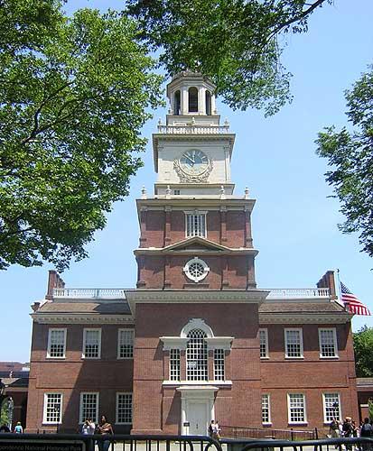
J. L. BELL is a Massachusetts writer who specializes in (among other things) the start of the American Revolution in and around Boston. He is particularly interested in the experiences of children in 1765-75. He has published scholarly papers and popular articles for both children and adults. He was consultant for an episode of History Detectives, and contributed to a display at Minute Man National Historic Park.

Subscribe thru Follow.it


•••••••••••••••••


Monday, June 29, 2026

Show Changes on the Declaration of Independence

On this date 250 years ago, the Continental Congress was taking the weekend off from formal sessions.

The Congress’s proposed Declaration of Independence was lying “on the table,” discussion of it tabled in favor of tasks like a naming a committee on manufacturing sulphur and choosing who would sign another $1,000,000 in currency.

Of course, a lot of politicking happened that weekend, off the record. Delegates were no doubt reading the draft submitted on 28 June 1776, composed by Thomas Jefferson with input from John Adams, Benjamin Franklin, Roger Sherman, and possibly Robert R. Livingston. Obviously, it needed further revision.

Earlier this year, the Thomas Jefferson Papers project at Princeton University created a website laying out that writing and revision process in detail, displaying and analyzing the existing documentary record. It’s well worth a visit.

It’s also interesting to think about the pedagogical and design challenge of this project. As the editors explain:
Past editors of Jefferson’s papers employed different techniques to show the declaration’s development and the committee’s revisions to the draft. Some used the root text before any revisions were made and added extensive annotation to explain later changes. Others printed the draft as it was submitted to Congress, using annotation to describe the changes that had been made up to that point. One edition printed three stages of revision as three separate, side-by-side columns for comparison. Others simply included an image of the chaotic draft without attempting to transcribe or break down the contents . . .

The Papers of Thomas Jefferson, in the series’ first published volume, printed the underlying “original Rough draught” with footnotes showing changes made before Adams made his copy. In a different part of the same volume, the Papers printed the draft as submitted to Congress, with the changes made by the committee marked, and also printed the final Declaration of Independence. While a dedicated researcher could piece together the development of the draft, it is difficult to get a clear narrative of the draft’s development through print sources alone. For this exhibit, we separated stages of revision into three tabs, so changes to the text can be viewed side by side with zoom-capable images of the manuscript.

The first tab shows the base text before any alterations were made. This is completely in Jefferson’s hand and strips out changes and corrections that were later marked on the page.

The second tab shows changes marked before Adams made his copy. These might be early revisions Jefferson made to his own work or revisions made in early consultations with committee members.

The third tab shows the remaining revisions marked on the document prior to its submission to Congress. To ascertain this stage, we examined three copies that Jefferson sent to friends in the days shortly after July 4, in which he reconstructed the draft that the committee had laid before Congress. We also consulted another copy of the draft that Jefferson transcribed into his Notes of Proceedings of the Continental Congress, which he compiled sometime between August 1776 and August 1783. When possible, we have identified the committee member who contributed each revision.
Adams and Jefferson both left recollections of the writing process. Unfortunately, that means we don’t know what happened.

TOMORROW: The Adams chronicle.

Sunday, June 28, 2026

“By dawn on June 18, 1775, nothing was left standing”

The current issue of Archaeology magazine includes a dispatch about the City of Boston’s Archaeology Department recent work in Charlestown, filed by a journalist with the almost-too-good-to-be-true named of Jason Urbanus.

Urbanus writes:
In early 1775, Charlestown was already almost 150 years old. It was a bustling settlement of between 1,500 and 2,000 people representing all walks of life—farmers, artisans, merchants, and mariners, including both free and enslaved Black people.

There were large landholders, such as 53-year-old distiller David Cheever, who owned multiple properties across the peninsula, and those who were less well-off, such as widow Elizabeth Moore, who rented a simple room in a neighborhood tavern. The town’s diverse population also included Margaret Thomas, who bought a humble home in 1773, likely making her the first free Black woman to own property in Charlestown. Among the wide array of craftspeople were goldsmith Nathaniel Austin, chaise maker James Frothingham, and Cato Hanker, a shoemaker. Hundreds of houses, workshops, and other buildings lined the town’s streets and wharves.

By dawn on June 18, 1775, nothing was left standing and everyone was gone. Less than 24 hours earlier, a brutal engagement, known as the Battle of Bunker Hill, had raged across the Charlestown Peninsula. . . . Townspeople were sent fleeing, and many never returned. Nearly all lost everything they owned. . . .

Many of Charlestown’s inhabitants had departed over the previous month amid increasing unrest, but those who remained were jolted from their homes. A widow named Relief Ellery and her 20-year-old daughter of the same name were among those who narrowly escaped the bombardment. The younger woman pocketed two valuable silver tablespoons from the kitchen table—the only things she had time to grab. When the pair returned to Charlestown, none of their property remained. “We have records of British troops coming back the next day and setting fire to any building that still stood,” says [City Archaeologist Joe] Bagley. “It was vindictive.” In a matter of hours, one of the oldest settlements in Massachusetts had ceased to exist. . . .

At the urging of a committee of Charlestown residents, more than 450 families submitted inventories of their lost possessions after the battle in hopes of receiving restitution. . . . Usually, when archaeologists excavate a residence, they record the artifacts that they uncover during the process. In this instance, they already have a list of everything that was in a house before beginning excavations. They know exactly what they might expect to find buried in dozens of backyards and basements.
Or, rather, buried underneath a dense modern city, or perhaps already dug up and tossed aside in construction projects over the past two and a half centuries. It seems unlikely that we’ll see a confluence of household inventory and newly dug artifacts. Still, the written record provides a lot for scholars of domestic material culture to work with.

No doubt Archaeology readers love ceramics, and another section of the article discusses Charlestown early pottery industry, which can also be dated with finality:
No commercial sector was hit as hard as Charlestown’s once-thriving ceramics industry. Although not well-known today, Charlestown had been among the largest pottery production centers in the northeast. That all changed on the day of the battle. With their workshops burned to the ground, Charlestown’s potters scattered throughout New England. “They lost everything—their kilns, all of their work tools—everything was gone,” says Bagley. “None of them came back.”
Pictured above is a milk pan from the site of the Parker-Harris Pottery, excavated during the Big Dig highway project a generation ago.

Saturday, June 27, 2026

New Boston Museum Exhibits to Visit During the Sestercentennial

Two venerable Boston museums are unveiling big reworked exhibit spaces for the Sestercentennial.

At Revolutionary Spaces’ Old South Meeting House, “Ruckus!” opens formally on 2 July. This is a 25-minute “immersive” show that
drops you right into the heart of the debate and defiance that once filled this iconic space, where ordinary people set extraordinary change in motion.

From the floorboards to the balconies, you will be surrounded by dynamic sound, lighting, and projected animations of fiery revolutionaries, determined citizens, and some unlikely troublemakers whose courage shook these walls.
Revolutionary Spaces encourages people to buy tickets in advance since space at each showing is limited. Arrive around the top of the hour, and the show begins at fifteen minutes past. Tickets include admission to all of Old South’s exhibits and the Old State House.

“Ruckus!” includes loud noises and dynamic lighting to reflect the intensity of the story it tells. It therefore might not be comfortable all visitors. Revolutionary Spaces also offers “Sensory-Friendly Mornings” at the Old State House each month.

The Museum of Fine Arts has reopened its “Art of the Americas: 1700–1800” galleries with a new, hemispheric approach. Thomas Sully’s massive painting of Washington crossing the Delaware stayed where it is, but lots of other iconic artworks are arranged in a new way.

The museum says:
The MFA’s reimagined galleries of 18th-century Art of the Americas bring together works from across North, Central, and South America, and the Caribbean—including works by Native American and Indigenous makers. Together, the eight spaces in this suite, organized by theme, explore how artists have contributed to, or in some cases resisted, ideas of nationhood and identity. Visitors can immerse themselves in expansive versions of familiar stories, discovering the interconnectedness of the Americas and its history, institutions, and people.
The galleries have the themes of “Power and Resistance,” “History and Mythmaking,” “Asian Styles in the Americas,” “Boston’s World,” “Something’s Brewing” (not revolutions but caffeinated beverages), “Communities of Makers,” “Families at Home,” and “Copley’s Ambition.”

Friday, June 26, 2026

Celebrating the Sestercentennial at Adams National Historical Park

Adams National Historical Park will host a full week of events commemorating the Sestercentennial of the Declaration of Independence, which John Adams had a little something to do with.

Unless otherwise noted, all these events will take place on the grounds of the Old House at Peace field, located at 135 Adams Street in Quincy.

Friday, 26 June, 6 P.M.
Slice of History
A night of pizza and rewatching the animated cartoon Liberty’s Kids. This event is intended for viewers ages 18–30, who might enjoy memories of the original broadcasts, but all are welcome.

Saturday, 27 June, and Sunday, 28 June
The Adamses and the American Revolution
Adams Farm at Penn’s Hill, 141 Adams Street
Ranger talks and special programs sharing the experiences of the Adams family during the American Revolution and their contributions to American independence.

Sunday, 28 June, 4 P.M.
Jefferson & Adams
This stage play by Howard Ginsberg dramatizes the friendship between John Adams, Thomas Jefferson, and Abigail Adams. Actors Bill Barker, Sam Goodyear, and Abigail Schumann bring to life the fifty-year relationship—often contentious, sometimes turbulent, and ultimately enduring.

Tuesday, 30 June, 6 P.M.
My Dearest Friend
Written by Peter Manos, this play reveals the American Revolution and the founding of the United States through the rich, witty, and passionate correspondence between Abigail and John Adams. They spent years apart, sometimes on separate continents, but stayed intensely in love for more than half a century.

Wednesday, 1 July, 10 A.M. to 4 P.M.
Stories of the American Revolution
Learn more about the many stories of the American Revolution through ranger talks and special programs.

Wednesday, 1 July, 6 P.M.
Quincy’s Women on the Page
Novelists Stephanie Dray, Laura Kamoie, and Jodi Daynard share their experiences bringing Quincy women, including Abigail Adams, to life through historical fiction.

Thursday, 2 July, 11 A.M., 1 and 3 P.M.
Independence Forever: The Continental Congress
Become a delegate to the Second Continental Congress and re-enact the passage of the Declaration of Independence. This interactive event is an invitation to adults and children to take part in the debate about whether to remain loyal to the British crown or to create a new nation.

Friday, 3 July, 11 A.M., 1 and 3 P.M.
John and Abigail Adams
The couple share their experiences during the American Revolution. Music by the Conchords at noon and 2 P.M.

Saturday, 4 July, 11 A.M., 1 and 3 P.M.
Readings of the Declaration of Independence
Lend your voice to these live public readings of the Declaration of Independence 250 years after it was adopted. The afternoon readings will be held at the Adams Farm at Penn’s Hill, the Adamses’ home during the American Revolution.

Sunday, 5 July, 10 A.M. to 4 P.M.
Stories of the American Revolution
Learn more about the many stories of the American Revolution through ranger talks and special programs.

These special programs are all free to attend and don’t require reservations. Parking is at the Visitor Center at 1250 Hancock Street, half a mile away. Also half a mile away is the Quincy Center station on the M.B.T.A. Red Line. Events may be modified or cancelled due to especially hot or stormy weather.

Thursday, June 25, 2026

“From which patterns of everyday life and social change would emerge”

Back in April the Concord Bridge published a nice retrospective profile of Robert Gross, author of The Minutemen and Their World.

Published in 1976 and recently updated, that book has proved the most lasting of the New England community studies that came out in the middle of the twentieth century.

No doubt Minutemen gets a boost from its connection to the nation’s origin story, but it’s a really good book that offers both an early example of computer-aided data analysis and interesting new ideas about how generations interact.

Plus individual stories, as the article says:
Gross wanted to write about “men, women, free and slave, native and newcomer, patriot, neutral, and loyalist” — all of those who had been excluded from conventional accounts — recovering their voices. His approach would reflect his interest in social history, a method that was growing in popularity. It involved tapping overlooked sources such as tax lists, censuses, vital records, genealogies, and town meeting minutes, from which patterns of everyday life and social change would emerge, he says.

Among those who people “Minutemen” is John Jack, an enslaved man who worked for a cobbler, bought his freedom, built a cabin in Great Meadows, and paid his taxes, but was never allowed to vote. At the time of Jack’s death, he owned eight acres, a pair of oxen, and seven barrels of cider. “His was a marginal place in the community, but it was nonetheless a real place,” Gross writes.

And there is Lucy Barnes Hosmer, daughter of a prosperous farmer and town clerk. When Joseph Hosmer, a cabinet maker, asked for permission to marry 16-year-old Lucy, her father refused, wanting her to wed someone wealthy and important.

Though a father could not dictate his daughter’s choice of spouse, he could try to arrange unions and pressure her to agree, Gross says. Lucy rebelled, denying her father’s choice of a cousin for her, and acted on her own. When she married Hosmer at 19, she was two months pregnant.
Highlighting people like that reflects the appeal of such human detail in a study of a society, a balance that The Minutemen and Their World achieved.

Wednesday, June 24, 2026

Chelsea Creek and Fighting in the Indian Way

Earlier this spring the Army Historical Foundation shared Alexander Cain’s detailed article “‘The Firing Begun on Boath Sides’: The Battle of Chelsea Creek, 27-28 May 1775.”

Cain’s introduction says:

Positioned between the significant events at Lexington and Concord (19 April) and the Battle of Bunker Hill, the Battle of Chelsea Creek (27-28 May) is frequently overshadowed by these more renowned engagements. Nevertheless, Chelsea Creek should not be regarded merely as a preliminary skirmish to Bunker Hill. The events of 27-28 May are equally essential to understanding the Siege of Boston as those at Lexington and Concord and at Bunker Hill. Therefore, the Battle of Chelsea Creek warrants comparable scholarly attention.

The Battle of Chelsea Creek holds considerable significance within the broader context of the American Revolution. This engagement is notable for several key milestones, including the first planned offensive by Provincial land forces, which resulted in direct combat. It also marked the initial collaboration between military units from different colonies and the first use of artillery by American forces in support of the Revolutionary cause. Most importantly, Chelsea Creek signaled the emergence of the American Army and the adoption of a supply interdiction strategy that benefited the Provincials in subsequent campaigns.
The Battle of Chelsea Creek also led to the first time Native Americans fought for the American forces in the “Indian” way, as opposed to individual Native men serving within militia companies modeled on the British regulars.

That started on 29 May, the day after the battle. Chaplain David Avery recorded in his diary:
About noon Capt. [Jehoiakim] Yoking, a Stockbridge Indian & I reconnoitered the Ground East of the schooner & judged that the taking off the cattle was practicable. The Capt. with 3 men took a canoe & went about a mile & a quarter upon the north side of the river from the Ferry & went across to Noddle’s Island & reconnoitered & scouted round about an hour & a quarter, when he fixed his centuries & another canoe went over to his assistance & soon took 2 horses & mired a 3d when a cannon ball fell pretty near them & four barges landed upon which all the scout retreated to the main shore & came over.

Upon that I advised that they should go back & get the stock. Accordingly they got off the Stock about sunset.
On 3 July the Massachusetts committee of safety considered a request from a man who had evidently been on that raid:
Henries Vomhavi, an Indian, having represented to this committee, that he had taken two horses at Noddle’s island, one a little horse, which he is desirous of retaining as some recompense for his fatigue and risk in that action, in which, it is said he behaved with great bravery; it is the opinion of this committee, that said Indian should be gratified in his request, which will be an encouragement to others in the service, provided, the honorable Congress should approve thereof.
The Massachusetts Provincial Congress did resolve that Vomhavi should receive “a small Horse…for his own use.”

That small operation to seize livestock from Noddle’s Island thus appears to have been conceived and carried out by the Stockbridge Indian company. That was an official part of the Massachusetts force, but people viewed those fighters as living and fighting in their own way. The horse for Vomhavi, who’s otherwise unknown, shows the rebel government saw value in compensating those men differently as well. 

Tuesday, June 23, 2026

The Significance of Breed’s Hill Instead of Bunker’s

For one last posting on the label “Breed’s Hill,” I’ll share some thoughts on whether that label matters.

These days, it’s mostly useful as a fact that people (mostly of the male variety, to be frank) deploy to show they know more than average: ‘Well, actually, the Battle of Bunker Hill was fought on Breed’s Hill.”

Which is true, though:
Even more trenchant, what difference did that name make to the outcome of the battle? How did the “Breed’s Hill” label affect the seizure of the Charlestown peninsula? Or the deaths or wounding of nearly 1,500 men?

Well, actually, there’s an argument that Col. William Prescott’s insistence on fortifying Breed’s Hill before Bunker’s Hill, as he understood his orders to specify, did shape the outcome of the battle. Could the provincials have prevailed if they’d had a strong fallback position?

I’m dubious. The goal of the Massachusetts command—the committee of safety, Gen. Artemas Ward, and his council of war—was to keep the British army from seizing the Charlestown and Dorchester peninsulas, as intelligence said the Crown would soon try to do. The New England army’s countermeasure was to seize those positions first.

The real challenge, as Gen. John Thomas indicated from Roxbury, was holding those positions against a British counter-countermeasure. Thomas didn’t think that was feasible and declined to go onto Dorchester Heights that June.

The geography of Charlestown was more welcoming for such an advance from the mainland, but it doesn’t look like the New England army was truly prepared to hold that ground. With only a couple of days to get organized, the provincials didn’t have all the tools, artillery, and reinforcements lined up to fortify and stay on those high points. We see that from the limited support the front-line troops got during the battle.

Even beyond that, the crucial problem for the New England army turned out to be gunpowder. That would have been a problem no matter which hill they fortified.

To be fair to Gen. Ward, he was worried about a possible second British advance in Roxbury or elsewhere along the siege lines. He couldn’t throw all the provincial resources into Charlestown. But the Continental operation to fortify Dorchester Heights in March 1776 shows how effective preparation could overcome adverse conditions.

I even wonder if fortifying Bunker’s Hill might have changed the British commanders’ thinking in a way that would have produced a worse outcome for the provincials. Gen. William Howe saw a small redoubt on a relatively short hill that was close enough for cannon to reach Boston and thus worth cleaning out. He focused on that spot, with disastrous results.

If Howe had seen fortifications on Bunker’s Hill also or instead, he might have decided on a more cautious strategy, focused on cutting the provincials off at the neck. That might have produced many more rebel casualties and fewer British ones. The New Englanders could have ended the day more dismayed, the regulars more chuffed, with a consequent effect on the larger siege.

Monday, June 22, 2026

“Orders to march to Breeds Hill in Charlestown”

As I quoted yesterday, in July 1775 the Massachusetts Provincial Congress officially deemed the provincial fortification of Breed’s Hill in Charlestown to have been done “by some Mistake.”

Nine months later, Dr. Cotton Tufts echoed that assessment in a letter to John Adams: “Could a greater Blunder have been committed than that of Breeds Hill. Yet it finally has operated to our Advantage and trust will continue to do so.”

By then, New Englanders had decided that the Battle of Bunker Hill had worked out well because, even though they’d suffered hundreds of casualties and lost territory, the cost for the British army was catastrophic.

Who had made that fateful mistake? The report used the passive voice to avoid naming names, but everyone knew the battlefield commanders who’d overseen the building of the redoubt were Col. William Prescott, Connecticut general Israel Putnam, and Massachusetts colonel Richard Gridley of the artillery.

And the rumor I quoted here absolved Gridley, saying one of the top two infantry officers had insisted on Breed’s Hill. Or, to be exact, either Prescott or Putnam had insisted on digging the redoubt there before fortifying a fallback position on Bunker’s Hill, as the other two men thought wise.

Adams followed up the report from Massachusetts with some questions from Philadelphia. On 25 August, Prescott wrote back: “On the 16 June in the Evening I received Orders to march to Breeds Hill in Charlestown. . . . We arrived at the Spot, the Lines were drawn by the Enginier and we began the Intrenchmant…”

No written orders survive. If Gen. Artemas Ward and his council of war did indeed use the name “Breed’s Hill,” that would be our earliest confirmed example of that label, before the newspapers accounts I quoted here. But it’s also possible Prescott wrote “Breed’s Hill” in hindsight to reflect his understanding of those orders.

Prescott’s letter criticized some other officers. Gridley “the Enginier forsook me.” His “Field Officers being indisposed could render me but Little Service.” That makes it notable that Prescott didn’t complain about Putnam overruling his judgment and insisting on fortifying Breed’s Hill first. It thus seems clear that Prescott had been the officer sticking to that course.

Prescott didn’t take that position (figuratively and literally) because he deemed it more strategic for attacking Boston, as some analysts have argued. He declared that he was following instructions from his superiors. Perhaps those orders included some ambiguous term like “Charlestown Hill.” The memory of such a command probably empowered Prescott to convince Gridley to draw the entrenchment lines despite his and Putnam’s concerns—because that’s what they understood the council of war had told them to do.

TOMORROW: Why that mattered.

Sunday, June 21, 2026

“The detachment marched upon this design to Breed’s hill”

After the British army drove provincial troops off the Charlestown peninsula on 17 June 1775, the Massachusetts committee of safety proposed an inquiry into what happened.

Nominally the committee wanted to respond to statements from Gen. Thomas Gage. But I’m pretty sure those politicians were also wondering what factors led to losing the Battle of Bunker Hill.

On 6 July the committee urged the Massachusetts Provincial Congress to form a committee to write this report. The next day, the congress handed that responsibility back to the committee of safety.

The committee then commissioned three Patriot clergymen—the Rev. Peter Thacher (1752–1802, shown here), William Gordon, and Samuel Cooper—to produce the report. Thacher’s draft was published by the American Antiquarian Society. The final report, dated 25 July, appears in the Adams Papers.

The report says that the New England commanders’ plan was to fortify Bunker’s Hill, near the Charlestown neck:
Genl. Gage had issued Orders for a Party of Troops under his Command, to post themselves on Bunkers Hill, a Promontory just at the Entrance of the Peninsula of Charlestown; upon which it was determined, with the Advice of this Committee, to send a Party who might erect some Fortifications upon said Hill and defeat this Design of our Enemies.
But that’s not what happened.

Thacher’s draft is transcribed as:
about 9 o clock in the evening the detachment marched upon this design to Breed’s hill situated on the further part of the peninsula next to Boston, for by a mistake of orders this hill was marked out for the entrenchment instead of the other hill.
Thacher initially finished that sentence to “the hill behind, Bunkers,” a perspective that conflicted with his earlier “the further part of the peninsula.” And should “next to” be “west of,” as in the final report?

After editing for clarity and brevity, the final language was:
just before 9 oClock they left Cambridge, and proceeded to Breeds Hill, situated on the further Part of the Peninsula West of Boston, for by some Mistake this Hill was marked out for the Entrenchment instead of the other…
That report thus officially distinguished between Bunker’s Hill and Breed’s Hill. As laid out in previous postings, the term “Breed’s Hill” hadn’t appeared in print until shortly after the battle. This report deemed that distinction significant—indeed, a matter of life and death.

Thus, the name “Breed’s Hill” for that part of Charlestown’s geography was solidified by the battle fought there and the need to discuss it. Before June 1775, that might have been the local name, or one of the local names, but it wasn’t on any map, any official document, or any known letter. By the end of July, the “mistake” about Breed’s Hill was on its way to being notorious.

TOMORROW: What difference does it make? 

Saturday, June 20, 2026

“The engineer and two generals went on to the hill”

engraved portrait of Israel PutnamYesterday I quoted Samuel Gray’s 11 July 1775 description of the Battle of Bunker Hill, based on what he called “my own knowledge.”

Gray wasn’t in the battle—he was probably behind the lines in Roxbury—but he could describe the terrain and basic action.

Gray then went on to share a rumor that must have been going around the provincial camps, specifying that this wasn’t first-hand knowledge:

I am informed that, in a council of war, it was determined to intrench on Charlestown Hill and on Dorchester Hill the same night, but not till we were so supplied with powder, &c., as to be able to defend the posts we might take, and annoy the enemy; that on Friday a resolution was suddenly taken to intrench the night following, without any further council thereon; that the engineer and two generals went on to the hill at night and reconnoitered the ground; that one general and the engineer were of opinion we ought not to intrench on Charlestown Hill till we had thrown up some works on the north and south ends of Bunker Hill, to cover our men in their retreat, if that should happen, but on the pressing importunity of the other general officer, it was consented to begin as was done.
Gray didn’t name names. But “the engineer” was Richard Gridley, commander of the artillery regiment. The “two generals” were William Prescott (actually a colonel) of Groton and Israel Putnam from Connecticut (shown above).

A fair amount of ink has flowed out debating whether Prescott or Putnam was responsible for building the redoubt on Breed’s Hill (Gray’s “Charlestown Hill”) before fortifying portions of the taller Bunker’s Hill.

Some authors have written Putnam made that call, based on his higher rank; his image as fearless, aggressive fighter; and a conviction that he was in command of the provincial troops during that battle.

Others point out that Prescott oversaw the building of the redoubt and then its defense while Putnam was more focused on Bunker’s Hill, trying to get men to fortify there.

And of course there’s the possibility that Gray’s information was incorrect, that Gridley, Putnam, and Prescott did discuss where to fortify but didn’t divide so neatly, at least on that night.

This letter confirms that in the weeks after the battle people were asking why the provincials positioned themselves as they did. Because that was turning out to be a very big deal.

TOMORROW: Mistakes were made?

Friday, June 19, 2026

“Intrenched on the southerly part of Charlestown Hill”

In his History of the Siege of Boston, Richard Frothingham published a letter about the Battle of Bunker Hill written by Samuel Gray in Roxbury on 12 July 1775.

That letter was addressed to a “Mr. Dyer.” I agree with Bernard Knollenberg’s guess that Samuel Gray was from Windham, Connecticut, probably the man born in 1751 who served as a Continental Army commissary, and “Mr. Dyer” was his uncle Eliphalet Dyer, or another maternal relation.

Gray provided an account of the battle that gives us a different name for where the provincials dug their redoubt:
Friday night, after the 16th of June, a large part of the Continental army intrenched on the southerly part of Charlestown Hill, on the height toward Charles River. North of this hill lies Bunker Hill, adjoining East or Mystic River. Between these two is a valley. North of Bunker Hill is a low, flat, narrow neck of land, the only avenue to the hill and town. The low neck and the valley (both which must be passed in advancing to or retreating from the intrenchment) are exposed to a cross fire from the ships and floating batteries on each side, and the valley to the fire of the battery on Copps Hill, in Boston.

About sunrise, the 17th, our intrenchment was discovered, and a heavy fire immediately began from the ships and batteries, which continued with very little cessation till about one o’clock, when a large party of the ministerial troops landed on a point of land S. E. from the intrenchment, about 4 o’clock. The savages set fire to the town, beginning with the meeting-house. A heavy fire from the cannon and musketry was kept up on both sides till about five o’clock, when our men retreated:…
Gray thus referred the high spot above the Charlestown waterfront as “Charlestown Hill,” different from “Bunker Hill” to the north. And he apparently thought Dyer would recognize those designations.

I haven’t found “Charlestown Hill” in any newspaper, but some other eighteenth-century sources use the term:
  • Isaac Winslow, 10 July: “We were alarmed by the firing of guns the morning of the seventeenth of last month and found the country people had erected a work on Charlestown Hill.”
  • James Jeffry, 7 July, in Québec: “This day four or five topsail vessels arrived, a transport or two from Boston. The report off the Capt. of one of the transports is that the battle was at Charlestown hill; that a party of Provincials were on the evg. of the 17th. entrenching themselves there & a party of the Regulars were sent out to dislodge them.”
  • William Cooper, 3 Jan 1776 letter: “an attested Copy of the account of the Battle on Charlestown Hill”
But of course that nomenclature isn’t entirely clear for us. Decades earlier, Judge Samuel Sewall wrote in his diary on 5 Oct 1709, “As came homeward went over Charlestown Hill on the Neck of Land; and came into the Rode again by Mr Emerson’s.” That appears to use the same term to refer to Bunker’s Hill.

And in a 26 Jan 1776 letter from Boston, Lt. William Carter twice used “Charles-Town Hill” to mean Bunker’s Hill since he was writing about the promontory that the British army had fortified against the Continentals.

At the very least, these sources offer more evidence that “Breed’s Hill” hadn’t yet solidified as the name of the place where the provincials built their redoubt.

TOMORROW: The choice.

Thursday, June 18, 2026

“Breed’s Hill, about half a mile from the ferry”

Yesterday I started to dig into a recent social-media post by the City of Boston Archaeology Department about when the term “Breed’s Hill” arose.

The department has used claims from Charlestown residents seeking compensation for their damaged property in 1776 to produce a terrific website about the town one year earlier, just before it was destroyed in battle.

It looks like those locals didn’t label the height where the provincials dug their redoubt as “Breed’s Hill.”

The social-media posting went on to say: “It’s possible some may have called it Breed's at the time, but deeds & other official documents do not start using that name until the 1790s, long after the battle.”

Outside of legal documents, however, we do have examples of people describing the provincial redoubt as having been on “Breed’s Hill” very soon after the battle on 17 June 1775. Examples include:
  • Letter from Isaac Lothrop, delegate to the Massachusetts Provincial Congress from Plymouth, 22 June 1775, copied by Thaddeus Burr and published in Rivington’s New-York Gazetteer on 29 June: “took possession of Breed’s hill, about half a mile from the ferry”
  • Extract of a letter from Hartford, 23 June 1775, printed in the 28 June Pennsylvania Journal: “The Provincials were entrenched at Breed’s Hill, & were there first attacked;…the Regulars are entrenched at Bunker’s Hill”
  • Extract of a letter from Cambridge dated 12 or 21 or 22 July 1775 [the scan is blurry], printed in John Pinkney’s Virginia Gazette on 3 August: “The Enemy are situated on Bunker’s and Breed’s hills, both on the peninsula . . . every man in Boston, and at Bunker’s and Breed’s Hill must fall”
Thus, by the summer of 1775 some people were making a distinction between Breed’s Hill, center of the fighting on 17 June, and Bunker’s Hill, fortified afterward by the British army. None of those correspondents were from Charlestown, though. 

It’s notable that no newspaper in Boston or elsewhere mentioned Breed’s Hill by that name before the battle. There are some mentions of the Breed family of Charlestown, and of Samuel Swan, who owned part of the hill, sold wine, and hired out a horse. But the hill didn’t attract journalistic attention.

For that matter, neither did Bunker’s Hill. Not until war broke out and the British column ended their march there on the night of 19 Apr 1775. Then the newspapers referred to “Bunker’s Hill.”

But as to whether everyone agreed that that label did or didn’t also include what people would soon write about as “Breed’s Hill” is foggy.

TOMORROW: An alternative name.

Wednesday, June 17, 2026

“Ye pasture where ye fight was in June”

On this anniversary of the Battle of Bunker Hill, I’m taking note of a document the City of Boston Archaeology Department recently highlighted which touches on the term “Breed’s Hill.”

The department’s social media stated:
Samuel Swan, who owned the pasture where the battle took place, wrote in his claim for damages, “the Pasture where the fight was in June & pasture on Bunker’s Hill, breastwork on it & the ground almost all cut up within the breastwork.” The actual owner of the hill calls it Bunker’s Hill.
I was excited by this finding and was planning to simply pass on the news. But on digging down to the documents I’m not convinced.

The problem is that Samuel Swan owned three pastures on the Charlestown peninsula, according to his claim in March 1776. One was on the hill where the provincials built their redoubt, the focus of the 17 June battle. Swan’s larger tracts were to the west, near the neck. We can see all three on the map of 1775 Charlestown real estate that the department has created.

The department has shared a scan of Samuel Swan’s document about his pastures. I wish the wording, punctuation, and difference between “ye” and “&” were clearer, but I think it says:
Swans Act. of Trees Apple, Loacust, Button wood Pair [pear] in my 3 pastures. 250 at Least my son sett 200 Loacust & Aple trees—

Stone Walls [of ye?] 3 pastures Great part took away. all ye Rales Gone. ye Ground Cutt Great part of it ye pasture where ye fight was in June. ye pasture on Bunker hill Brest work on it & ye Ground almost all Cutt up within ye Brest work ye Loer part ye other Pasture Cutt up not much ye Well wholly Filled up—
It looks to me like Swan was distinguishing between “ye pasture where ye fight was in June” and “ye pasture on Bunker hill Brest work on it.” I think the latter phrase referred to the large fortification that the Royal Engineers built on Bunker’s Hill rather than to the provincials’ redoubt.

(As for Swan’s “other Pasture,” that sustained less damage because it was on lower ground, so neither the provincials nor the regulars built works there.)

By my reading of his claim, Swan referred to the promontory near the neck as “Bunker hill” and didn’t name the hill where the monument now stands at all.

TOMORROW: Words, not deeds.

Tuesday, June 16, 2026

Act Worthy of Yourselves at King’s Chapel, 18–20 June

King’s Chapel has brought back Act Worthy of Yourselves, a sixty-minute drama set around the funeral of Dr. Joseph Warren in April 1776.

The teaser copy says:
The British army has finally left Boston. Now, nearly a year after his death, friends and family can finally hold a funeral for Dr. Joseph Warren.

Inside King’s Chapel, his brother, his fiancée, and his good friend Paul Revere gather to mourn Warren and to make sense of their loss. Outside the Chapel, two Black abolitionists wonder what this revolution will mean for them. A play about memory, legacy, and the potential and pitfalls of the American Revolution.
While anchored in April 1776, the play flashes back to episodes in the life of Dr. Warren earlier in the 1770s. In addition to the doctor’s brother John and his fiancée, Mercy Scollay, the characters include the black businessmen Lancaster Hill and Prince Hall, Paul and Rachel Revere, Abigail Adams, merchant and Freemason John Rowe, medical trainee William Eustis, rising young lawyer Perez Morton, and Christopher Monk, badly wounded at the Boston Massacre.

This play was written by Noah Good and Kaitlin Rose, and directed by Anjie Echemendia. With that large cast and many scenes set at different times and places, it’s a complex undertaking. Last year, as I recall, many of the performers came from the King’s Chapel interpretive staff rather than Boston’s professional theatrical scene.

The remaining performances for this year are on 18–20 June at 7:30 P.M. and on Saturday, 20 June, at 2:00 P.M. Tickets cost from $40 to $15 depending on the view, and are available through this website.