
J. L. BELL is a Massachusetts writer who specializes in (among other things) the start of the American Revolution in and around Boston. He is particularly interested in the experiences of children in 1765-75. He has published scholarly papers and popular articles for both children and adults. He was consultant for an episode of History Detectives, and contributed to a display at Minute Man National Historic Park.

Subscribe thru Follow.it


•••••••••••••••••


Showing posts with label maps. Show all posts

Tuesday, September 08, 2026

“The British Empire Strikes Back” in New Jersey, 6–8 Nov.
The next Pursuit of History Weekend session is called “The British Empire Strikes Back,” and it will cover the New York and New Jersey campaigns from August 1776 to January 1777.

Here’s how we’re describing the developments of 250 years ago:
Even as the United States declared their independence, the British military returned to New York. Starting in August 1776, Gen. William Howe pushed Gen. George Washington off Long Island, off Manhattan Island, and down into New Jersey. The Continental Army struggled through battles at Brooklyn, Harlem Heights, White Plains, and Fort Washington.

By late December, the Congress was evacuating Philadelphia, Washington was estranged from top aides, and Continental soldiers’ enlistments were about to run out. Only by counterattacking Gen. Cornwallis and his Hessian vanguard at Trenton and Princeton did Washington reenergize the American cause.
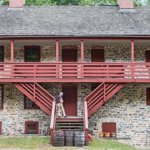
Our main meeting space for this weekend will be the Old Barracks Museum in Trenton, New Jersey, built to house troops in the French and Indian War. On 6–8 November, we’ll visit sites of fighting in that city; Washington Crossing, Pennsylvania; and Princeton, New Jersey. 

Here are some of the experts I’m eager to hear from:
  • Ricardo Herrera, Ph.D., joins the Pursuit of History Weekends as a program director and faculty member. He is Senior Historian at the George Washington Leadership Institute at George Washington’s Mount Vernon, having previously served as Professor of Military History at the U.S. Army War College and as an Armor and Cavalry officer. For the U.S. Army Center of Military History Rick wrote The New York Campaign 1776 (2026).
  • Friederike Baer, Ph.D. (friederikebaer.com), is the author of Hessians: German Soldiers in the American Revolutionary War (2022), honored with the American Revolution Round Table of Philadelphia’s Annual Book Award and the Society of the Cincinnati Prize. She is a Professor of History at Penn State University Abington College.
  • Benjamin L. Carp, Ph.D. (benjamincarp.com), wrote The Great New York Fire of 1776 (2023) and Rebels Rising: Cities and the American Revolution (2007), and other award-winning studies of the American Revolution. He holds the Daniel M. Lyons Chair in American History at Brooklyn College within the City University of New York.
  • William L. “Larry” Kidder, M.A. (wlkidderhistorian.com), has written several books about the Revolutionary War, including Ten Crucial Days: Washington’s Vision for Victory Unfolds, Crossroads of the Revolution: Trenton 1774–1783, and Revolutionary Princeton 1774–1783. He is a veteran of both the U.S. Navy and forty years of teaching high school.
  • Phillip Papas, Ph.D., explored the life of the Continental Army’s most confounding commander in Renegade Revolutionary: The Life of General Charles Lee (2014). Also author of That Ever Loyal Island: Staten Island and the American Revolution (2007), Papas is Senior Professor of History in the Economics, Government, and History Department at Union County College.
We’re still finalizing the schedule with the venues, but I expect to give some brief presentations as well.

Pursuit of History Weekends are limited to about forty people to facilitate discussion with speakers and among attendees. As of this holiday weekend, only ten slots are left.

For more information and to register, please visit this webpage.

Wednesday, June 17, 2026

“Ye pasture where ye fight was in June”

On this anniversary of the Battle of Bunker Hill, I’m taking note of a document the City of Boston Archaeology Department recently highlighted which touches on the term “Breed’s Hill.”

The department’s social media stated:
Samuel Swan, who owned the pasture where the battle took place, wrote in his claim for damages, “the Pasture where the fight was in June & pasture on Bunker’s Hill, breastwork on it & the ground almost all cut up within the breastwork.” The actual owner of the hill calls it Bunker’s Hill.
I was excited by this finding and was planning to simply pass on the news. But on digging down to the documents I’m not convinced.

The problem is that Samuel Swan owned three pastures on the Charlestown peninsula, according to his claim in March 1776. One was on the hill where the provincials built their redoubt, the focus of the 17 June battle. Swan’s larger tracts were to the west, near the neck. We can see all three on the map of 1775 Charlestown real estate that the department has created.

The department has shared a scan of Samuel Swan’s document about his pastures. I wish the wording, punctuation, and difference between “ye” and “&” were clearer, but I think it says:
Swans Act. of Trees Apple, Loacust, Button wood Pair [pear] in my 3 pastures. 250 at Least my son sett 200 Loacust & Aple trees—

Stone Walls [of ye?] 3 pastures Great part took away. all ye Rales Gone. ye Ground Cutt Great part of it ye pasture where ye fight was in June. ye pasture on Bunker hill Brest work on it & ye Ground almost all Cutt up within ye Brest work ye Loer part ye other Pasture Cutt up not much ye Well wholly Filled up—
It looks to me like Swan was distinguishing between “ye pasture where ye fight was in June” and “ye pasture on Bunker hill Brest work on it.” I think the latter phrase referred to the large fortification that the Royal Engineers built on Bunker’s Hill rather than to the provincials’ redoubt.

(As for Swan’s “other Pasture,” that sustained less damage because it was on lower ground, so neither the provincials nor the regulars built works there.)

By my reading of his claim, Swan referred to the promontory near the neck as “Bunker hill” and didn’t name the hill where the monument now stands at all.

TOMORROW: Words, not deeds.

Sunday, April 26, 2026

“John Hill be sent under a proper Guard to Boston Goal”

As recounted yesterday, on 25 Apr 1776 the Massachusetts General Court issued a resolve to catch John Hill, an Irish-born Loyalist accused of helping to loot Boston as the British evacuated.

I haven’t found any newspaper advertisements for Hill, suggesting that local authorities located him within just a few days.

The Marblehead committee of correspondence sent the man back to Watertown, and on 1 May the legislature passed a new act: 
Whereas John Hill a Prisoner now before this Court is justly suspected to have been assisting Crean Brush in Robbing the Inhabitants of the Town of Boston of their Goods & Merchandize

It is therefore
Resolved that the said John Hill be sent under a proper Guard to Boston Goal, there to be confined as a prisoner until he shall be Examined by the Seven Justices of the Peace of the County of Suffolk or the major part of them who are appointed to try associators and abetters of the Ministerial Army, which Justices are impowered to Examine the said Hill and deal with him in the same manner as if he had remained in Boston after the said Fleet & Army had gone away
Magistrates in Boston were questioning a long list of people who had stayed in town through the siege about their political loyalties.

Boston’s “goal” or jail appears on the detail from the 1769 town map above, but barely. At the bottom of that image are two large buildings: the Town House, now the Old State House (lowercase a), and the First or Old Brick Meeting-House (big A). Above the meeting-house is the label “Church Square.” And above that, mostly worn off because of a fold, is the label “Prison.” That building faced onto Queen Street, now Court Street—named for the courthouse, which was conveniently near the prison.

Hill remained in that Boston jail for several months. The United States declared independence. The British military returned to New York in force.

On 18 October, the Connecticut Gazette of New London reported:
Last Saturday [12 October], the Wife and Daughter of one John Hill, a Prisoner in Boston Goal, for being concerned with Crean Brush and others, in Robbing the Inhabitants of Boston, when that Place was evacuated; came to this Town from Providence by Water, and was endeavouring to get a Passage to the West End of Long-Island, but were stopped by the Committee of this Town, and on Examination were found upon them, sundry Papers, containing Matters of Intelligence respecting the People, and State of the Country, sent from said Hill and others in Boston, to be communicated to General [William] Howe;…
TOMORROW: Mystery women.

Tuesday, February 24, 2026

“As ever the two Armies met”

Yesterday we left schoolteacher Jonathan Hastings, Jr., and the rest of Col. Thomas Gardner’s Cambridge militia contingent caught near the Lexington meetinghouse on 19 Apr 1775.

Lt. Col. Francis Smith’s expedition to Concord (which Hastings called “the Detachment”) was headed back their way from the west, harried by other militia companies.

Col. Hugh Percy’s reinforcement column (“the Brigade”) was approaching from the east. Percy had more soldiers. And he had cannon.

We return to Hastings’s 11 June letter, now in the Thomas Gage Papers:
We were commanded to retreat into a thick Grove of Oaks over a Meadow, up to our Knees in water, wch. saved us. The Brigade turned their Artillery immediately upon us.—Their Cannon Balls cut down the Branches of the Trees merrily but none of us were killed.

As ever the two Armies met, it being about 3 Quarters after one OClock, they begun a precepitate Retreat for Bunkers Hill in Charlestown under the Protection of the navy. There were not above 400 that attacked them, being 1850 at once that day. Lord Peircy put the Cannon in Front, himself in the Centre, & the Marines were formed in the Rear. The Grenadiers & Marines were nobly peppered. Peircy had a Ball shot thro’ the Bosom of his shirt.

Two Officers were treppaned in the Red House leading to Charlestown. Quarters were offered them, they refused, replying their Orders were neither to give nor take any Favour. They met Death bravely.—

It is easier for you to imagine, than for me to describe the Horrid Barbarity & savage Cruelty of the British Troops in their Retreat. Houses plundered & burnt, wounded Men begging for mercy, had Bayonets struck into their Heads, & the Piece discharged, Women in Child Bed commanded into the Streets with a Gun at their Breasts, Old Men unarmed thrust thro’ their Bodies. Harmless young Fellows shot dead, such was the horrid Scene.

But on our side no such Vestiges of Cruelty were seen or exercised on any who chose to live: the wounded taken the utmost Care of, & when exchanged for our Men who were taken Prisoners, & have been treated most inhumanly: they cryed like Children to tarry among us.—
Of course, the redcoats had their own tales of atrocities by the enemy, starting with the “scalping” at Concord’s North Bridge.

I can think of one example of a woman who had recently given birth ordered out of her house (Hannah Adams of Menotomy) and one of a young teenager shot when he peeked out a window (Edward Barber of Charlestown). But Hastings’s letter rendered those examples as plural. And I’m not sure what he referred to with the bayonets.

Likewise, Hastings’s numbers of the troops engaged—400 militiamen chasing off 1,850 regulars—are skewed to make his side look good. Many groups of 400 provincials attacked the British column in turn. The Massachusetts force had a clear advantage in numbers.

Hastings wrote of emergency surgeries in “the Red House leading to Charlestown” as if his correspondent knew that location. Indeed, there appears to have been a brick house fitting that description. I haven’t been able to identify who owned or lived there, but sources do refer to its appearance and location.

On 12 May the Massachusetts committee of safety mentioned “the red house at the head of the creek near the road from Cambridge to Charlestown.” Soon provincials built the “Red House Fort,” more commonly called Fort No. 3, to guard a nearby crossroads, as shown in the detail of Henry Pelham’s map above. Today the site is just south of Union Square in Somerville.

TOMORROW: Finishing the letter.

Wednesday, January 14, 2026

Knox Trail Commemorations on 15–18 Jan.

Sestercentennial commemorations of the progress of Col. Henry Knox’s artillery convoys across western Massachusetts continue this weekend.

(I’m trying to list all of these events, but there are so many that I might miss some being promoted locally.)

Thursday, 15 January, 6:30 to 7:30 P.M.
The Most Proper Spot in America: The Continental Arsenal at Springfield
Alex MacKenzie
Captain Charles Leonard House, 663 Main Street, Agawam

The winter meeting of the Agawam Historical Association will hear from Alex MacKenzie, curator of collections at the Springfield Armory National Historic Site. Having visited the region in 1776, Col. Knox chose Springfield to be the site of the Continental Army’s laboratory, or depot for building and repairing ordnance and other military supplies. Starting in 1777, that operation eventually grew into the Springfield National Armory, now a national park. This event is free and open to the public.

Friday, 16 January, 6 to 8 P.M.
250th Anniversary of Henry Knox in Monterey
Monterey Library, 452 Main Road

A new exhibit opens at the town library with a reception and remarks by Mark Makuc, Heather Kowalski, Rob Hoogs, and Jonathan Barkan, including presentations on the Bicentennial and current reenactments of Knox’s trek. These presentations will be repeated at the library on Saturday morning.

Saturday, 17 January, 2 to 3 P.M.
250th Anniversary Commemoration of the Henry Knox Trail
Springfield Armory National Historic Site

Revolution 250, Boston Celebrations, the Springfield Armory National Historic Site, and citizens of the towns of Westfield, West Springfield, Springfield, Wilbraham, Palmer, and Warren join to commemorate the “Noble Train of Artillery” on its way to Boston. Attendees can take in the site’s exhibit “The Continental Arsenal at Springfield During the Revolution” and ongoing display of weaponry through the decades.

Saturday, 17 January, 2 to 4 P.M.
Walk the Old Knox Trail
Bidwell House Museum, Monterey

After an outdoor gathering with a bonfire and hot mulled cider, Rob Hoogs will lead attendees along a segment of old road that Knox’s teamsters used, about half a mile each way.

Saturday, 17 January, 7 to 8:30 P.M.
Panel Discussion on Ye Trodden Path
Monterey Library, 452 Main Road

As the Berkshire County Historical Society publishes a new booklet on the trails through the region in 1775, titled Ye Trodden Path, local historians Rob Hoogs, Bernie Drew, Gary Leveille, Ron Bernard, and Tom Ragusa discuss the research going into that publication.

Sunday, 18 January, shows at 1:30 and 4 P.M.
For Love! For Liberty!
Springfield Performing Arts Venture

This new musical theater production by Vana Nespor and Clifton (Jerry) Noble tells the story of Henry Knox, his young wife Lucy Knox, and his mission to bring cannon to the Continental forces around Boston. Middle school history students help the U.S. Park Service, teachers, and grandparents explore this tale. Tickets available through this webpage.

(The photograph above shows William Wilber portraying Henry Knox during the 1976 reenactment, courtesy of Gerry Francis and the Berkshire Edge.)

Tuesday, October 21, 2025

“A Sett of Globes (which came over by Mistake)”?

In eighteenth-century New England, booksellers sold more than books, pamphlets, and magazines. 

As the business letters of Thomas Hancock and Henry Knox show, they also purveyed medicines, tea, “Instruments,” quills, stationery, snuff, and other genteel goods.

In the spring or summer of 1773, Knox received a set of globes from one of his London suppliers. This set probably consisted of a terrestrial globe—the spherical representation of Earth that we’re used to—and a celestial globe showing the constellations and other stars.

We have a bunch of Knox’s incoming correspondence, published by the Massachusetts Historical Society in 1928, but I don’t see a clue about who sent those globes.

Some London merchants, such as the publisher Thomas Longman, just shipped Knox the latest magazines and the books reviewed in those magazines without waiting for an order. So it’s possible one of the young bookseller’s suppliers put those globes on a ship expecting he would find a market for them.

Fortunately, a customer appeared. On 6 August, the schoolmaster John Vinal wrote to Knox from Newburyport:
Mr. [Tristram?] Dalton informed me that you had a Sett of Globes (which came over by Mistake) that you would dispose of at the Sterling Cost and Charges. I was just going to write to London for such a Sett; but if you have not disposed of yours, and the price is agreeable, and they are the right sort I will purchase them. I should be glad of a Line immediately; you may inclose one to me directed to my Friend Mr. Wm. Miller Collector.

I should be glad to know the following particulars, vizt. Whither they are Senex’s Globes—who they are made by, if they have a Magnetic Needle and Card, if they have a Nonius Scale and Analemma, Quadrant of Altitude, etc. and what Cases they are in. . . .

Please to express the Price either in Sterling or L[awful] M[one]y.
As published, this letter told Knox to send mail through “Wm. Millen,” but the deputy collector of customs in Newburyport was another of Knox’s customers, William Miller. Since Vinal was officially a handwriting master, you’d think he’d render his friend’s name unmistakably.

As a teacher of adult classes in navigation, among other subjects, Vinal’s wanted to know this product’s features. “Senex’s Globes” meant those modeled on the work of cartographer John Senex (1678–1740). A “Nonius Scale” was the invention of the Portuguese scientist Pedro Nuñez (1492–1577). An “Analemma” is the figure-8 pattern traced by the Sun when viewed from the same spot day after day over a full year.

As for the price, that probably depended on how large these globes were. Sets ranged from small enough to fit in a pocket to large enough to count as furniture, and their price tags were proportional.

Did Knox and Vinal close the deal? We don’t know because we don’t have both sides of the bookseller’s correspondence. But on 27 June the Rev. John Murray had written to Knox from Boothbay in Maine asking for “one pair of 18 inch Globes.” (Murray also complained about how Knox had supplied “Copies of the Classical authors,” nonetheless ordered some other books, and asked how to reach Knox’s childhood friend the Rev. David McClure.) So if those globes from London were 18 inches across, they were probably on their way past Newburyport to Boothbay.

TOMORROW: Mr. Vinal’s notices.

Monday, October 20, 2025

A New Schoolmaster for a New Town

In January 1764 the Massachusetts General Court passed a law allowing part of the town of Newbury to split off as the new town of Newburyport.

The new town held its first meeting on 8 February, choosing a clerk, selectmen, and other officials. The inhabitants also chose a committee to determine what schoolhouses the children needed. They decided to keep paying the masters of the Newbury grammar and writing schools for now.

In March that committee recommended:
that at least three large schools should be provided and maintained in sd. Town, viz: one Grammar school not far from the Revd. Mr. [John] Lowel’s meeting house, and two reading, writing & arithmetick schools, one of them adjoining to Queen street, Ordua Lane, or Bartlet’s Lane, preferring the latter, and the other adjoining or near Cross street or Elbow Lane.
That summer, the town bought some land on what is now Winter Street, beside Route 1, and started building a schoolhouse.

To oversee that school the selectmen hired John Vinal, usher of Boston’s South Writing-School. They offered him £80 per year, significantly more than he had been earning in Boston though less than what the bigger town’s schoolmasters earned. In addition, each pupil was to bring “two pistareens” to pay for firewood used during the year.

The selectmen announced: “Boys that can read in a Psalter will be received and carefully taught Reading, Writing & Arithmetick.” The school would meet 8 A.M. to noon and 1 to 4 P.M.

Vinal’s school opened on Monday, 5 November, with the Rev. Mr. Lowell and the selectmen present. Given that Newbury’s youth usually celebrated Pope Night with a big procession and bonfire, I imagine that student body was rather antsy that day.

John Vinal continued to look for ways to supplement his salary. The town needed to survey the “common and undivided land” near the Frog Pond, and in 1771 Vinal produced the map shown above, shared by History Newburyport. Around the pond it shows a burying-ground, a potash house, a ropewalk, a powderhouse, and a windmill.

TOMORROW: Vinal’s lessons.

Monday, October 13, 2025

On the Trail of Capt. William Browne

In the HUB History podcast episode “Drinker, Draftsman, Soldier, Spy,” Jake Sconyers quotes my remark on how difficult it is to track Capt. William Browne of the 52nd Regiment before 1775 because there were so many men named William Brown(e).

He also quoted a portion of Ens. Henry DeBerniere’s report on his spy missions with Capt. Browne that I’d read many times but hadn’t tumbled to how it’s helpful with that precise challenge.

One of my favorite moments in that narrative is when Browne, DeBerniere, and their manservant have reached Jonathan Brewer’s tavern in Waltham.

a little out of this town [Watertown] we went into a tavern, a Mr. Brewer’s, a whig, we called for dinner, which was brought in by a black woman, at first she was very civil, but afterwards began to eye us very attentively; she then went out and a little after returned, when we observed to her that it was a very fine country, upon which she answered so it is, and we have got brave fellows to defend it, and if you go up any higher you find it so,—

This disconcerted us a good deal, and we imagined she knew us from our papers which we took out before her, as the General had told us to pass for surveyors; however, we resolved not to sleep there that night, as we had intended, accordingly we paid our bill which amounted to two pounds odd shillings, but in [sic] was old tenor.

After we had left the house we enquired of John, our servant, what she had said, he told us that she knew Capt. Brown very well, that she had seen him five years before at Boston, and knew him to be an officer, and that she was sure I was one also, and told John that he was a regular—he denied it; but she said she knew our errant was to take a plan of the country; that she had seen the river and road through Charlestown on the paper; she also advised him to tell us not to go any higher, for if we did we should meet with very bad usage
That waitress didn’t just recognize Brown—she recognized him from “five years before at Boston.” That was in 1770, and there were only two British army regiments in Boston then: the 29th and the 14th. That narrows the field considerably.

Sure enough, the officers of the 14th included Lt. William Browne. On 12 July 1771, the War Office announced that “Lieut. William Brown, of the 14th regiment of Foot,” had purchased the rank of captain in the 52nd in the place of Archibald Williams. In the 14th, Ens. William Napier moved up to lieutenant’s rank.

One implication of that fact is that Gen. Thomas Gage might have chosen Capt. Browne to scout the countryside in 1775 because that officer was more familiar with Massachusetts than most of his colleagues, having spent about two years in Boston and on Castle Island back in 1768–1770.

Of course, that had the drawback of more people in Massachusetts being familiar with Browne, as the woman in Waltham showed.

For earlier information on Lt. Browne I hunted down the Army List for 1767. And I found this list of lieutenants in the 14th Regiment of Foot:
Goddammit!

Two men named William Browne became lieutenants in the 14th Regiment four days apart in June 1766. One of them had joined the army in 1762, the other at some unknown time. They were both still lieutenants in the 14th at the start of 1771. 

And during the same period when one or both of these lieutenants were serving in Boston:
And there were probably others.

TOMORROW: Capt. Browne’s own voice?

Tuesday, July 01, 2025

“To-morrow I go on another attack”


We met Thomas James as a major in the Royal Artillery stationed in New York in 1765. After he vowed to protect the stamped paper and said nasty things about the people opposing the new tax, a crowd attacked his home.

Maj. James went home to Britain to report on the situation to Parliament, and he reported on Parliament to royal authorities in New York.

By 1771 James was a lieutenant colonel in the artillery. In that year he published an illustrated two-volume study titled The History of the Herculean Straits, Now Called the Straits of Gibraltar: Including those Ports of Spain and Barbary that Lie Contiguous Thereto.

The “authour,” as he’s called on the title pages, had served in Gibraltar in 1749–1755. He’d been working on this book for years, and is credited with being the first Englishman to publish observations on the area’s geography.

In 1775 Lt. Col. James was inside besieged Boston. Here’s his brief report on the aftermath of the Bunker Hill battle in a letter to Lt. Col. Francis Downman in London dated 23 June 1775:
We are in thickness of war, we have had two battles already, in the last we carried our point, took the lines and a strong redoubt, with 2,500 men against 7,000.

We have upwards of 80 officers killed and wounded, and the flower of the grenadiers and light infantry; some regiments have but five grenadiers left. We had at one gun the officer and volunteer wounded, and but one man without a wound. [Capt.-Lt. John] Lemoine is wounded, so are [Capt. W. Oren] Huddlestone and [Lt. Ashton] Shuttleworth. We are well. My volunteer hands have been full.

To-morrow I go on another attack, covering the left in my gondolas, which I have made, viz., three with a heavy 12-pr. in each prow. Adieu.
James’s “gondolas” seem to have gone down in American records as the Crown’s “floating batteries.”

It’s notable that both sides of the Bunker Hill battle insisted they were heavily outnumbered by the enemy.

Tuesday, June 24, 2025

“The only one now living of those who acted as aids-de-camp to General Howe”

Thomas Hyde Page (1746–1821) graduated top in his class from the Royal Military Academy at Woolwich in 1769, winning a gold medal from the king.

Page became a lieutenant in the Corps of Engineers and arrived in Boston in the spring of 1775. During the Battle of Bunker Hill he served as one of Gen. William Howe’s aides.

Richard Frothingham quoted the 11 Jan 1776 London Chronicle as saying:
A few days ago arrived in town, from Boston, Lieutenant Page, of his majesty’s corps of engineers, on account of the wounds he received the 17th of June, in the action of Charlestown. This gentleman is the only one now living of those who acted as aids-de-camp to General Howe, so great was the slaughter of officers that day. He particularly distinguished himself in the storming of the redoubt, for which he received General Howe’s thanks.
Page was back in London because he had been wounded in the leg, badly enough to require some sort of amputation.

Capt. John Montresor wrote to Page from Philadelphia on 17 June 1778 noting the “disagreeable memory” of the date. “I hope you are able to saunter without a stick.”

In his journal, however, Montresor grumped about his lack of a pension and wrote, “Page served Eleven days and was then wounded and return’d home and had ten shillings per diem settled for life.” (Of course, Montresor still had both his legs.)

Page continued to work on various engineering projects for the British military. Promotion was slow in that branch of the service, but between 1781 and 1783 he became a captain. That summer he received a double honor: he was elected to the Royal Society and knighted. A couple of years later he shifted to the invalid corps.

In 1790, Lt. Col. John Small, who had been Gen. Robert Pigot’s brigade major, wrote to Page:
The interesting position we were placed in side by side at the memorable Battle of Bunker’s Hill will never be forgotten, and will ever excite the most anxious emotions in the breast of the fellow campaigner who has now the honor of addressing you; who witnessed in the most trying moments, your innate worth, your professional Intrepidity and skill, and was most seriously affected when at your side he saw you ffall from a very dangerous wound, receiv’d when displaying your exertions in the ffield, when your cool and manly example, and sound judicious advice, contributed much to acquire success and victory.
I wish I had more of that letter to understand who was asking what favor.

Using surveys by Montresor and others, Page published very good maps of Boston harbor and the town of Boston. His 1793 “Plan of the Action at Bunkers Hill” is still the most useful source on the topography of the Charlestown peninsula in 1775—though it’s also notable in switching the labels of Bunker’s Hill and Breed’s Hill.

Most of Page’s engineering work involved drainage, harbors, canals, and other civil projects rather than fortifications. James Northcote’s portrait of Page above shows him “holding a Plan of Fort Landguard and seen in the distance.” Page didn’t build that fort, but he engineered its tricky well. (Once apparently at Boston, that painting is now on display at the Tyntesfield estate in North Somerset.)

Sir Thomas Hyde Page remained active all around Great Britain for decades and finally retired to Boulogne, France, where he died.

Sunday, June 22, 2025

A Closer Look at the Landscape of Bunker’s Hill

Back in 2017, I shared a map of the Battle of Bunker Hill that Gen. Henry Clinton had drawn himself on the back of some sheet music (permalink).

I wrote:
One eye-catching detail is that Clinton sketched a small fortification on top of Bunker’s Hill . . . There are even lines indicating that one of the warships in the Charles River fired at that site. . . .

evidently on 17 June, Clinton perceived the provincials as having fortified themselves there
This spring Boston 1775 reader Adam Derenne sent an email shedding some light on that mystery:
I believe that Clinton misinterpreted the site — it wasn’t a partial fortification but a gravel pit operated by Charlestown resident Peter Edes.
As Mr. Derenne pointed out, Edes’s gravel pit is mentioned in Charlestown’s 1767 land survey:
Then we measurd a Gravel Pitt Enclos’d & Improv’d by Mr. Peter Edes with his land lying Bounded on the way leading over Bunker’s Hill just opposite to Temple’s Barn. We began about 8 Feet below the easterly part of his Mr. Edes’s Stone Wall, said Wall being on the Way from Temples leading over Bunker’s Hill…
This owner was probably the Peter Edes (1705–1787) whose son Benjamin became a printer of the Boston Gazette (and had a son named Peter).

Mr. Derenne also noted that the City of Boston’s G.I.S. website shows what properties Peter Edes owned in 1775, covering the odd spot in Clinton’s map. Thomas Hyde Page’s map of the battle, published in 1793, showed a blob where Clinton drew that second fortification, presumably the gravel pit.

I then went looking for a mention of this pit in accounts of the battle. Did provincials use it to shelter themselves from the Royal Navy shelling that side of Charlestown? Did British engineers incorporate it into their fortifications on Bunker’s Hill, either the quick barriers made on the evening of 19 April or the sturdy fort built over time after 17 June? But I couldn’t find any account mentioning the gravel pit. So there’s still a mystery to solve.

Sunday, April 27, 2025

Earl Percy’s Map of the Route to Safety

American Heritage just shared a scoop in Edwin S. Grosvenor‘s article “Discovered: First Maps of the American Revolution.”

It’s based on a return visit to the seat of the Dukes of Northumberland, a title bestowed on Earl Percy’s father and inherited by him after his return from the American war.

Grosvenor writes about one document:

On the newly found map, Percy had drawn his route from Lexington to Menotomy and back to Boston. “He's sketching the line of march,” observed local historian Michael Ruderman, studying the new Percy map. “It's the theatre of battle, the hostile territory he had to travel during the afternoon. And he's sketching the landmarks that were significant to him like the Old Powder House tower that he passed on his left."

The Percy map provides many details about the landscape, roads, taverns, and houses that existed in 1775.

Percy averted an even greater disaster by marching his 1,700 men by an unexpected route. Rather than continuing straight to Cambridge, he took a left turn to head to the Charlestown neck, where the ships of the Royal Navy could protect his force with their guns and ferry him across the Charles River, back to Boston.

For nearly 250 years, the maps lay forgotten in a box with dozens of other maps of Revolutionary war battles and encampments brought back by Gen. Percy.
The caption explains: “When rotated with north facing up, the town of Medford is in the upper left, with the home of ‘Col. [Isaac] Royal’ marked outside the town.” At the center, looking like rude high-school graffiti, is the Charlestown powderhouse.

In the lower right corner is Cambridge. Along the bottom is the road from Menotomy village into central Cambridge with several landmarks labeled: “Menotomy mill:g House,” “Adams’s Tavern,” “Brook,” “Grove of Locust Trees,” and “Tavern.”

The last stands at the crucial corner where Col. Percy turned his column onto “Kent’s Lane through which the Troops return’d from Concord” to Charlestown.”

Sunday, March 23, 2025

“Secrets on the Road to Concord” in Scituate, 15 May

On Saturday I attended the “Spies Among Us” event in Concord, described back here.

Top highlights:
  • Seeing the Wright Tavern sprucing up as it prepares to reopen to the public next month, including the Pursuit of History weekend on “The Outbreak of War” that I’m helping to organize there (a couple of seats may still be available).
  • Enjoying all the special touches the National Park Service staff and volunteers brought to this event, including a full-size replica of Ens. Henry DeBerniere’s map from the Library of Congress and a Concord role-playing game.
  • Hearing details about what brought the British troops to Concord and remembering back during the 2000 commemoration when many of those were still little beads I was trying to string together into a narrative that became The Road to Concord.
So I’m eager to keep spreading the word at my upcoming speaking engagement for the Scituate Historical Society. [This event was originally scheduled for March and postponed.]

Thursday, 15 May, 7–8:30 P.M.
Secrets on the Road to Concord
G.A.R. Hall, 353 Country Way, Scituate

Early in the spring of 1775, British army spies located four brass cannon belonging to Boston’s colonial militia that had gone missing months before. British general Thomas Gage devised plans to regain the cannon. Massachusetts Patriots prepared to thwart the general’s hopes. Each side wanted control of those weapons, but each also had reasons to keep their existence a secret. That conflict would end with blood on the road to Concord.

Admission is $15, or $10 for society members. Reservations are recommended, but payment will be accepted at the door.

I look forward to meeting more folks in shoreside Plymouth County.

(The picture above is a page from one of Scituate Historical Society’s artifacts of the 1770s: Caleb Litchfield’s notebook from when he was a teenager studying mathematics and navigation. Litchfield served in the Continental forces on land and sea during the war. After a brief time as a merchant ship’s master, he retired inland to Milton and then Weathersfield, Vermont.)

Thursday, February 06, 2025

Reading the Map of Rhode Island with Andrew Middleton

In December, Andrew Middleton went viral on Bluesky. This was unknown territory for him—ironic, since he’s an expert on maps.

Middleton had written: “Hi. I’m Andrew. I own New England’s oldest map store because last year I moved across the country after an old guy retired and gave it to me Willy Wonka-style. Visit my store in Rhode Island. www.mapcenter.com.”

The Map Center not only sells maps, atlases, and related products, but offers research, classes, and connections to cartographers around the country.

I’m going to link to Middleton’s online presentation “Eight Interesting Aspects: Narragansett Bay and the Invention of Rhode Island” at Pixeum.

Built around Charles Blaskowitz’s 1777 chart “Topographical Chart of the Bay of Narraganset,” this online offering is somewhere between a video and a slide show.

Pointing out details on the chart, Middleton shows how to read it as Royal Navy officers did:
These numbers (or soundings) measure the depth of the channels in fathoms (a fathom is about six feet). The water needed to be deep enough for British warships.

While Blaskowitz fills in the topography around the islands and coasts, he leaves places farther inland blank.

The Navy only cared about the places from which those pesky American rebels could fire on their ships: high ground close to the water.
Perhaps because he’s come from California, Middleton can tease Rhode Islanders for their fondness for this map. It was, he points out, created to facilitate an invasion by the British military! He recommends a French rip-off instead.

Tuesday, January 14, 2025

Online Talk about Henry Pelham and His Map, 15 Jan.

On Wednesday, 15 January, the National Parks of Boston, in partnership with the Boston Public Library, will present a virtual lecture on the topic “Mapping a City Under Siege: Henry Pelham.”

The event description says:
In 1775, Henry Pelham, aspiring artist and half-brother of the famed John Singleton Copley, found himself inside a city under siege. A loyalist with ample time and nowhere to go, Pelham gained permission from the British military to map the war developing around him. Though many other engineers mapped Boston in 1775 and 1776, Pelham’s artistic eye and intimate loyalist connections resulted in something unparalleled in how it depicts the landscape of the first chapter of a civil war. Today, his work is immensely valuable in helping us understand and reconstruct a Boston under siege 250 years ago.
The N.P.S. ethos apparently precludes naming who on the interpretive staff will speak about this map, but of course the agency has high standards for accuracy.

This Zoom program begins at 6:00 P.M. Anyone who registers can tune in for free.

For more on places that appear Henry Pelham’s map of Boston, and how they appear today, check out the sunny video I made with Lee Wright of The History List.

To tie this event together with my talk at Gore Place on Sunday, in the summer of 1788 the painter and paint merchant Samuel Gore was advertising:
A few elegant Plans of Boston, and its environs, including Milton, Dorchester, Roxbury, Brookline, Cambridge, Medford, Charlestown, parts of Malden and Chelsea, with the military works constructed in those places, in the years 1775 and 76, by Mr. H. PELHAM.
That was shortly after Samuel’s father John Gore had returned from Loyalist exile, probably bringing the first copies of Pelham’s siege map to be sold in Boston. The Gore and Copley/Pelham families had done business before the war, and they did business after the war, too.

Sunday, January 05, 2025

Mapping Boston in 1795

ARGO (American Revolutionary Geographies Online) offers a new article by John W. Mackey titled “Practical Knowledge and the New Republic.”

It begins:

Perhaps what is most visually striking about Osgood Carleton’s recently rediscovered 1795 map of Boston is its sheer size. At approximately seven feet by six and a half feet, this wall map dwarfs many other Boston maps of the late eighteenth century, including Carleton’s own 1797 work, which until recently was considered the largest Boston map from this period known to be extant in a collection.
This isn’t a printed map but a drawing. The Massachusetts Charitable Mechanic Association donated it to the Leventhal Map & Education Center at the Boston Public Library in 2021. Based on a cartouche dedicating the map “To the Select-Men of the Town of Boston,” curators deduced it was originally town, then city property.

Indeed, volume III of a report on Documents of the City of Boston, for the Year 1879 (published 1880) had an appendix listing “Plans of Boston in the City Surveyor’s Department,” and that included:
Boston, 1795.—An original map. Surveyed by Osgood Carleton for the Select-men.
As for the cartographer:
Osgood Carleton was born to a New England farming family in 1742 and had little schooling. At age 16, he began military service in Nova Scotia during the Seven Years’ War, and he later served in the Continental Army during the American Revolution. While he was born in New Hampshire and appears to have lived for a time in Haverhill, Massachusetts and in Maine, it was in Boston that Carleton made his mark and built the bulk of his career. Armed with mathematical skills presumably gained during his military service, Carleton earned his living putting these skills to practical use: he became a surveyor, a contributor to the ubiquitous almanacs of the era, and the leading cartographer in Massachusetts during his lifetime. . . .

he also left a legacy in his role as a teacher of young men in the City of Boston. . . . he offered on an array of practical mathematical skills from navigation to surveying and mensuration to gunnery, bookkeeping, and the projection of spheres and maps.
Mackey’s article discusses and displays Carleton’s maps of Massachusetts, one of which was eventually printed with state approval, as discussed back here.
The 1795 Boston map captures the town’s post-war transition. Carleton marked the place for the “New State-house” on “State Land.” That new government building would be dedicated that year.

Mackey also discusses how this map didn’t label Oliver’s Dock, though Carleton had used that as a landmark in advertising his school. By 1795 he may have moved to “an unfinished building in Merchant’s Row,” where Robert Bailey Thomas remembered studying under him. Nonetheless, “Oliver’s Dock” was still the official name of that location, preserving the memory of the unpopular royal appointee Andrew Oliver.

Friday, November 15, 2024

“There is one very bad place in this five miles”

A few days back, I linked again to a hand-drawn map at the Library of Congress that appears to be the work of Ens. Henry DeBerniere. The locations on that map match DeBerniere’s first spying trip to the west with Capt. William Brown in February 1775.

Gen. Thomas Gage had those two British officers make a second foray into the countryside starting on 20 March, this time to look for cannon and other military supplies in Concord.

We know the two officers went out to Concord on roads that appear on this map, as shown in the detail above. DeBerniere wrote:
We went through Roxbury and Brookline, and came into the main road between the thirteen and fourteen mile-stones in the township of Weston; we went through part of the pass at the eleven mile-stone, took the Concord road, which is seven miles from the main road.
But Brown and DeBerniere came back by a different route:
Mr. [Daniel] Bliss…told us he could shew us another road, called the Lexington road. We set out and crossed the bridge in the town, and of consequence left the town on the contrary side of the river to what we entered it. The road continued very open and good for six miles, the next five a little inclosed, (there is one very bad place in this five miles) the road good to Lexington.

You then come to Menotomy, the road still good; a pond or lake at Menotomy. You then leave Cambridge on your right, and fall into the main road a little below Cambridge, and so to Charlestown; the road is very good almost all the way.
That “Lexington road” doesn’t appear on the hand-drawn map. It’s possible that DeBerniere produced another map to show it. That would have been useful since that’s the road that Lt. Col. Francis Smith followed to Concord on 18–19 April and then withdrew along.

Donald L. Hafner of Boston College drew my attention to that omission when he left this comment to my recent posting:
It is unfortunate that the surviving map attributed to Ensign DeBerniere does not include the alternate route through Lexington and Menotomy that he and Capt William Brown took on their return to Boston, because it leaves a puzzle about where on that route was the "one very bad place" that DeBerniere describes in his written report to Gage. DeBerniere's sentence is a bit garbled, but he is referring to some location between Lexington and Menotomy center. A good guess would be those locations where the main road is hemmed in to the south by sharply-rising hills, and on the north by wetlands and the Mill Brook. A good candidate would be near the current Lexington/Arlington border. But that is just a guess. Are there better candidates that a soldier would describe as "one very bad place"?
DeBerniere wasn’t clear about where in Concord he started estimating distances, but it is about six miles from the center of Concord to Lexington common, and about five from Lexington common to the modern Arlington town hall. So that does suggest somewhere in the second stretch the officers judged the road “good” but “a little inclosed” with “one very bad place.” The area between Liberty Heights and the Mill Brook in east Lexington indeed seems to be the best candidate—about where Wicked Bagel sits, in fact.

Notably, Smith’s column had its worst experiences before reaching Lexington center at places like Merriam’s Corner, Elm Brook Hill, and the “Parker’s Revenge” site—other spots where the road turned and/or narrowed, but not so much as to make DeBerniere worry.

Monday, November 11, 2024

Looking at Lexington and Concord through Eighteenth-Century Eyes

Last month Alexander Cain at Historical Nerdery announced a resource for people researching the Battle of Lexington and Concord ahead of next spring’s Sestercentennial: a list of links to eyewitness accounts of the day.

That listing will be very useful, and it can grow. Perforce these are texts that have been digitized in one way or another. I’m sure that more lurk within books, newspapers, and letters. It’s a matter of ferreting them out and/or digitizing them in usable forms.

For instance, here is the list’s link to Gen. Thomas Gage’s instructions to Lt. Col. Francis Smith for the march to Concord on 18–19 April.

We also have what appears to be Gage’s notes or first draft of those instructions, quoted in General Gage’s Informers (1932) by Allan French. A digital version of that book can be borrowed from the Internet Archive, at least for now. Look on pages 29–30.

Since the Massachusetts Historical Society has scanned merchant John Rowe’s diaries, we can see his response to the news coming into Boston here. A transcription of what a descendant thought were the most important parts of that diary was published a century ago. Among the details one can find only in the handwritten journal is that on 20 April Capt. John Linzee, R.N., dined and spent the evening at Rowe’s house after fending off an attack on his ship on the Charles River.

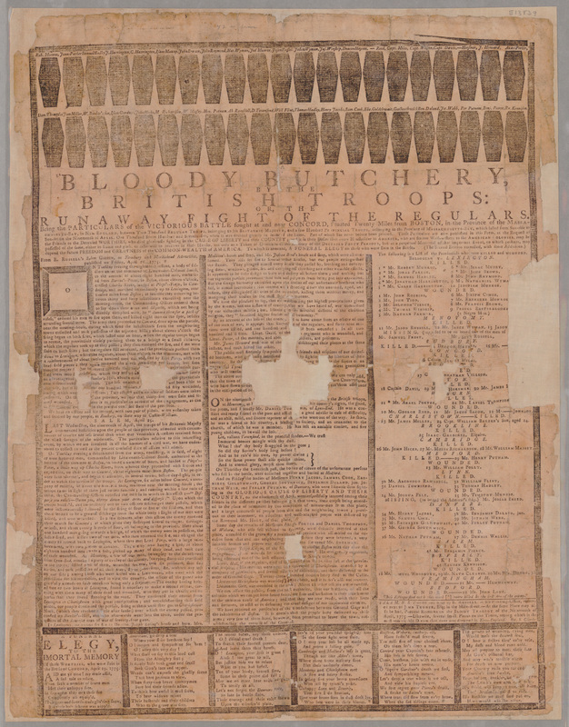
It’s possible to identify the sources of some anonymous accounts. One resource on the list, Ezekiel Russell’s “Bloody Butchery by the British Troops” broadside, includes text headlined “SALEM, April 25.” Those paragraphs commence: “LAST Wednesday, the nineteenth of April, the troops of his Britannic Majesty commenced hostilities upon the people of this province…”

The preceding paragraphs come with a source citation—not coincidentally, to Russell’s own Salem Gazette newspaper. But Russell didn’t give his competition publicity by revealing that he took the second and longer passage from Samuel Hall’s Essex Gazette for 25 April. That text was later imperfectly transcribed in Peter Force’s American Archives.

The 3 May Massachusetts Spy on the list includes an unsourced story about what happened “When the expresses [from Boston] got about a mile beyond Lexington.” That story matches one that William Dawes’s family recalled hearing from him, revealing that Dawes was probably printer Isaiah Thomas’s source.

Among the lately revealed visual resources is this hand-drawn map in the Library of Congress. I’m convinced by Ed Redmond’s hypothesis that Ens. Henry DeBerniere created this map ahead of the march to Concord. It thus offers a look at what British army officers knew of the countryside west of Boston. (I discussed details of that map starting here.)

TOMORROW: A source from May 1775.

Sunday, September 15, 2024

Where Was the Charlestown Powderhouse?


Before departing from the “Powder Alarm” entirely, I’ll draw on guest blogger Charles Bahne to address a pertinent question: Where was the powderhouse?

That may seem like a silly question since it’s a stone building that has stood atop the same hill since it was built shortly after 1700.

But some of our sources from 1774 refer to that location in different ways:
  • William Brattle: “This morning the Select Men of Medford, came and received their Town Stock of Powder, which was in the Arsenal on Quarry-Hill.”
  • Boston Gazette: “the powder house on quarry hill in Charleston bounds”
  • Rev. Dr. Samuel Cooper: “You have heard of the taking ye. Windmill, at Cambridg with the Province Powder.”
  • Rev. Ebenezer Parkman: “The Contents Magazine of Powder at Winter Hill had been carryed off.”
  • John Adams: “the Provincial Powder from the Magazine at Cambridge”
Charles Bahne wrote in an email:
Legally, the powder house was in Charlestown. But it was closer (both crow-flies distance, and actual roads) to the populated centers of either Medford or Cambridge, or even Menotomy, than it was to Charlestown.
  • Powder House Sq. to Medford Sq. = 1.23 miles airline, 1.47 miles by road, according to Google Maps
  • Powder House Sq. to Harvard Sq. = 1.90 miles airline, 2.14 miles by road
  • Powder House Sq. to Menotomy [Arlington Center] = 2.13 miles airline, 2.17 miles by road
  • Powder House Sq. to Charlestown Neck [Sullivan Sq.] = 2.47 miles airline, 2.49 miles by road
Once you got "beyond the Neck", Charlestown got long and skinny. And hardly anyone lived there. . . . While the powder house itself was in the town of Charlestown, the property just across the street was in Medford. The town/city boundaries in that area were adjusted at some point in the 1800s.

I suspect that one reason for choosing that site for a powder house—besides the fact that the old windmill was available—was that the area was unpopulated. If by chance it blew up, there was no one nearby to be killed or injured, no other property that might be destroyed.

But it was conveniently at a crossroads. Broadway was a straight line road between Charlestown Neck and Menotomy, although I suspect that it was a lightly used, poorly maintained thoroughfare, and not a highway. . . . The other crossroad was more important, the road from Medford to Cambridge, present day Harvard St., Warner St., and College Ave.
The picture above is a detail from an 1833 map, before the western arm of Charlestown became Somerville. The arrow points to the powderhouse. The circles show the population centers of Medford, Cambridge, and (at the lower right) Charlestown.

Proximity helps to explain why the man who “for a Number of Years had the Care of [the gunpowder] as to sunning and turning it,” William Gamage, lived in Cambridge. Proximity might explain why the Medford selectmen were the last to remove their town’s powder from the tower in August 1774; it was, after all, quite convenient where it was.

As for Winter Hill, that was fairly nearby and large. But the powderhouse stood atop its own drumlin, called Quarry Hill for decades because locals had taken stone from it, including the stone used to build the tower itself. That spot is now known as Powder House Hill.

Thursday, September 05, 2024

The Flight of the Cambridge Loyalists, part 2

One direct target of the “Powder Alarm” protest in Cambridge on 2 Sept 1774 was Joseph Lee, a judge and appointee to the mandamus Council.

He tried to get ahead of the crowd’s demands by writing out a resignation from that Council in the morning, then reading it aloud on Cambridge common at midday.

But Lee and his wife Rebecca were still nervous. Her brother, Sheriff David Phips, and her niece’s husband, Lt. Gov. Thomas Oliver, took refuge in Boston, as recounted yesterday. Toward the middle of the month, the Lees decided to leave town, too.

Instead of seeking the protection of the troops, the Lees headed south. To make their journey secure, they obtained this certificate from Isaac Foster, Jr., on 16 September:
To our Bretheren the Friends of Liberty

Whereas the honourable Joseph Lee Esqr has proposed to take a Tour through the Country for his [insert: Ladys] health, and it is possible that some Persons unacquainted with the Transactions at Cambridge on the 2d. instant, (when so great a Part of this County were collected there) may still be uneasy at his having taken the Oath as Councellor, on the intended new and unconstitutional Plan; these may certify that the said honourable Joseph Lee Esqr. had voluntarily, before he was called upon, and as we trust from a Conviction of the unconstitutionality of his Appointments, resigned his seat at the Council Board; which resignation he publickly and politely declared to the respectable Inhabitants of this County, with a promise that in future he would accept of no Office inconsistent with the Charter of this Province; and that the said Declaration and Promise was by the People assembled as aforesaid, unanimously voted satisfactory, having given such ample Satisfaction, we doubt not he will be treated by all the Friends of our happy Constitution, with such Civility and Respect, as shall do honour to our common Cause.

By order of the Committee of Correspondence for Charlstown
That’s another document from the Massachusetts Historical Society’s Miscellaneous Bound Manuscripts collection.

During Monday’s commemoration of the “Powder Alarm” in Charlestown, Karen Falb alerted me to a glimpse of Joseph and Rebecca Lee on their journey south. It appears in a letter from Henry Pelham to his half-brother John Singleton Copley, dated 2 November from Philadelphia. Pelham wrote:
I wish I had a more satisfactory account to give than that I have taken this Journey in search of lost Health; but still Happy should I be could I say I had entirely recovered it. I have been for near 10 Months [i.e., pretty much since the Tea Party] past very subject to nervous complaints which shewed themselves in an almost continued Dizziness, Headack, Loss of Appetite, Trembling of the Nerves, and Lowness of Spiritts. for these I early put myself under the Care of Doct’r [William Lee or Nathaniel] Perkins, who ordered me a course of Steel and frequent Riding, and recommended a long journey in the fall which my friends much advised too.

Mr. and Mrs. [Charles and Sarah] Startin [Susanna Copley’s sister and her husband] returning home, I thought it a favourable time for the excursion, and have come thus far in Company with them and Judge Lee and Lady, our Cambridge Friends, who propose passing the winter here. In a few days I intend to sett out for home, stoping for about a fortnight at New Haven, where Mr. [Adam] Babcock has engaged me to do two or three minature Pictures.
This letter shows that Pelham was friendly with the Lees before he drew his monumental map of the siege of Boston. (Another letter in the collection shows that Copley had visited Judge Lee at his home.) That has a bearing on the question of how much accuracy we can assign to Pelham’s rendering of the “Tory Row” estates, shown above.

Joseph and Rebecca Lee sat out the first years of the war in New Jersey and returned to their Cambridge home in 1777. Since they were no longer ”absentees,” Massachusetts did not confiscate that property.

The next mansion west from the Lees belonged to George and Susanna Ruggles. She was a Vassall by birth, thus a paternal aunt to Elizabeth Oliver.

George Ruggles made a unique arrangement for leaving the neighborhood: he swapped houses with the Boston merchant Thomas Fayerweather. On 31 October, Fayerweather deeded his house on Summer Street to Ruggles, and Ruggles deeded his estate on the Watertown road to Fayerweather. That estate included more than fifty acres of land, and Fayerweather paid Ruggles £2,000 to make an even swap.

That’s why Henry Pelham’s map of the siege of Boston labels that property as belonging to “Mr. Fairwather”—the one “Tory Row” estate no longer legally owned by a Loyalist at the start of the war.

TOMORROW: John Vassall’s secret.