J. L. BELL is a Massachusetts writer who specializes in (among other things) the start of the American Revolution in and around Boston. He is particularly interested in the experiences of children in 1765-75. He has published scholarly papers and popular articles for both children and adults. He was consultant for an episode of History Detectives, and contributed to a display at Minute Man National Historic Park.

Subscribe thru Follow.it


•••••••••••••••••


Showing posts with label geography. Show all posts

Tuesday, August 05, 2025

“On the Alarm being given…”

The Massachusetts Patriots weren’t the only folks building an alarm system over the winter of 1774–75.

On 30 December, Gen. Thomas Gage set out this plan for his garrison in case they were attacked from the countryside:
The Alarm Guns Will be Posted at the Artillery Barracks, the Common & the Lines, the Alarm given at either of those places, is to be repeated at all the rest, by firing three Rounds each.

On the Alarm being given the 52d Regt. is immediately to Reinforce the Lines, leaving a Captain & 50 at the Neck, The 5th Regt. will draw up between the Neck Guard & the Liberty Tree.

The 4th or Kings own Regt. will Reinforce the Magazine Guard with a Captain & 50 and with the Remainder draw up under Bartons Point.

The 43d Regt. will join the Marines & together defend the Passage between Bartons Point & Charles Town Ferry.

The 47th Regt. will draw up in Hanover Street securing both the Bridges over Mill Creek.

The 59th Regt. will draw up in the Front of the Court House.

The 3 Companies of the 18th Regt. joined by those of the 65th Regt. the 10th 23d & 38th Regts will draw up in the Street between the Generals House & Liberty Tree.

Majors [William] Martins Company of the Royal Regt. of Artillery will move with expedition to the Lines, Reinforcing the Neck with one Commission’d Officer 2 Non Commission’d & 12 Men the Remainder of the Royal Regt. of Artillery will get their Guns in order & wait for orders.

If any Alarm happens in the Night, the Troops will March to their Post without Loading, & on no Account to Load their Firelocks, it is forbid under the Severest Penalty to fire in the Night, even if the Troops should be fired upon, but they are to Oppose & Route any body that shall dare to Attack them (with their Bayonetts) And the greatest care will be taken that the Countersign is well known to all the Corps & Small Parties, Advanced, that in case of meeting they should know their friends & not Attack each other in the Night thro’ Mistake.

The Officers Commanding Regts will Reconoiter the Streets leading from their Quarters, to their Respective Alarm Posts. & fix upon the Streets they intend passing thro’, each taking a different Route.
Bartons Point was the northwest tip of the town, sticking out into the Charles River. It’s striking that the army adopted the designation “Liberty Tree” for the big elm in the South End, despite its political origin.

Gen. Gage’s plan was never implemented, of course. On 20 Apr 1775, he stated: ”All former Orders Respecting Alarm Posts to be Cancel’d, & the Regts. to form in their Barracks.”

Saturday, July 05, 2025

“Siege and Liberation of Boston,” 7–8 Aug.

Registration is open for the third Pursuit of History Weekend that I’ve helped to program, this one on “The Siege and Liberation of Boston” on 7–8 August.

Organized with the folks who manage History Camp, these sessions are designed to offer in-depth looks at developments 250 years ago through expert speakers and visits to the actual sites where the history happened.

We’ll start on the slope of Breed’s Hill in Charlestown, exploring what turned out to be the decisive battle of the first campaign of the Revolutionary War. Sam Forman and Mary Adams will introduce two of the leaders of the American forces, Dr. Joseph Warren and John Stark. We’ll walk the battlefield and hear about ongoing investigations of the landscape from Boston City Archaeologist Joe Bagley. Then we’ll take a road trip to other places that the Continental Army fortified, which few visitors see. That day we plan to have meals at two restaurants that go back to the eighteenth century.

On the following day, we’ll move into the North End, collaborating with the Paul Revere House, the Old North Church, and veteran tour guide Charles Bahne to offer an in-depth look at the experience of living inside besieged Boston. Finally, I’ll speak about George Washington as a new commander-in-chief, what he thought his job was, and what he really learned.

The Pursuit of History webpage for this event has a video of me explaining more. Sam Forman and I are also scheduled to talk about the siege and this event in the History Camp discussion series on Thursday, 10 July, at 8:00 P.M.

This Pursuit of History Weekend is not, in fact, on a weekend but on a Thursday and Friday. That’s to allow people to also attend History Camp Boston on Saturday, 9 August, and even the related tours the next day if their history interests are still unsated.

And speaking of History Camp Boston 2025, I’ll be speaking there, too. My topic is related to the end of the Boston siege. That talk is called “Henry Knox, Loyalist?” It offers a new interpretation of that American general’s rise to prominence.

Tuesday, July 01, 2025

“To-morrow I go on another attack”


We met Thomas James as a major in the Royal Artillery stationed in New York in 1765. After he vowed to protect the stamped paper and said nasty things about the people opposing the new tax, a crowd attacked his home.

Maj. James went home to Britain to report on the situation to Parliament, and he reported on Parliament to royal authorities in New York.

By 1771 James was a lieutenant colonel in the artillery. In that year he published an illustrated two-volume study titled The History of the Herculean Straits, Now Called the Straits of Gibraltar: Including those Ports of Spain and Barbary that Lie Contiguous Thereto.

The “authour,” as he’s called on the title pages, had served in Gibraltar in 1749–1755. He’d been working on this book for years, and is credited with being the first Englishman to publish observations on the area’s geography.

In 1775 Lt. Col. James was inside besieged Boston. Here’s his brief report on the aftermath of the Bunker Hill battle in a letter to Lt. Col. Francis Downman in London dated 23 June 1775:
We are in thickness of war, we have had two battles already, in the last we carried our point, took the lines and a strong redoubt, with 2,500 men against 7,000.

We have upwards of 80 officers killed and wounded, and the flower of the grenadiers and light infantry; some regiments have but five grenadiers left. We had at one gun the officer and volunteer wounded, and but one man without a wound. [Capt.-Lt. John] Lemoine is wounded, so are [Capt. W. Oren] Huddlestone and [Lt. Ashton] Shuttleworth. We are well. My volunteer hands have been full.

To-morrow I go on another attack, covering the left in my gondolas, which I have made, viz., three with a heavy 12-pr. in each prow. Adieu.
James’s “gondolas” seem to have gone down in American records as the Crown’s “floating batteries.”

It’s notable that both sides of the Bunker Hill battle insisted they were heavily outnumbered by the enemy.

Sunday, April 27, 2025

Earl Percy’s Map of the Route to Safety

American Heritage just shared a scoop in Edwin S. Grosvenor‘s article “Discovered: First Maps of the American Revolution.”

It’s based on a return visit to the seat of the Dukes of Northumberland, a title bestowed on Earl Percy’s father and inherited by him after his return from the American war.

Grosvenor writes about one document:

On the newly found map, Percy had drawn his route from Lexington to Menotomy and back to Boston. “He's sketching the line of march,” observed local historian Michael Ruderman, studying the new Percy map. “It's the theatre of battle, the hostile territory he had to travel during the afternoon. And he's sketching the landmarks that were significant to him like the Old Powder House tower that he passed on his left."

The Percy map provides many details about the landscape, roads, taverns, and houses that existed in 1775.

Percy averted an even greater disaster by marching his 1,700 men by an unexpected route. Rather than continuing straight to Cambridge, he took a left turn to head to the Charlestown neck, where the ships of the Royal Navy could protect his force with their guns and ferry him across the Charles River, back to Boston.

For nearly 250 years, the maps lay forgotten in a box with dozens of other maps of Revolutionary war battles and encampments brought back by Gen. Percy.
The caption explains: “When rotated with north facing up, the town of Medford is in the upper left, with the home of ‘Col. [Isaac] Royal’ marked outside the town.” At the center, looking like rude high-school graffiti, is the Charlestown powderhouse.

In the lower right corner is Cambridge. Along the bottom is the road from Menotomy village into central Cambridge with several landmarks labeled: “Menotomy mill:g House,” “Adams’s Tavern,” “Brook,” “Grove of Locust Trees,” and “Tavern.”

The last stands at the crucial corner where Col. Percy turned his column onto “Kent’s Lane through which the Troops return’d from Concord” to Charlestown.”

Sunday, January 05, 2025

Mapping Boston in 1795

ARGO (American Revolutionary Geographies Online) offers a new article by John W. Mackey titled “Practical Knowledge and the New Republic.”

It begins:

Perhaps what is most visually striking about Osgood Carleton’s recently rediscovered 1795 map of Boston is its sheer size. At approximately seven feet by six and a half feet, this wall map dwarfs many other Boston maps of the late eighteenth century, including Carleton’s own 1797 work, which until recently was considered the largest Boston map from this period known to be extant in a collection.
This isn’t a printed map but a drawing. The Massachusetts Charitable Mechanic Association donated it to the Leventhal Map & Education Center at the Boston Public Library in 2021. Based on a cartouche dedicating the map “To the Select-Men of the Town of Boston,” curators deduced it was originally town, then city property.

Indeed, volume III of a report on Documents of the City of Boston, for the Year 1879 (published 1880) had an appendix listing “Plans of Boston in the City Surveyor’s Department,” and that included:
Boston, 1795.—An original map. Surveyed by Osgood Carleton for the Select-men.
As for the cartographer:
Osgood Carleton was born to a New England farming family in 1742 and had little schooling. At age 16, he began military service in Nova Scotia during the Seven Years’ War, and he later served in the Continental Army during the American Revolution. While he was born in New Hampshire and appears to have lived for a time in Haverhill, Massachusetts and in Maine, it was in Boston that Carleton made his mark and built the bulk of his career. Armed with mathematical skills presumably gained during his military service, Carleton earned his living putting these skills to practical use: he became a surveyor, a contributor to the ubiquitous almanacs of the era, and the leading cartographer in Massachusetts during his lifetime. . . .

he also left a legacy in his role as a teacher of young men in the City of Boston. . . . he offered on an array of practical mathematical skills from navigation to surveying and mensuration to gunnery, bookkeeping, and the projection of spheres and maps.
Mackey’s article discusses and displays Carleton’s maps of Massachusetts, one of which was eventually printed with state approval, as discussed back here.
The 1795 Boston map captures the town’s post-war transition. Carleton marked the place for the “New State-house” on “State Land.” That new government building would be dedicated that year.

Mackey also discusses how this map didn’t label Oliver’s Dock, though Carleton had used that as a landmark in advertising his school. By 1795 he may have moved to “an unfinished building in Merchant’s Row,” where Robert Bailey Thomas remembered studying under him. Nonetheless, “Oliver’s Dock” was still the official name of that location, preserving the memory of the unpopular royal appointee Andrew Oliver.

Sunday, September 15, 2024

Where Was the Charlestown Powderhouse?


Before departing from the “Powder Alarm” entirely, I’ll draw on guest blogger Charles Bahne to address a pertinent question: Where was the powderhouse?

That may seem like a silly question since it’s a stone building that has stood atop the same hill since it was built shortly after 1700.

But some of our sources from 1774 refer to that location in different ways:
  • William Brattle: “This morning the Select Men of Medford, came and received their Town Stock of Powder, which was in the Arsenal on Quarry-Hill.”
  • Boston Gazette: “the powder house on quarry hill in Charleston bounds”
  • Rev. Dr. Samuel Cooper: “You have heard of the taking ye. Windmill, at Cambridg with the Province Powder.”
  • Rev. Ebenezer Parkman: “The Contents Magazine of Powder at Winter Hill had been carryed off.”
  • John Adams: “the Provincial Powder from the Magazine at Cambridge”
Charles Bahne wrote in an email:
Legally, the powder house was in Charlestown. But it was closer (both crow-flies distance, and actual roads) to the populated centers of either Medford or Cambridge, or even Menotomy, than it was to Charlestown.
  • Powder House Sq. to Medford Sq. = 1.23 miles airline, 1.47 miles by road, according to Google Maps
  • Powder House Sq. to Harvard Sq. = 1.90 miles airline, 2.14 miles by road
  • Powder House Sq. to Menotomy [Arlington Center] = 2.13 miles airline, 2.17 miles by road
  • Powder House Sq. to Charlestown Neck [Sullivan Sq.] = 2.47 miles airline, 2.49 miles by road
Once you got "beyond the Neck", Charlestown got long and skinny. And hardly anyone lived there. . . . While the powder house itself was in the town of Charlestown, the property just across the street was in Medford. The town/city boundaries in that area were adjusted at some point in the 1800s.

I suspect that one reason for choosing that site for a powder house—besides the fact that the old windmill was available—was that the area was unpopulated. If by chance it blew up, there was no one nearby to be killed or injured, no other property that might be destroyed.

But it was conveniently at a crossroads. Broadway was a straight line road between Charlestown Neck and Menotomy, although I suspect that it was a lightly used, poorly maintained thoroughfare, and not a highway. . . . The other crossroad was more important, the road from Medford to Cambridge, present day Harvard St., Warner St., and College Ave.
The picture above is a detail from an 1833 map, before the western arm of Charlestown became Somerville. The arrow points to the powderhouse. The circles show the population centers of Medford, Cambridge, and (at the lower right) Charlestown.

Proximity helps to explain why the man who “for a Number of Years had the Care of [the gunpowder] as to sunning and turning it,” William Gamage, lived in Cambridge. Proximity might explain why the Medford selectmen were the last to remove their town’s powder from the tower in August 1774; it was, after all, quite convenient where it was.

As for Winter Hill, that was fairly nearby and large. But the powderhouse stood atop its own drumlin, called Quarry Hill for decades because locals had taken stone from it, including the stone used to build the tower itself. That spot is now known as Powder House Hill.

Thursday, April 18, 2024

The Launch of Concord’s Arrowhead Ridge

As Patriots’ Day season continues, Boston 1775 is pleased to welcome back our old friend Christopher Lenney, author of Sightseeking: Clues to the Landscape History of New England, as a guest blogger.

In this posting, Chris discusses the origin of a name that has come to appear in maps and descriptions of the Battle of Lexington and Concord, but which the locals of 1775 didn’t use.


The mile-long ridge running parallel to Lexington Road from Meriam’s Corner to the center of Concord has long been a looming presence in the landscape and the history of the town. However, until the mid-twentieth century, it had no single, well-established name. At various times, various parts have been known as ye Hill above ye Meeting house, Meriam’s Hill, Heywood’s Hill, or simply the hill (or hills).

Its present name, Revolutionary Ridge, likely first appeared about 1915 and was popularized as the original name of Ridge Road. It was officially adopted by the U.S. Geological Survey on the 1943 Concord quadrangle map and has become widely accepted.

So anachronistic a name as Revolutionary Ridge has obvious drawbacks when recounting the events of April 19, 1775. It presupposes what hasn’t yet occurred. Something less glaringly modern, please!

Since the 1960s, Arrowhead Ridge, a name of even more recent coinage and one borrowed from another war, has come to fill the void. While a few arrowheads have coincidentally been found there, this is not how the name came about.

Arrowhead Ridge originated almost accidentally with military historian John R. Galvin, who brought a shrewd eye for terrain to the study of the battle. In the text of his book The Minute Men (1967), he employs the term purely descriptively—lowercase—four times:
  • “A long ridge, shaped like an arrowhead, runs eastward from the center…The arrowhead points directly at Lexington”
  • “At Meriam’s Corner, just below the east tip of the arrowhead ridge”
  • “the British were preparing to march out along the arrowhead ridge”
  • “climbing up the slope of the arrowhead ridge”
Gen. Galvin was a Massachusetts native (Melrose and Wakefield) who had a lifelong interest in the battle. The term could only have occurred to someone studying a U.S.G.S. topographical map, and then perhaps only to a military topographer. It is inconceivable that Galvin, who was a cadet at West Point from 1950 to 1954, could have been unaware that Arrowhead Ridge (uppercase) was also the name of a fierce October 1952 battle of the Korean War.

To illustrate Galvin’s account, Arrowhead Ridge was understandably, but misleadingly, given equal weight with other place names on the endpaper map of the first edition of his book. From there it slowly spread. A decade later Arrowhead Ridge resurfaced on a map in The Minute Men 1775–1975, a booklet published locally by the Council of Minute Men in 1977.

Relatively few have ever seen the original Galvin map, as most copies of the 1967 edition are now locked away in local history rooms and the map was omitted altogether from the much-revised and more widely available 1989 edition (although use of “arrowhead ridge” persisted in the text). Still fewer have seen the Council of Minute Men publication, which is something of a rarity.

However, virtually everyone interested in the events of April 19, 1775, has seen Arrowhead Ridge where it truly came into its own: on the map of the British retreat on page 223 of David Hackett Fischer’s now classic Paul Revere’s Ride (1994). Although not original to Paul Revere’s Ride, the influence of that book has assured that use of the term would survive and thrive: notably in Time-Life’s The Revolutionaries (1996). Nathaniel Philbrick’s Bunker Hill (2013), and Rick Atkinson’s The British Are Coming (2019). It has even made its way into a 2005 National Park Service report.

While Fischer refers to Galvin at least twenty-four times, the term Arrowhead Ridge never actually appears in the text of Paul Revere’s Ride. It was perhaps introduced by the cartographer, who compiled the map from Galvin and other sources. Its use is somewhat surprising in that Fischer twice takes exception to anachronistic terminology in his footnotes: Hardy’s Hill for Brooks Hill and, more famously, Bloody Angle for Bloody Curve. The latter is especially singled out for criticism as a Civil War name being reused for a battle in the Revolutionary War.

Ironically, in the use of Arrowhead Ridge we can see an example of much the same thing. Only in this case it was not a Civil War name that was borrowed, but one with ultimate origins in the Korean War.

We might ask whether Concordians of 1775 ever thought of that high ground as arrowhead-shaped since they weren’t used to picturing the world from above, the way we are in this era of widespread maps, plane travel, and satellite views.

Thanks, Chris!

Saturday, January 01, 2022

“Fair the year of glory lies”

It’s a Boston 1775 tradition to post a period poem for New Year’s. Usually I’ve chosen verses written and sung by young news carriers, but this year I’m picking up on this month’s thread of poetry debating the new U.S. Constitution.

“A POEM, Addressed to the PEOPLE of VIRGINIA, on New-Year’s Day, 1788” appeared in the Virginia Journal and Alexandria Advertiser dated 10 Jan 1788. Since that newspaper isn’t in the database I can access, I’ve transcribed the version reprinted in the Pennsylvania Packet on 25 January.

Despite the poem being reprinted in several more newspapers and the American Mercury magazine, it really is meant for a Virginia readership. It boasts about the state’s geographic bounties and drops the names of more than a dozen state politicians in a way that would make John Adams grumble, “You know Virginian geese are always swans.”

So far as I can tell, this poem was not included in the Documentary History of the Ratification of the Constitution, perhaps because it was published several months before the Virginia ratifying convention got under way.

Still, there’s no question what the anonymous poet was on about.
A POEM, Addressed to the PEOPLE of VIRGINIA, on New-Year’s Day, 1788.

FAIR VIRGINIA, ever dear,
See arriv’d th’ important year!
While the annual song I pay,
Truth inspires the patriot lay:
Wake!—too long thy sons have dream’d—
Where’s the sister state, that beam’d
Fairer in the dawn of fame,
Glowing with a purer flame?
Shall the ancient wreaths you gain’d
By thy latter deeds be stain’d?
Shall not fed’ral conduct crown
All thy acts of old renown?
Union into ruin hurl’d,
Shall a Tyrant grasp a world?
Or shall sep’rate Unions grow,
Endless source of war and woe?
Or, if Anarchy ensue,
Who hath more to lose than you?

Shall we basely sell the boon,
Bought with so much blood, so soon?
Oh! the muse a tale could tell,
How our heroes fought and fell—
Must our Empire’s short-liv’d reign
Prove they fought and bled in vain?

Blest Virginians, sum the cost!
Shall the price of blood be lost?
Lost the blessings ye possess,
Freedom and the pow’r to bless?
Your’s are planted plains and farms,
Villas fair in rural charms;
Lovely girls and prattling boys,
All the bliss of home-born joys;
When the soothing voice invites
Guests to hospitable rights.—
Your’s th’ illimitable waste,
Flow’ry meads and valleys vast;
Your’s stupendous cliffs that rise,
Bosom’d high in fleecy skies;
Your’s the Alleganian hills,
Spouting forth in num’rous rills.
List ye, how, from many a shore,
Distant sons of ocean roar?
Rivers broad to you belong,
Yet to run in deathless song—
Fair Ohio gently roves
Through the sweet Acasian groves;
Rappahannock (sounding name)
And Fluvanna, slow to fame;
Pohawtan superbly rolls;
Great Potomack, void of shoals;
Mississippi’s waves will gain,
Spite of fraud, for you, the main;
Harvests, by your fields supplied,
Then may float on ev’ry tide.

Go, thou miscreant, from whose tongue
Accents of DISUNION rung;
At the shrine of self, in lies,
Every blessing sacrifice!
Bid the kindling beacons far
Light the realms to civil war;
Bid the drum’s obstrep’rous sound
Rumbling run along the ground;
Bid the trumpet sing to arms,
Swell the cannon’s dread alarms;
Wake the clang of steel again;
Purple every flood and plain;
Make the sick’ning harvest die,
Burning cities scorch the sky:
Heav’n for this shall on thy head
Chosen bolts of vengeance shed.
Round our forests, on our coast,
We have nobler names to boast—
Liberal souls, by none surpast,
Names with time itself to last.
Hail Virginia’s patriot sons.
Griffin, Blair, M’Clurg and Jones!
Join the Pages firm and just:
Steward faithful to his trust:
Maddison, above the rest,
Pouring from his narrow chest
More than Greek or Roman sense,
Boundless tides of eloquence:
Withe, who drank the source of truth,
Skill’d in lore of laws from youth:
Thruston’s mind of ample reach;
Innis, fraught with powerful speech:
Too reluctant to engage:
Pendleton with locks of age,
Mild his eye with wisdom beams,
Lent from other worlds he seems;
Heav’n, resume not such a loan,
Ere we make his choice our own.
Erst the Lees, a glorious band,
For their country made a stand.
Wise and brave, unapt to yield.
In the council or the field;
Why asunder are they torn?
Why his* loss must millions mourn,
Who, to glad th’ astonish’d earth,
Spoke an empire into birth?
The footnote explains, “R. H. Lee made the motion in Congress for the declaration of Independence, July 4, 1776.” In late 1787 Lee publicly objected to the lack of specified rights in the new Constitution, though not to a restructured federal government. This poet thought Lee was undercutting his earlier actions while he, of course, felt he was acting on the same principles as before.
While the awful hour demands
Ablest heads and purest hands.
Him, in vain, we call from far,
Second splendor, other star,
Light and glory of the age,
Jefferson, the learned sage!
Yet a name adorns our state,
Great as modest, good as great;
Though unnam’d, illustrious far,
PRIDE of PEACE and STRENGTH of WAR!

Though a FEW, or false or blind,
Strive to taint the public mind;
Trust the muse’s Heav’n-taught strain,
All the noise, the labour’s vain—
Numbers vast will own the plan,
That secures the rights of man;
Gives the States their destin’d place,
High amidst the human race:
Our illustrious hero then,
(First of sages, best of men)
Will the nation’s cares assume,
And again avert its doom.

Bards! your wreaths immortal twine:
Brighter days begin to shine.
Come, ye freemen! Patriots, come!
Read with me Columbia’s doom—
Lo! involv’d in yonder skies,
Fair the year of glory lies.
Ravish’d far, in vision’d trance,
I behold, with mystic glance,
Towns extend on many a bank,
Late with darkling thickets dank,
And the gilded spires arise,
Grateful to propitious skies—
Arts, refinements, morals blest,
Claim perfection in the WEST—
Peace, with commerce in her train,
Brings a golden age again—
While our woven wings unfurl’d
Sail triumphant round the world.
Among the prominent Virginians not named in these lines were Patrick Henry, Edmund Randolph, and George Mason, all known to oppose the new Constitution.

Also unnamed, but only because he was too “Great” to need specifying, was George Washington.

(The photograph above shows Virginia’s capitol building in Richmond, designed by Jefferson and under construction in 1788.)

Monday, August 02, 2021

Podcast Episodes to Search Out

I subscribe to several podcasts dedicated to Revolutionary history (broadly defined).

I also listen to several podcasts that range more widely in topics but every so often land in the eighteenth century.

Here are a few recordings from the latter group that I’ve found interesting in recent weeks.

At HUB History, Jake Sconyers recounted “The Liberty Riot” of 1768, “Three Battles for Boston Light” during the siege, and “The Prison Ship Uprising” in 1780.

At Mainely History, Ian Saxine welcomed Tiffany Link for a discussion of “The Bombardment of Falmouth,” Maine, on 18 Oct 1775. The podcast also hosted a “Pageant of Corruption,” with Saxine, Kristalyn Shefveland, and Alexandra Montgomery presenting their case for the most string-pulling, greedy, and petty gentleman of colonial America. The contenders were Virginia lieutenant governor Alexander Spotswood, New Jersey and Massachusetts governor Francis Bernard, and Maine developer Samuel Waldo.

On the B.B.C. interview show In Our Time, Melvyn Bragg led discussions by academic experts on “Edward Gibbon,” author of The History of the Decline and Fall of the Roman Empire (1776–), and “Kant’s Copernican Revolution,” about the significance of Critique of Pure Reason and its sequels (1781–).

The In Our Time discussion of “Longitude” makes a good companion for the Travels Through Time podcast interview of author Nicholas Crane on “Latitude.”

And cementing the Anglophiliac theme of this posting, the History Extra podcast offers interviews with Jacqueline Riding about “Hogarth: The Chronicler of the 18th Century,” with Sir Tom Devine on “The Highland Clearances,” and with Norman Davies on “George II.”

Sunday, May 16, 2021

“A conception that rivers were boundaries”?

In the Aacimotaatiiyankwi discussion of Little Turtle’s speech at the 1795 Treaty of Greenville, the scholars noted how that Myaamia (Miami) leader referred to the territory at stake.
Hunter Lockwood: …one of the things I noticed about that boundary definition is that it’s basically all using the rivers and watersheds. So one of the things I’ve been thinking about also is: what sorts of things are hard to translate, and what sorts of things are relatively easier to translate in general? . . .

David Costa: One thing Rich Rhodes talked about long ago, when I was a grad student, he said that one of the big salient differences between how territory was conceived of back then versus how white people conceived of it is white people came with a conception that rivers were boundaries. Whereas in North America, at least in the Great Lakes and Midwest, rivers were, that was the heart of territory, so conceiving of those as boundaries as Europeans were wont to do was a drastic change. Because, as you know, that was how people got around. People would take huge detours to get from A to B by following rivers when, if you look at it, as the crow flies a direct line will be much shorter but also next to impossible to do. . . .

Daryl Baldwin: The boundaries are probably heavily influenced because treaty negotiations are not about tribal epistemologies, but about American ideas of land ownership and boundaries. Little Turtle and the other leaders are having to figure out how to talk in those terms, and this might have been a good example of an early attempt for Little Turtle to speak in those terms.

David Costa: Yeah, even though I think he did not speak English, it is actually an interesting big adaptation to European ways of thinking. It’s already evident.
That got me thinking about whether making rivers into borders was a European way of thinking or whether it was an eighteenth-century American way of thinking.

When British settlers first came to New England in the 1600s, they built their settlements at harbors, the outlets of rivers. The colonies spread out from both sides of those bays, so when they met and had to define boundaries, the rivers ended up at the center of the territory, not the edges.

Massachusetts thus grew from Salem and Boston harbor and took over Plymouth harbor. Rhode Island got both sides of Narragansett Bay. Connecticut spread from New Haven, New London, and smaller ports. A minor river defined the southernmost part of the border between Connecticut and Rhode Island, but otherwise those colonies’ lines are straight, not natural.

The easternmost border between Massachusetts and New Hampshire is still defined by the Merrimack River, but it is not the Merrimack River. Rather, William and Mary’s grant stated:
That a line shall run Paralell with the sd. river at the Distance of Three English miles north from the mouth of the sd. river beginning at the southerly side of the Black Rocks so called at low water mark… 
That kept the mouth of the Merrimack River in Massachusetts.

Of course, there was another border between the New Hampshire and Massachusetts colonies, now between New Hampshire and Maine. The Crown finally defined that border with a decree in 1742: “the Divideing Line shall pass up thro the mouth of Piscataqua Harbour & up the midle of the river into the river of Newhichwannick (part of which is now called Salmon Falls) & thro’ the middle of the same to the furthest head thereof…” Legally, New Hampshire owns the river, with Maine starting on the eastern bank.

Finally, the Connecticut River became the dividing line between New Hampshire and Vermont. But of course before the Revolution (as shown in the 1755 map above), New Hampshire claimed everything on both sides.

The New England borders thus show us European settlers at first defining borders without little regard to rivers, then using a river but keeping both of its sides within one domain, and only in the mid-1700s making rivers the actual boundary lines. By the time Americans were divvying up the Northwest Territory, rivers like the Ohio, Wabash, and Mississippi were major lines on the maps.

Wednesday, December 23, 2020

“Found me in the Hold of the Vessel where I had hid”

As recounted yesterday, shortly after nine o’clock on the evening of 18 May 1770, a crowd seized Customs land waiter Owen Richards as he was returning to a schooner he had seized for smuggling that afternoon.

The attackers ripped off Richards’s hat, wig, and at least most of his clothing and covered him with tar and feathers. The Customs man’s report continued:
in this barborous, Cruel & Inhuman manner they carted me thro’ all the Streets in Boston. they also fix’d a paper on my breast, with Capital Letters thereon, but cannot Recollect what it contained—

so after, so much cruel usage. and being so Long naked, it being to the best of my Knowledge, from 10 OClock in the Evening, till Two in the Morning. I gott away at last by the Help of some friends, from my merciless, and bitter Enemies, which happned before Capt. John Homers door, at Bartons point; whilst that another party of the same mob were contending what they should with John Woart; whom they had, in a Riotous manner, brought there, in order to serve him as I had been served as I had been served—

in fine [i.e., finally] I gott to my house, by the Assistance of God, and some friends, where my Wife and Children with unspeakable Grief, and astonishment, beheld me in that Horrible Condition—
Again, Richards later described this attack with more dire details. A court filing in January 1771 stated he “lost his Cloaths, Money, and Papers to the Amount of near £20 st[erling]. And in order to satiate their abandoned Brutality, they set fire to the Feathers as they stuck in the Tar, upon his naked back.”

Richards’s petition to the Loyalists Commission in 1782 said the crowd “set the Feathers on Fire on his Back, and fixed a Rope round his Neck. In this Position they Exposed him around the Town for seven Hours untill he was just expiring.” Back in the month it happened, he estimated the ordeal as four hours long.

Meanwhile, Richards’s original statement said, parts of the crowd went after his partner in the Customs service the same way. John Woart stated:
Soon after Dark Seven or Eight People with Clubs came alongside the Schooner & enquired for Mr. Richards & me, they were told by the Master & mate that Mr. Richards was dismist from that Vessel, & put on board another & that I was not on board, they went away, & about half an hour after, about a Dozen came, & made the same Enquiry, they were told as before, that Mr. Richards was dismist from that Vessel soon after Dinner, & that I was not on board

about 12 or 1 oClock, there came a great number of People & demanded me from on board, the Captain still telling them I was not there, they swore I was on board & were determined to have me, Mr. Richards (they said) having told them that I was on board & durst not leave the Vessel; they immediately got a Candle & came on board to search for me, & found me in the Hold of the Vessel where I had hid myself.

They then took me & carried me up to New Boston where there was a Cart with Mr. Richards in it. they asked Mr. Richards if I was the Man, he told that I was his Partner, & a Partner concerned, they were then going to hoist me into the Cart, but by my strugling & the Assistance of some of the Standers by I got away from them, & went to my own house & received no further Molestation
Barton’s Point, as shown in the map detail above, was a sparsely populated part of the Boston peninsula in West (or New) Boston that stuck out into the Charles River. It didn’t have the political significance as Liberty Tree or the government buildings near the center of town. That seclusion, plus the interference of passersby, suggests that this mob wasn’t exercising as much popular will as some other mobs had.

Two other Customs men were back on the confiscated schooner Martin, Josiah King and Joshua Dutton. They reported the same story to their superiors. This is Dutton’s wording:
I was ordered by Mr. [William] Sheaffe on board the Schooner Martin Silvanus Higgins Master from New London & continued walking on Deck of said Vessel untill 11 oClock at Night when a great number of People came on board said Schooner.

Capt. Higgins on seeing the People collecting, advised Mr. King and myself to go down into the Cabbin, and as we apprehended it not safe for us to tarry there, We accordingly went down accompanied by him soon after we got down, the Companion Doors was shutt by the People above, & we heard a great noise of People on the Deck, Knocking with Sticks, or Clubs.

We tarried shutt up in the Cabbin untill about three oClock in the morning when the Noise in some measure ceased & several People came in the Cabbin & satt Drinking there for about half an hour when they went away & all was quiet.
Back in 1768, Customs employee Thomas Kirk testified that a captain and crew locked him below decks and then emptied out their ship. That doesn’t seem to have happened with the Martin, however. It’s possible the Customs office had already hauled its undeclared sugar away.

TOMORROW: The legal fallout.

Sunday, December 20, 2020

Digital Databases to Stay Home For

Here are four digital resources that caught my attention over the past few months.

The British Library has digitized George III’s Topographical Library and put the scans on Flickr, each linked back to its own catalogue for full information. There are 17,908 images in this album, many appearing to come from Germany. As I clicked through, I saw maps, landscape prints, pages from books, gravestone rubbings, printed maps, elevations of fortifications and other buildings, garden plans, bird’s-eye views of towns, architectural drawings, harbor charts, elevation of canals, hand-drawn maps, maps, and maps. Finding specific items may mean starting from the British Library catalogue and then running a search for a title on Flickr.

The American Philosophical Society transcribed three ledgers from Benjamin and Deborah Franklin’s Philadelphia print shop in Philadelphia in the 1730s and ’40s. Alongside images of those financial records, researchers can now find the data in spreadsheets totaling over 15,000 rows, ready to download and study. The transcribers also handled the task of linking people entered into the books with different spellings of their names. These transcriptions expand an earlier project on Franklin’s post office records. Learn more here.

The Papers of Thomas Jefferson at Princeton University and the Center for Digital Editing at the University of Virginia announced the publication of the Jefferson Weather & Climate Records. For nearly fifty years, starting when he was in the exotic city of Philadelphia at the Continental Congress, Jefferson recorded observations about the weather. These included temperature and general conditions, sometimes barometric pressure, moisture, wind direction and force, and precipitation. Occasionally he mentioned the appearance of particular birds or the first harvest of peas. Visitors to the website can view images of Jefferson’s meteorological manuscripts, drawn from the collections of five different repositories, alongside the transcriptions.

Finally, if you’re frustrated that the Leventhal Center’s handsome Atlascope site overlaying maps of Boston goes back only to 1868, check out Bill Warner’s Mapjunction. Its images go back to 1769, plus more recent renderings of the town as far back at 1630. Of course, some of those have to be stretched a bit as cartography has become more exact. Atlascope works like Superman’s X-ray vision while MapJunction has a nifty slider interface.

Sunday, November 15, 2020

Atlas of Boston History Wins Historic New England Book Prize

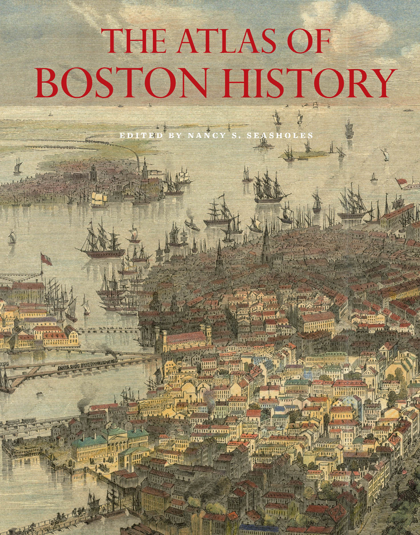
Historic New England (formerly the Society for the Protection of New England Antiquities) has awarded its 2020 Book Prize to The Atlas of Boston History, edited by Nancy S. Seasholes and written by her and a bevy of contributors, including me.

The society honors “a book that advances the understanding of life in New England from the past to today by examining its architecture, landscape, and material culture.”

About this year’s winner it says:
The book traces the city’s history and geography from the last ice age to the present with fifty-seven beautifully rendered maps. Thirty-five experts in a variety of fields contributed to the publication. From ancient glaciers to landmaking schemes and modern infrastructure projects, the city has been transformed almost constantly over the centuries. The Atlas of Boston History explores the history of the city through its physical, economic, and demographic changes, and social and cultural developments.
Historic New England also named two titles as Honor Books for the year: All three could of course make good holiday gifts for the right people.

In other present-day news, last week I spoke to Bradley Jay and Prof. Robert Allison for the Revolution 250 podcast. I was prepared to speak about the Boston Massacre trials and other Sestercentennial events. But Bob and Bradley wanted to talk mostly about my projects, so you’ll learn more about the background to this blog. Find the episode here or wherever you download podcasts.

Tuesday, April 14, 2020

Some Out of Town Jasper

As I quoted yesterday, in 1853 a story surfaced saying that Josiah Waters, Jr., had delivered intelligence about the impending British army march on 18 Apr 1775.

This story is significant in predating Henry W. Longfellow’s poem “Paul Revere’s Ride,” which romanticized the event and focused people’s attention on Revere over all the other people involved in the Lexington Alarm.

It also came with a provenance: from Waters himself to Joseph Curtis to his relation Catherine Curtis to the New England Historic Genealogical Society. Though that story might have evolved along that path of transmission, it’s always good to know that path.

Waters reportedly credited his knowledge of the British military plans to “Jasper, an Englishman, a gunsmith by trade, whose shop was in Hatter’s Square.” This man “worked for the British,” gaining their trust. He rented space to the family of a sergeant major who ended up “telling him all their plans.” Or at least the plans that a sergeant major would be privy to.

Of course I went looking for traces of a gunsmith named Jasper working in pre-Revolutionary Boston. I didn’t find any. But I did find a man named Jasper who came from Britain and worked with metal, so he could have repaired gunlocks along with other things.

William Jasper moved from Britain to North America soon after the end of the French and Indian War. The first sign of him is this advertisement from the 29 Aug 1763 New-York Gazette.

WILLIAM JASPER, cutler, Just arrived from England, is now settled in New York, near the Fly, Queen-Street, near the Burling’s and Beekman’s Slip next Door to Mr. Murray’s, takes this Method to acquaint the publick, That he makes all kinds of Surgeons instruments, and grinds and cleans them; makes Razors, Pen knives, scissars, and all kinds of Edge Tools, which he also grinds; and makes Cutlery in general; makes Buckles of the best Block-Tin, wrought and plain Men’s Gold and Silver Ware; Pinking-Irons of all Sorts; Sadlers Tools; Fret-Saws; Hatters knives; likewise draws Teeth with great Ease and Safety, being accustomed to it for many Years. He likewise has brought over a Quantity of Copper and Tin Hard-Ware. All Persons that please to favour him with their Custom, may depend upon being served in the best and cheapest Manner.
A cutler, according to Dr. Samuel Johnson, was “one who makes or sells knives.” Jasper made all sorts of bladed tools, from surgeon’s scalpels to fret saws, and he also offered some dentistry.

In 1768 William Jasper was in Boston, marrying Anne Newman on 29 June 1768. This couple appears on the list of marriage intentions read in all the pulpits, and it’s not clear to me where they actually wed. I also can’t find records of the couple having children, though there’s a mention of them having done so.

The Curtis story said Jasper the gunsmith had a shop “in Hatter’s Square,” which was also known as Creek Lane and later Creek Square. It was near the center of town, literally on the Mill Creek that defined the edge of the North End. I can’t situate William Jasper the cutler there, but he must have rented a shop somewhere.

Weapons collectors have found William Jasper’s name on a couple of blades possibly made during the war. Above is his maker’s stamp on a spontoon head from the late 1700s. In For Liberty I Live, Al Benting described a halberd inscribed with Jasper’s name. I don’t see any sign that he made guns, though perhaps he repaired them.

There was also a William Jasper among the American prisoners of war taken on the Boston-based privateer Rising States on 15 Apr 1777 and housed in Forton Prison in Britain. I have no idea what happened to that man and thus whether he could be the cutler. But the surname Jasper was rare in Massachusetts.

The next time William Jasper appeared in a newspaper was this notice in the 8 Aug 1782 Continental Journal:
TO THE PUBLIC.

JASPER, Surgeon Instrument Maker in Boston, has lately invented and compleated an Instrument for drawing Teeth perpendicular, which was never done before, for which if he can have a patentee from Congress, it shall be universally known, if not, let it die in oblivion.
I see no indication that the Confederation Congress considered granting Jasper a patent for this new dental instrument. There was no statutory process for the national government to grant patents until 1790, and the Congress had a lot of other business to handle in 1782.

Finally, the Continental Journal of 23 Nov 1786 reported that “Mr. William Jasper, Cutler,” had died in Boston. Anna Jasper administered William’s estate, relying on two men to complete the paperwork since she couldn’t sign her name. William Jasper’s property, evaluated at £24.6.6, included metal-working tools, some old books and pictures, and household utensils, but no real estate. Probate judge Oliver Wendell signed off on the administration, which included a general mention of children.

On 10 Apr 1791 a woman named Nancy Jasper married Joseph Jones in the Rev. Thomas Baldwin’s Second Baptist Meeting-house. Was this the widow Anne Jasper? Or a daughter of the 1768 marriage? The next year, on 25 Mar 1792, another Baptist minister, the Rev. Samuel Stillman, married Mary Jasper to John Dumaresque Dyer. Was this a daughter of the cutler William Jasper? If the family had been Baptist before the war, that would explain why there are no records of the children being baptized soon after birth, as there usually are for Congregationalist and Anglican families.

Thus, the sparse record of William Jasper’s life in America shows that he could have been Josiah Curtis’s informant in April 1775 but is far from confirmation of that story.

Friday, October 04, 2019

Big News for Boston History Fans

The Atlas of Boston History is a big book. I just got my copy, and it’s 14 inches tall and 11 inches wide, 224 full-color pages of maps, charts, and other illustrations of Boston history.

I got a copy because I worked with editor Nancy S. Seasholes on the page spread about Revolutionary Boston. You can see the whole list of topics and contributors, and several sample spreads, at the website for the book. Needless to say, a project this big has been several years in the making.

The Atlas of Boston History will be officially launched at the Boston Public Library’s central building on Thursday, 24 October, at 6:30 P.M. Nancy will speak about the project, and there will be a question-and-answer session with her and contributors. (I hope to participate, but I’ll have to come from another event in Cambridge.)

Other Atlas events include:

  • Wednesday, 30 October, 7:00 P.M.: Porter Square Books, Cambridge, author talk
  • Thursday, 14 November, 5:30 P.M.: Massachusetts Historical Society, Boston, author talk and panel

Wednesday, April 24, 2019

Upcoming Events in Charlestown and Weston

Here are a couple of interesting Revolutionary history happenings in the next few days.

On Thursday, 25 April, the Bunker Hill Museum will host a talk by Salem Maritime National Historic Site historian Emily Murphy titled “‘I Am An Honest Woman’: Female Revolutionary Resistance.”

Dr. Murphy will describe how middling-class women in Boston, Salem, and other towns of eastern Massachusetts participated in the colony’s resistance in the years before 1775. Though restricted by law and society, colonial women still found ways to express their political convictions.

This talk is scheduled to start at 7:00 P.M. in the lower-floor meeting room of the museum, 43 Monument Square in Charlestown. It is free and open to the public.

On the afternoon of Sunday, 28 April, Brian Donahue, associate professor of American environmental studies at Brandeis, will lead a walking tour of Weston, exploring its eighteenth-century landscape.

Donahue, author of The Great Meadow: Farmers and the Land in Colonial Concord, has created G.I.S. maps detailing how Weston big man Isaac Jones assembled and used his farm. This tour will start at the Golden Ball Tavern with a short presentation showing how innkeeper Jones’s farm developed over several generations and was divided among heirs.

Participants will then walk for one to two hours south, crossing Route 20 and on trails and roads back to Chestnut Street and into Highland Forest—all part of the Jones farm—and then back by a slight variation. We will look at lanes and stone walls and talk about what various parcels were likely used for (meadow hay, tillage, orchard, pasture, woodland) along the way. (There will be a turning-off point for those who do not want to continue up into Highland Forest.)

To join in all or part of this walk through history, please send an R.S.V.P. to gbtmuseum@gmail.com and hope for a lovely spring day. The Golden Ball Tavern is at 662 Boston Post Road in Weston.

Friday, December 21, 2018

Looking for the Tea Party Location Today

In the 1850 Boston Evening Transcript story about public memory of the Boston Tea Party that I quoted a couple of days ago, John Russell wrote: “Very few persons now know where to find Griffin’s Wharf, the name of which should have been preserved through all time.”

Boston had grown significantly between 1773 and the date of that article, grown even more since. The site of the tea destruction, the shallow water at low tide beside Griffin’s Wharf, has become dry land. But where exactly?

John Robertson has a website devoted to that question, considering many clues, false clues, and more or less reliable maps produced over the years. Since he first posted his findings, what was a vacant lot has become the site of the InterContinental Hotel Boston, 510 Atlantic Avenue. Under the western slice of that building, Robertson says, was where Griffin’s Wharf lay in 1773.

The tablet above is on 470 Atlantic Avenue, the brick building beside the chrome hotel. It was installed (on a predecessor to that building, numbered 495) as early as 1898 by the Massachusetts Society of the Sons of the American Revolution. The Boston Tea Party Ships & Museum is nearby in the channel.

Sunday, September 23, 2018

“There are no Barracks in the Town”

Thursday, 22 Sept 1768, was not only the first day of the extralegal Massachusetts Convention of Towns. It was also the anniversary of the coronation of George III.

That royal holiday was accordingly observed in Boston, as the Boston Evening-Post described:
by the firing of the Cannon at Castle William and at the Batteries in this Town, and three Vollies by the Regiment of Militia, which, with the Train of Artillery, were mustered on the Occasion.——

At the Invitation of his Excellency the Governor, his Majesty’s Health was drank at the Council-Chamber at Noon.
So much for ceremonial harmony. At that same meeting in the Old State House, Gov. Francis Bernard and the Council were in a major dispute.

Three days before, the governor had formally told the Council the news that he’d leaked earlier—that British army regiments were on the way to Boston. Under the Quartering Act, the local authorities were required to provide housing and firewood for them. As John G. McCurdy argued at a Colonial Society of Massachusetts session last February, we can think of the Quartering Act as one of Parliament’s taxes on the colonies, requiring resources from local communities without their vote.

Gov. Bernard wanted the Council to start arranging to house four regiments, two on their way from Halifax and two more to arrive later from Ireland. But the Council was determined not to cooperate. In a report to London, Bernard claimed James Otis, Jr., had laid out this strategy for the Whigs:
There are no Barracks in the Town; and therefore by Act of parliament they [the soldiers] must be quartered in the public houses. But no one will keep a public house upon such terms, & there will be no public houses. Then the Governor and Council must hire Barnes Outhouses &c for them; but no body is obliged to let them; no body will let them; no body will dare to let them.

The Troops are forbid to quarter themselves in Any other manner than according to the Act of parliament, under severe penalties. But they can’t quarter themselves according to the Act: and therefore they must leave the Town or seize on quarters contrary to the Act. When they do this, when they invade property contrary to an Act of parliament We may resist them with the Law on our side.
Bernard was anxious to head off such trouble. He wrote:
I answered, that they must be sensible that this Act of parliament (which seemed to be made only with a View to marching troops) could not be carried into execution in this Case. For if these troops were to be quartered in public houses & thereby mixt with the people their intercourse would be a perpetual Source of affrays and bloodsheds; and I was sure that no Commanding officer would consent to having his troops separated into small parties in a town where there was so public & professed a disaffection to his Majesty’s British Government.

And as to hiring barnes outhouses &c it was mere trifling to apply that clause to Winter quarters in this Country; where the Men could not live but in buildings with tight walls & plenty of fireplaces. Therefore the only thing to be done was to provide barracks; and to say that there were none was only true, that there was no building built for that purpose; but there were many public buildings that might be fitted up for that purpose with no great inconvenience.
Bernard proposed that the province make the Manufactory House available for the troops. This building had been put up in 1753 to house spinners and weavers. The province had loaned money to build it, expecting to be paid back from the profits of the cloth-manufacturing enterprise. The scheme never made money, the businessmen behind it defaulted on the loan, and Massachusetts was left with ownership of this big building near the center of town.

The Council formed a committee led by James Bowdoin to consult with Boston’s selectmen about the troops. On 22 September, the day of the toasts to the king, that committee reported that the selectmen “gave it for their Opinion that it would be most for the peace of the Town that the two regiments expected from Halifax should be quartered at the Castle.”

That was a new strategy, avoiding confrontations with the soldiers by housing them in the barracks on Castle William—which was on an island in the harbor. Of course, that meant those troops couldn’t patrol Boston and protect Customs officers, which was the whole point of sending them into town. Bernard wrote, “I observed that they confounded the Words Town & Township; that the Castle was indeed in the Township of Boston but was so far from being in the Town that it was distant from it by water 3 miles & by land 7.”

The governor reproached his Council: “I did not see how they could clear themselves from being charged with a design to embarras the quartering the Kings troops.” Bernard thus hinted that the body was being disloyal to the king—and on the anniversary of his coronation! “I spoke this so forcibly,” he wrote, “that some of them were stagger’d, & desired further time to consider of it.” But one member warned the governor not to expect any progress, “pleasantly” adding, “what can you expect from a Council who are more affraid of the people than they are of the King?”

On 23 September, 250 years ago today, a smaller committee, also led by Bowdoin, was ready to present a formal report on the matter to Gov. Bernard.

Who was now at his country house out in Jamaica Plain. This of course kept him distant from the Convention going on in Faneuil Hall. Province secretary Andrew Oliver told the Council “that the Weather being so stormy the Governor will not be in Town to-day, and desires they will meet him at the Province-House to-morrow ten o’Clock, A.M.”

The next morning was stormy, too. Bernard finally came into town that Saturday afternoon to hear what the Council had to say. Which was the same thing as before, except longer: the only place for the troops was out at Castle William. After cleaning up some errors in their report, the Council had it published in the newspapers on 26 September, making the dispute a public matter.

COMING UP: Meanwhile, back in Faneuil Hall.

Sunday, June 03, 2018

The Hourglass Effect and Its Discontents

Last month the Panorama, the blog of the Journal of the American Republic, shared Nathan Perl-Rosenthal’s essay “The Hourglass Effect in Teaching the American Revolution.”

Perl-Rosenthal, a professor at the University of Southern California, wrote:
The hourglass problem arises from trying to synthesize old and new ways of seeing the American Revolution in a single course. You probably start your class with a wide-angle early modern frame: Big, oceanic topics like global empire, Atlantic slavery, and the consumer revolution are good for framing and explaining the coming imperial crisis.

But before long, the course’s terrain contracts as you turn to the traditional chronology of the Revolution. One feels the squeeze already with the Sugar, Stamp, and Townshend Acts. After early 1770, it gets hard to leave eastern North America. First one is in Boston for the Massacre, then explaining the local politics of the Coercive Acts, followed by Lexington and Concord, and the debate over independence. The same goes for the war years and the critical period. A reopening outward typically only gets underway in the 1790s. . . .

The geographic cinching-up of the 1760s and 1770s, by temporarily shutting out events anywhere but North America, paradoxically ends up reinforcing the very exceptionalist narrative of the Revolution that a wider lens is supposed to help us avoid. The wider world may play its part in the revolutionary era, this approach implies, but during the crucial period of the 1770s and 1780s there is a particular and special North American story that must be told.
Perl-Rosenthal then tries to sketch out (with sketches!) how a course might “tell the story of the revolutionary decades in parallel with simultaneous developments elsewhere in the continent and the world.”
What would a course on the American Revolution look like with this approach in mind? First, it would begin by sketching out the common traits of the eighteenth-century Atlantic world—not just in the British empire but across imperial boundaries. . . .

Second, you would want to use these shared traits to constantly relativize and contextualize the American experience. . . .

Third, those shared elements would provide a basis for incorporating contemporaneous revolutions into the course, starting in the 1780s. The idea would be to see these revolutions not as disparate phenomena in distant regions, but as branches off of the same trunk in constant interaction. . . .

I’ll conclude by going back to Lexington and Concord, a particularly tricky point in the course if one wants to avoid the hourglass effect. Where are the “Atlantic cultures” to be found in this story of British regulars marching into a provincial burgh? Not far off at all. Civic militia were an almost universal feature of the Euro-American world, who generally defended local interests—as the American militiamen did. The British regulars’ tactics had much in common with those of career soldiers elsewhere in the Atlantic, from Prussia to Cape Colony. And the confrontation between the two was hardly unusual. The Dutch patriot revolt, the early French Revolution, and the Haitian Revolution—to name just a few—were also set off in part by similar clashes. 
John Fea, professor at Messiah College, responded briefly on his own blog:
As I read Perl-Rosenthal’s post I was struck by the presuppositions that guided the piece. It is assumed that any discussion of local narratives is bad or somehow contributing to American exceptionalism. He uses terms like “traditional chronology” as if that is a bad thing. Those who get too caught-up in this narrative “feel the squeeze.” And, of course, the word “exceptionalism” is a very loaded term with negative connotations in the academy. (In some ways, I would argue, the American Revolution was an exceptional event, even as it was shaped by global forces).
Perl-Rosenthal himself acknowledges the outsized influence of events in the thirteen colonies, but only parenthetically: “This emphatically does not mean denying the American Revolution’s transformative power in the region, nor its wider global significance.”

All of which suggests to me that some hourglass effect might be inevitable, especially if one is teaching American history at an American university to American students.

Saturday, March 10, 2018

Seasholes on “The Changing Shape of Boston,” 14 Mar.

On Wednesday, 14 March, the Old North Church will host a talk by Nancy S. Seasholes on “The Changing Shape of Boston: From ‘One if by land, and two if by sea’ to the Present.” This talk is co-sponsored by the Leventhal Map Center at the Boston Public Library.

The Old North Speaker Series event description says:
Did you know that Boston was once a small peninsula? How did the fact that Boston was located on a peninsula affect the choices made by both the British and the Patriots on April 18, 1775? What happened to that small peninsula afterwards to transform it into the Boston of today? This talk will explore the changes in Boston’s topography from the time of the Revolutionary War to the present.
Seasholes is the expert on how Boston has physically grown over the years. She is the author of Gaining Ground: A History of Landmaking in Boston and Walking Tours of Boston’s Made Land.

Right now Seasholes is directing a project to produce an historical atlas of Boston, to be published by the University of Chicago Press in fall 2019. I’m one of the many contributors she’s wrangling to get that book finished.

This talk starts at 6:00 P.M. Reserve seats through this webpage. Admission is on a “pay what you will” basis. (This was Old North Church’s previous general admission policy; it has just announced a big change.)