J. L. BELL is a Massachusetts writer who specializes in (among other things) the start of the American Revolution in and around Boston. He is particularly interested in the experiences of children in 1765-75. He has published scholarly papers and popular articles for both children and adults. He was consultant for an episode of History Detectives, and contributed to a display at Minute Man National Historic Park.

Subscribe thru Follow.it


•••••••••••••••••


Showing posts with label Henry DeBerniere. Show all posts

Wednesday, May 20, 2026

“Entirely useless by breaking off the Trunnions”

Yesterday I started quoting a 29 Apr 1776 letter from the Rev. Dr. Samuel Cooper to Samuel Adams about Boston’s defenses soon after the British military left.

That letter goes on to say:

The Enemy employ’d no little Time in…destroying the Guns: The Trunnions of all of which, except 8 or so, they entirely knock’d off, besides spiking up the Touch holes in the most effectual Manner.
“Trunnions” was a term technical enough not to appear in Dr. Samuel Johnson’s dictionary. Merriam-Webster now defines them as the pivots on which something can be rotated or tilted, particularly the “two opposite gudgeons on which a cannon is swiveled.” (And it defines “gudgeons” as pivots.)

This overhead view of a cannon might convey the information better.
A gun carriage held a cannon by the two horizontal trunnions. They provided the fulcrum that allowed gunners to point the cannon up or down. A cannon without its trunnions was a heavy metal tube, very hard to mount and impossible to aim. Or, as Gen. George Washington deemed the broken guns left behind in Boston, “entirely useless.”

British artillerists broke trunnions to keep the rebels from having useful weapons. In Concord on 19 Apr 1775, Ens. Henry DeBerniere reported, “Capt. [Mundy] Pole of 10th regiment…knock’d the trunnions off three iron 24 pound cannon and burnt their carriages.”

With little other choice, the Continental Army still tried to use such damaged artillery pieces. Dr. James Thacher reported that the army started out with “a few old honey-comb iron pieces, with their trunnions broken off.” The doctor was pleased when Capt. John Manley and Col. Henry Knox brought in some intact guns.

Given that expertise, and necessity, on 24 March Washington expressed hope that Boston’s broken and spiked cannon “may be made serviceable again.” But how?

TOMORROW: A genius appears.

Monday, October 13, 2025

On the Trail of Capt. William Browne

In the HUB History podcast episode “Drinker, Draftsman, Soldier, Spy,” Jake Sconyers quotes my remark on how difficult it is to track Capt. William Browne of the 52nd Regiment before 1775 because there were so many men named William Brown(e).

He also quoted a portion of Ens. Henry DeBerniere’s report on his spy missions with Capt. Browne that I’d read many times but hadn’t tumbled to how it’s helpful with that precise challenge.

One of my favorite moments in that narrative is when Browne, DeBerniere, and their manservant have reached Jonathan Brewer’s tavern in Waltham.

a little out of this town [Watertown] we went into a tavern, a Mr. Brewer’s, a whig, we called for dinner, which was brought in by a black woman, at first she was very civil, but afterwards began to eye us very attentively; she then went out and a little after returned, when we observed to her that it was a very fine country, upon which she answered so it is, and we have got brave fellows to defend it, and if you go up any higher you find it so,—

This disconcerted us a good deal, and we imagined she knew us from our papers which we took out before her, as the General had told us to pass for surveyors; however, we resolved not to sleep there that night, as we had intended, accordingly we paid our bill which amounted to two pounds odd shillings, but in [sic] was old tenor.

After we had left the house we enquired of John, our servant, what she had said, he told us that she knew Capt. Brown very well, that she had seen him five years before at Boston, and knew him to be an officer, and that she was sure I was one also, and told John that he was a regular—he denied it; but she said she knew our errant was to take a plan of the country; that she had seen the river and road through Charlestown on the paper; she also advised him to tell us not to go any higher, for if we did we should meet with very bad usage
That waitress didn’t just recognize Brown—she recognized him from “five years before at Boston.” That was in 1770, and there were only two British army regiments in Boston then: the 29th and the 14th. That narrows the field considerably.

Sure enough, the officers of the 14th included Lt. William Browne. On 12 July 1771, the War Office announced that “Lieut. William Brown, of the 14th regiment of Foot,” had purchased the rank of captain in the 52nd in the place of Archibald Williams. In the 14th, Ens. William Napier moved up to lieutenant’s rank.

One implication of that fact is that Gen. Thomas Gage might have chosen Capt. Browne to scout the countryside in 1775 because that officer was more familiar with Massachusetts than most of his colleagues, having spent about two years in Boston and on Castle Island back in 1768–1770.

Of course, that had the drawback of more people in Massachusetts being familiar with Browne, as the woman in Waltham showed.

For earlier information on Lt. Browne I hunted down the Army List for 1767. And I found this list of lieutenants in the 14th Regiment of Foot:
Goddammit!

Two men named William Browne became lieutenants in the 14th Regiment four days apart in June 1766. One of them had joined the army in 1762, the other at some unknown time. They were both still lieutenants in the 14th at the start of 1771. 

And during the same period when one or both of these lieutenants were serving in Boston:
And there were probably others.

TOMORROW: Capt. Browne’s own voice?

Friday, April 18, 2025

Counterfactual 3: If Prescott Hadn’t Alerted Concord

Continuing my speculation about what might have happened if Paul Revere and William Dawes hadn’t alerted Lexington about the regulars coming out, I’m now going to look at Concord.

This post was prompted by the suggestion in Kostya Kennedy’s book The Ride that if Revere hadn’t ridden out on 18 April “the munitions at Concord could have been seized.”

That’s mistaken because militia colonel James Barrett, his helpers, and his family had started moving the most valuable military supplies out of town days before the British army march. In part because Revere had brought a warning from Boston on an earlier ride. 

On 6 April, James Warren was in Concord for a meeting of the Massachusetts Provincial Congress, and he wrote to his wife Mercy: “This Town is full of Cannon, ammunition, stores, etc., and the Army long for them and they want nothing but strength to Induce an attempt on them.”

But when the redcoats arrived, Ens. Henry DeBerniere said, they “did not find so much as we expected.” Specifically, he reported:
Capt. [Mundy] Pole of 10th regiment…knock’d the trunnions off three iron 24 pound cannon and burnt their carriages; they also destroyed a quantity of flour, and some barrels of trenchers and spoons of wood for their camp.
At Barrett’s farm the soldiers burned some more carriage wheels. But the town was obviously no longer “full” of military stores. And that change had taken days, not a few hours.

If the British expedition hadn’t paused in Lexington but marched straight through, as I posited yesterday, the vanguard would probably have arrived in Concord less than half an hour earlier. Some of the local militia might have been on alert, but without Dr. Samuel Prescott’s warning, it probably wouldn’t have been at full force.

But would that have mattered at first? When the regulars approached the town, the Concord militia marched away and took a position on a hill west of the North Bridge. Other men and then other town companies joined them there while the redcoats searched both the town and Barrett’s farm.

Without the earlier alerts from Revere riding west from Medford to Lincoln and the Prescott brothers riding out of Concord, those militia companies from other towns wouldn’t have joined the Concord companies as quickly as they did. It’s thus possible there would have been significantly fewer men on that hill when smoke began to rise from the center of town, where redcoats were burning carriage wheels (and, briefly, the town house).

The Concord men might have been just as upset by the sight of that smoke, but might not have felt their numbers were strong enough to do anything about it. And eventually the smoke would have dissipated as people in town succeeded in dousing the fire. So the provincials might never have made their fatal march down to the bridge, with the Acton company in the lead.

TOMORROW: The battle that never was.

Sunday, March 23, 2025

“Secrets on the Road to Concord” in Scituate, 15 May

On Saturday I attended the “Spies Among Us” event in Concord, described back here.

Top highlights:
  • Seeing the Wright Tavern sprucing up as it prepares to reopen to the public next month, including the Pursuit of History weekend on “The Outbreak of War” that I’m helping to organize there (a couple of seats may still be available).
  • Enjoying all the special touches the National Park Service staff and volunteers brought to this event, including a full-size replica of Ens. Henry DeBerniere’s map from the Library of Congress and a Concord role-playing game.
  • Hearing details about what brought the British troops to Concord and remembering back during the 2000 commemoration when many of those were still little beads I was trying to string together into a narrative that became The Road to Concord.
So I’m eager to keep spreading the word at my upcoming speaking engagement for the Scituate Historical Society. [This event was originally scheduled for March and postponed.]

Thursday, 15 May, 7–8:30 P.M.
Secrets on the Road to Concord
G.A.R. Hall, 353 Country Way, Scituate

Early in the spring of 1775, British army spies located four brass cannon belonging to Boston’s colonial militia that had gone missing months before. British general Thomas Gage devised plans to regain the cannon. Massachusetts Patriots prepared to thwart the general’s hopes. Each side wanted control of those weapons, but each also had reasons to keep their existence a secret. That conflict would end with blood on the road to Concord.

Admission is $15, or $10 for society members. Reservations are recommended, but payment will be accepted at the door.

I look forward to meeting more folks in shoreside Plymouth County.

(The picture above is a page from one of Scituate Historical Society’s artifacts of the 1770s: Caleb Litchfield’s notebook from when he was a teenager studying mathematics and navigation. Litchfield served in the Continental forces on land and sea during the war. After a brief time as a merchant ship’s master, he retired inland to Milton and then Weathersfield, Vermont.)

Saturday, November 16, 2024

“The Spies in Henry Barnes’s House” at Hingham, 17 Nov.

Yesterday I wrote about Ens. Henry DeBerniere, the young mapmaking army officer.

He turned up at Henry and Christian Barnes’s house in Marlborough on 1 Mar 1775, along with Capt. William Brown.

Those two officers were “The Spies in Henry Barnes’s House” that I’ll speak about on the afternoon of Sunday, 17 November, in the Hingham Historical Society’s Revisiting The American Revolution series.

Dr. Samuel Curtis will also show up in my talk, just as he showed up at the Barnes house that night, trying to ferret out information on DeBerniere and Brown. So he was spying, too.

I may even bring in Gib Speakman and Prince Demah because of their ties to the Barnes family, even though I can’t link them to events of that night.

Why, you might ask, am I delivering this talk in Hingham rather than in Marlborough, where all the action happened?

Because another player in that night’s drama was Chrisy Arbuthnot, an orphaned ten-year-old niece living with the Barneses. She had come to them from Hingham.

In addition, Prince Demah’s portraits of Henry and Christian Barnes are now among the treasures of the Hingham Historical Society.

Like other talks in this series, this presentation will be accessible in person and online, as part of the whole series or on its town. Admission (which isn’t cheap) helps to fund the society.

Friday, November 15, 2024

“There is one very bad place in this five miles”

A few days back, I linked again to a hand-drawn map at the Library of Congress that appears to be the work of Ens. Henry DeBerniere. The locations on that map match DeBerniere’s first spying trip to the west with Capt. William Brown in February 1775.

Gen. Thomas Gage had those two British officers make a second foray into the countryside starting on 20 March, this time to look for cannon and other military supplies in Concord.

We know the two officers went out to Concord on roads that appear on this map, as shown in the detail above. DeBerniere wrote:
We went through Roxbury and Brookline, and came into the main road between the thirteen and fourteen mile-stones in the township of Weston; we went through part of the pass at the eleven mile-stone, took the Concord road, which is seven miles from the main road.
But Brown and DeBerniere came back by a different route:
Mr. [Daniel] Bliss…told us he could shew us another road, called the Lexington road. We set out and crossed the bridge in the town, and of consequence left the town on the contrary side of the river to what we entered it. The road continued very open and good for six miles, the next five a little inclosed, (there is one very bad place in this five miles) the road good to Lexington.

You then come to Menotomy, the road still good; a pond or lake at Menotomy. You then leave Cambridge on your right, and fall into the main road a little below Cambridge, and so to Charlestown; the road is very good almost all the way.
That “Lexington road” doesn’t appear on the hand-drawn map. It’s possible that DeBerniere produced another map to show it. That would have been useful since that’s the road that Lt. Col. Francis Smith followed to Concord on 18–19 April and then withdrew along.

Donald L. Hafner of Boston College drew my attention to that omission when he left this comment to my recent posting:
It is unfortunate that the surviving map attributed to Ensign DeBerniere does not include the alternate route through Lexington and Menotomy that he and Capt William Brown took on their return to Boston, because it leaves a puzzle about where on that route was the "one very bad place" that DeBerniere describes in his written report to Gage. DeBerniere's sentence is a bit garbled, but he is referring to some location between Lexington and Menotomy center. A good guess would be those locations where the main road is hemmed in to the south by sharply-rising hills, and on the north by wetlands and the Mill Brook. A good candidate would be near the current Lexington/Arlington border. But that is just a guess. Are there better candidates that a soldier would describe as "one very bad place"?
DeBerniere wasn’t clear about where in Concord he started estimating distances, but it is about six miles from the center of Concord to Lexington common, and about five from Lexington common to the modern Arlington town hall. So that does suggest somewhere in the second stretch the officers judged the road “good” but “a little inclosed” with “one very bad place.” The area between Liberty Heights and the Mill Brook in east Lexington indeed seems to be the best candidate—about where Wicked Bagel sits, in fact.

Notably, Smith’s column had its worst experiences before reaching Lexington center at places like Merriam’s Corner, Elm Brook Hill, and the “Parker’s Revenge” site—other spots where the road turned and/or narrowed, but not so much as to make DeBerniere worry.

Monday, November 11, 2024

Looking at Lexington and Concord through Eighteenth-Century Eyes

Last month Alexander Cain at Historical Nerdery announced a resource for people researching the Battle of Lexington and Concord ahead of next spring’s Sestercentennial: a list of links to eyewitness accounts of the day.

That listing will be very useful, and it can grow. Perforce these are texts that have been digitized in one way or another. I’m sure that more lurk within books, newspapers, and letters. It’s a matter of ferreting them out and/or digitizing them in usable forms.

For instance, here is the list’s link to Gen. Thomas Gage’s instructions to Lt. Col. Francis Smith for the march to Concord on 18–19 April.

We also have what appears to be Gage’s notes or first draft of those instructions, quoted in General Gage’s Informers (1932) by Allan French. A digital version of that book can be borrowed from the Internet Archive, at least for now. Look on pages 29–30.

Since the Massachusetts Historical Society has scanned merchant John Rowe’s diaries, we can see his response to the news coming into Boston here. A transcription of what a descendant thought were the most important parts of that diary was published a century ago. Among the details one can find only in the handwritten journal is that on 20 April Capt. John Linzee, R.N., dined and spent the evening at Rowe’s house after fending off an attack on his ship on the Charles River.

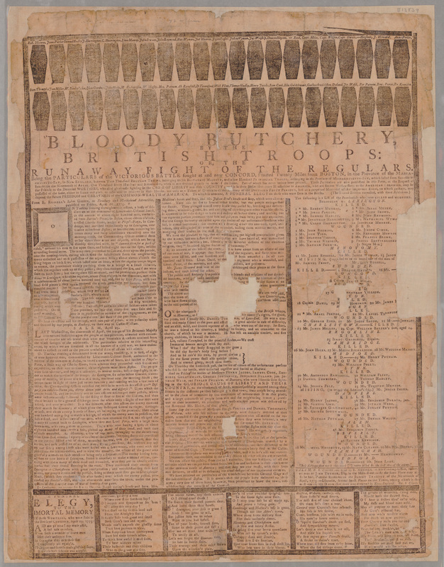
It’s possible to identify the sources of some anonymous accounts. One resource on the list, Ezekiel Russell’s “Bloody Butchery by the British Troops” broadside, includes text headlined “SALEM, April 25.” Those paragraphs commence: “LAST Wednesday, the nineteenth of April, the troops of his Britannic Majesty commenced hostilities upon the people of this province…”

The preceding paragraphs come with a source citation—not coincidentally, to Russell’s own Salem Gazette newspaper. But Russell didn’t give his competition publicity by revealing that he took the second and longer passage from Samuel Hall’s Essex Gazette for 25 April. That text was later imperfectly transcribed in Peter Force’s American Archives.

The 3 May Massachusetts Spy on the list includes an unsourced story about what happened “When the expresses [from Boston] got about a mile beyond Lexington.” That story matches one that William Dawes’s family recalled hearing from him, revealing that Dawes was probably printer Isaiah Thomas’s source.

Among the lately revealed visual resources is this hand-drawn map in the Library of Congress. I’m convinced by Ed Redmond’s hypothesis that Ens. Henry DeBerniere created this map ahead of the march to Concord. It thus offers a look at what British army officers knew of the countryside west of Boston. (I discussed details of that map starting here.)

TOMORROW: A source from May 1775.

Sunday, September 11, 2022

“General Gage’s Spies” via the Golden Ball Tavern, 15 Sept.

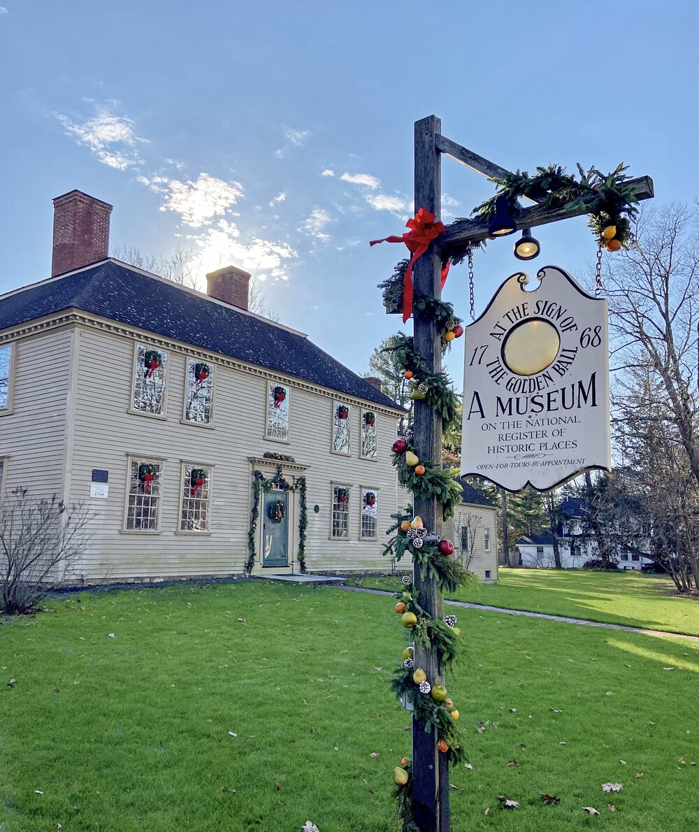
On Thursday, 15 September, I’ll deliver an online lecture for the Golden Ball Tavern Museum in Weston.

The talk will be titled “General Gage’s Spies,” and here’s our event description:
On February 23, 1775, three men arrived at Isaac Jones’s tavern in Weston, saying they were surveyors from Boston. They were actually two officers and a private from the king’s army. The royal governor, General Thomas Gage, had assigned them to find cannons and other military supplies that the rebel Massachusetts government was collecting outside of Boston. Drawn from new research, this talk discusses who those men were, the crucial role they played in the Battle of Lexington and Concord, and what happened to them after the Revolutionary War.
The spies’ visit to Jones’s Golden Ball Tavern is fairly well known. In The Road to Concord I showed how their mission fit into Gen. Gage’s larger strategy to locate and neutralize the artillery that rural Patriots were hiding. Since then I’ve gathered some more information about the two army officers, which will be part of this talk.

Yet another new wrinkle is that even as those spies were staying at the Golden Ball on their way to Worcester, people elsewhere in Weston were preparing two cannon for battle. Braddyll Smith, recently chosen to be both Weston’s representative to the Massachusetts Provincial Congress and colonel of the local militia regiment, knew about that effort and was probably in charge.

Smith’s predecessor in those posts was Elisha Jones, a Loyalist who had left for Boston around the turn of the year. Presumably Smith and his Patriot neighbors made sure that Elisha’s cousin Isaac, proprietor at the Golden Ball, never heard about their two cannon. After all, you didn’t know who might come through town.

My talk is scheduled to start at 6:00 P.M. Here’s the link to register. This event is free, thanks to support from the Weston Cultural Council, and folks can also join or donate to the Golden Ball Tavern Museum to support and learn about more such events.

Wednesday, April 13, 2022

Capt. William Browne’s War

William Browne received his commission as a captain in the British army on 24 June 1771. He must have enlisted at a lower rank a few years earlier, but because his name was so common and because officers moved from one regiment to another for promotions, I’m not sure when his military career began.

While the 52nd Regiment was in Boston, Capt. Browne commanded its light infantry company. That means he led those men out to Concord on 18–19 Apr 1775.

Browne had been to Concord before. On 20 March, he and Ens. Henry DeBerniere visited the town in civilian guise to confirm a local informant’s reports to Gen. Thomas Gage that militia colonel James Barrett was amassing arms there, including four cannon spirited out of Boston armories.

The two army officers did confirm that the Patriots had those four brass cannon “concealed in some place behind the town, in a wood.” That wording suggests they didn’t see the hiding-place but were told where it was. One source of information was probably the local lawyer Daniel Bliss, who felt so unsafe having suspicious visitors in his house that he went into Boston with Brown and DeBerniere. (Gage’s original informant remained in town.)

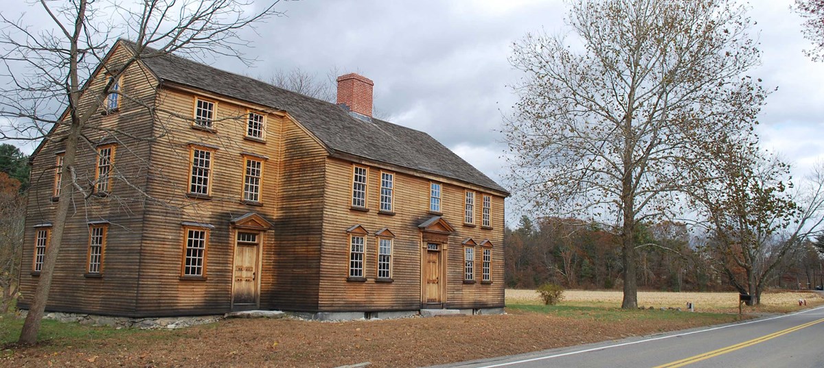
Browne, DeBerniere, and Bliss returned as part of the army expedition to Concord on 18–19 April. In fact, we know from other officers’ reports that Capt. Browne and his light infantrymen were among the three companies who went all the way to Barrett’s farm, a mile past the North Bridge (shown above).

Those redcoats didn’t find significant amounts of ordnance at that farm. On their way back, they did find some of their fellow soldiers killed at the bridge. That was the start of the column’s difficult fight back to Boston.

The 52nd Regiment was also in the Battle of Bunker Hill two months later. According to one source, the regiment ended that day camped closest to the provincial lines on the isthmus of the Charlestown peninsula. Capt. Browne was listed among the wounded.

On 1 August, the British command in London made Capt. Browne a brigade major, an administrative post with a corresponding rise in pay. Gen. William Howe announced that promotion in his orders from Halifax the following May. In 1778, the 52nd Regiment was drafted, meaning its men were distributed to other regiments and it began to recruit new soldiers.

Around that time, Browne was promoted to be the major of the 49th Regiment. Later in 1778 that unit took part in the British conquest of St. Lucia from the French. In 1780 the 49th moved to Ireland. Around the start of 1783 Browne became a lieutenant-colonel in the army. Henry Lawes Luttrell, then serving in the Irish Parliament, told that legislature that:
Colonel Brown was one of the best officers in the army, that he had distinguished himself on service, and was remarkable for a strict observance of discipline in the regiment, and an excellent corps of officers emulated his example—
If only that praise had come from a more respectable man.

That’s as far as I can trace William Browne. Again, his common name makes him easy to lose in a crowd.

Tuesday, April 12, 2022

Naming Captain Brown of the 52nd

On 22 Feb 1775, Gen. Thomas Gage dispatched two army officers (and the servant of one of them) to scout out the roads to Worcester and learn what they could about artillery that Patriots were collecting in that town.

The report those officers eventually filed was left behind in the British evacuation of Boston, printed in 1779 by John Gill, and reprinted in 1816 by the Massachusetts Historical Society. The original document is long gone, but the reprints provide the names of the two officers—sort of.

One of those names was printed as D’Bernicre, which was wrong but close enough to lead researchers to Ens. Henry DeBerniere of the 10th Regiment of Foot. His name was spelled in additional ways in period documents (D’Berniere, De Berniere, de Birniere), but because it was such a rare name he’s easy to identify. In fact, I traced his whole career before and after the war.

The other officer’s last name was Brown.

Naturally, that common surname poses more of a challenge. However, the report tells us that this was “Capt. Brown 52d regiment.” The British Army Lists for 1773 and 1778 and Worthington C. Ford’s British Officers Serving in the American Revolution, 1774-1783, which was assembled using more of those lists, yields only one candidate in that regiment: Capt. William Browne. (If I could, I’d go back and use the “Browne” spelling for his label on this blog since that seems to be the prevalent one, though not in the report to Gage.)

Several scholars identified DeBerniere’s companion as William Browne in the 1900s, including Elizabeth Ellery Dana, the editor of John Barker’s diary; John Bakeless; and Bernhard Knollenberg.

However, in Paul Revere’s Ride (1994), David Hackett Fischer wrote of “two enterprising young officers, Captain John Brown and Ensign Henry De Berniere of the 10th Foot.” That book offers no explanation for the name John, which appears in the report as the first name of Capt. Brown’s servant. 

Since then, several more authorities apparently relying on Fischer have used the name “John Brown.” That group includes the very helpful Massachusetts Historical Society webpage offering scans and a transcription of the report as first printed by Gill. But there was no such captain in the 52nd Regiment or other regiments in Boston.

TOMORROW: William Browne’s war.

Thursday, June 10, 2021

The Later Career of Henry DeBerniere

On 18–19 Apr 1775, Ens. Henry DeBerniere was in the column of British troops that marched to Concord and back. Having visited the town looking for cannon the month before, he was probably one of the main guides for his regimental commander, Lt. Col. Francis Smith.

A couple of months later, he drew a map of the Battle of Bunker Hill that I discussed back here.

We have just a few glimpses of DeBerniere through the next few years as the 10th fought at Brooklyn, Germantown, Monmouth, and Rhode Island. He became a lieutenant during the war, a captain-lieutenant sometime in 1783. As of 1792 he was a captain, still with the 10th Regiment, stationed on Jamaica. Three years later, he was promoted to major.

Britain’s wars with Revolutionary and Napoleonic France opened up more opportunities for career officers. In November 1796, DeBerniere transferred to the 9th Regiment with the rank of lieutenant colonel. Three years later, the regiment fought in Holland, including the Battle of Bergen (shown above).

In 1798 DeBerniere married Elizabeth Longley (1770-1858), eighteen years old and born the year the lieutenant colonel entered the army. That difference in ages may be why later sources estimated he was born later than he was.

Meanwhile, in 1799 Henry’s older brother, retired army officer John Anthony DeBerniere (1744-1812), and his family moved from Ireland to South Carolina. Papers from that branch of the family are in the collections of the South Carolina Historical Society. His gravestone is in the cemetery of St. Philip’s Episcopal Church in Charleston.

On 10 Nov 1805 three British transport ships sailed from Cork, Ireland, to carry Lt. Col. DeBerniere and the 9th Regiment to a new assignment on the continent. A storm blew up, and one of those ships, the Ariadne, was wrecked off Calais. All the regiment’s staff officers and 262 soldiers became prisoners of war.

The Times of London reported that twenty women and twelve children were also captured. Those might have included Lt. Col. DeBerniere’s wife, their son John (b. 1801), and daughter Elisabeth (b. 1803). If not, Elizabeth DeBerniere later joined her husband in France.

The French government chose not to exchange the regimental commander for an officer held in Britain. DeBerniere remained a prisoner at Nancy, far from the coast in northeastern France, year after year as the wars swirled around him.

Eventually Napoleon had to retreat from Moscow, and the Sixth Coalition formed to pursue his army, defeating it at Liepzig in late 1813 and then entering France. In his Narrative of a Forced Journey Through Spain and France, as a Prisoner of War, in the Years 1810 to 1814, Baron Blayney wrote:
Shortly after the head quarters of the grand army were established at Metz, and the sick and wounded were removed from Mayence, &c. towards Verdun and the interior. For six weeks the roads were crowded with waggons, and all the public buildings at Verdun were converted into hospitals. At the same time an hospital fever prevailed at Mayence, and was conveyed to Metz and Nancy, in which latter place Colonel de Bernière of the 9th regiment fell a victim to it, universally regretted.
Henry DeBerniere thus died a captive in the land of his Huguenot ancestors on 6 December 1813.

Parliament approved a £150 annual pension for the widow Elizabeth DeBerniere and her three daughters. The DeBernieres’ only son had already died. Francoise Charlotte Josephine, born while the couple was in France, married the Rev. Newton Smart, and the family took the name of DeBerniere-Smart. Among their descendants is Louis de Bernières, author of Captain Corelli’s Mandolin.

Wednesday, June 09, 2021

The Early Career of Henry DeBerniere

Earlier in the year I analyzed a map almost certainly made by Ens. Henry DeBerniere after his scouting expeditions in the Massachusetts countryside in early 1775.

I also promised a look at DeBerniere’s career after the outbreak of the Revolutionary War, which he helped to make happen when and where it did.

My research was complicated and delayed by what David C. Agnew wrote about the DeBerniere family in the genealogical reference book Protestant Exiles from France, Chiefly in the Reign of Louis XIV (1874):
Jean Antoine de Bernière…came over to Ireland. He is reputed by the present French representatives of the family to have been the chief of his name. For conscience sake he left the estate of Bernières near Caen; he is called in the Crommelin Pedigree, “gentilhomme d’aupres d’Alencon.”

The refugee served under the Earl of Galway at the battle of Almanza; he was wounded and lost a hand; his life was also in danger, but by means of an ancient ring which he wore, and which had been the gift of a French king to one of his ancestors, he was recognised by a tenant on the Bernières lands and received quarter.

On his return to Ireland he married Madeleine Crommelin, only daughter of the great Crommelin. His grandson was Captain [Louis Crommelin] De Bernière of the 30th Regiment, who died from exhaustion after the siege of Senegal in 1762, leaving an only son and heir, Henry Abraham Crommelin de Bernière, who rose to be a Major-General in the British army.

Major-General de Bernière, was born in 1762, and joined the 10th regiment in 1777, at once entering upon active service in America under General [John] Burgoyne.
If that birthyear is correct, then Ens. Henry DeBerniere was only twelve or thirteen years old when he scouted the roads to Worcester and Concord, drew his maps, and wrote his report. That narrative doesn’t read like the writing of a young teenager, and there’s no indication that the people DeBerniere met perceived him as unusually young.

Furthermore, Agnew was obviously wrong about when Henry DeBerniere joined the British army. He was serving in Boston in early 1775, so he probably enlisted before that. Plus, he wasn’t his father’s “only son.”

This webpage about the Crommelin family offers different and seemingly more reliable information, though it doesn’t cite sources:
In 1739 Louis Bernière married Elinor Donlevy, sister-in-law of the Bishop of Dromore, Louis was also a soldier and saw service in Canada and Senegal where he became ill and was sent home on furlough. He never reached Lisburn, dying at sea in 1762. His wife had died previously in 1759 and their children were taken by relatives to be brought up.

The elder son, John Anthony De Bernière born in Lisburn in 1744, was sent to his aunt, the wife of Bishop Marlay, and eventually entered the army. The younger son [Henry] went to Dublin, to the home of Paul Mangin, and in time he also became a soldier, serving in America and France and rising to the rank of Brigadier.
Since Henry’s mother died in 1759, he must have been at least sixteen and quite possibly a little older when he did his scouting missions. Not too much older since ensign was the most junior officer’s rank, but at least in his late teens.

In the 1890s Washington Chauncey Ford published a compilation of “British Officers in America, 1754–1774” in the New England Historical Genealogical Register. It included these listings of commissions:
Birniere, Henry / Ensign / [blank] / 22 August, 1770.
Ensign / 10[th Regiment] / 14 September, 1779.

Birniere, John de / Ensign / 55 / 22 November, 1755.
Lieut. / 44 / 9 August, 1760.
Lieut. / 18 / 4 February, 1769.
Because of the contradictory information, I had to consider the possibility that there were two men named Henry DeBerniere, perhaps cousins, serving in the British army at the same time. But the Army Lists published in the 1770s and 1780s show only one.

In the end, I concluded that Henry DeBerniere followed his father and his older brother John into the army in 1770. It looks like the DeBerniere family had connections and a military pedigree but not a lot of money, plus Henry was the younger son. His army career was probably slower than other officers because he couldn’t buy higher ranks as easily.

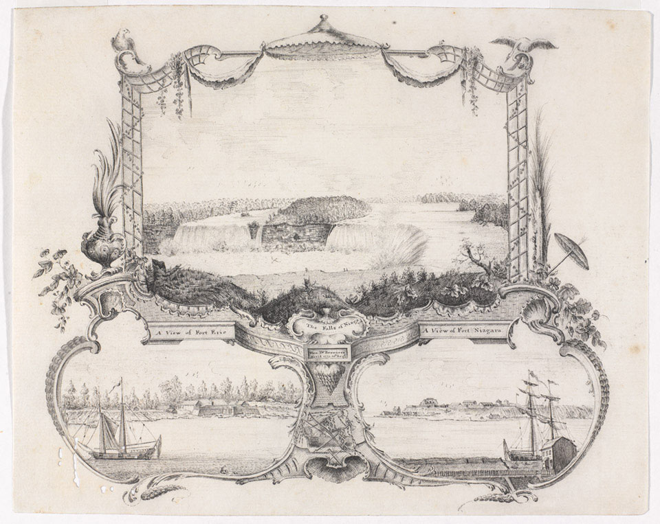
In 1773 the 10th Regiment was stationed along the Niagara River. And we have Ens. DeBerniere’s sketches of Fort Erie, Fort Niagara, and Niagara Falls from that year. Those appear above, courtesy of the U.K.’s National Army Museum. I found another statement saying he probably drew a map of Detroit around the same time.

Thus, by early 1775 Ens. DeBerniere had nearly five years of experience in the army and in North America, and was a practiced draftsman.

TOMORROW: DeBerniere after 1775.

Tuesday, April 27, 2021

“A view or plan of the battle of Bunker’s hill”

On 10 May 1816, the Wilkesbarre Gleaner newspaper, published by Charles Miner, announced a discovery about the Battle of Bunker Hill, more than forty years earlier.

According to a reprint in Niles’s Weekly Register the following month, it said:
I stepped into the house of a friend the other evening, and he told me, that in rummaging over some old drawers he found a curiosity. It was indeed very interesting and curious, to me at least, I dare say it would be so to you, reader.

The thing referred to was a view or plan of the battle of Bunker’s hill, taken by a British officer at the time, who was in the engagement. The execution was in a style of uncommon neatness; and as far as it was possible for me to judge, extremely and minutely accurate.

The references were numerous and particular. The place of landing of the British was laid down—each regiment numbered—the artillery and light infantry particularly designated—the precise line of march pointed out—the situation of the American posts of defence, even to a barn, and the particular force that attacked the barn, laid down.

The place of the greatest carnage or loss of the British—the two vessels that were moored to annoy our people—the battery that played upon our fortifications—the line of retreat and the situation of the craft stationed to cut off our troops, the situation of the commanding officer of the British; and indeed every thing that could tend to give a full and clear idea of the situation and movements of the parties.

On looking over this map deep and strong emotions were excited—pride at the glorious defence made by our undisciplined American yeomanry, against the best regular forces of the old world—patriotism, by considering the spirit and devotion of our militia in defence of freedom and their country—pity for the suffering of the number who fell, and admiration of the dauntless spirit of the assailants and the assailed.

At the same time it was impossible to repress the smile, half in anger and half in mirth at the repetition of the word “Rebels” which occurred so often in the delineation. It brought to our minds the battle of the kegs, where the frequent use of the odious and contemptible expression is so handsomely ridiculed.

This probably is the only accurate plan of that memorable battle, in existence. It ought certainly to be engraved, and the copies multiplied, together with a correct account of the engagement, and to be in the possession of every friend to the liberties of the country.
Publishers were intrigued. Some made inquiry and discovered the man who possessed the hand-drawn map was Jacob Cist of Wilkes-Barre, a postmaster, artist, naturalist, and promoter of anthracite coal (shown above).

A man named I. A. Chapham copied Cist’s map and brought it to Philadelphia, where an engraving firm produced prints for the February issue of the Analectic Magazine. Here’s a digitized image from the Leventhal Map Center at the Boston Public Library.

The next month, the Port Folio published a second engraving copied from the competing magazine with red marks overlaid to show corrections by Gen. Henry Dearborn, a veteran of the battle. Here’s an image of that map. Dearborn’s accompanying article ignited a feud with descendants of Gen. Israel Putnam and others that lasted for years.

The publication of the Analectic engraving revealed the name of the British officer who had sketched the map: Lt. Henry DeBerniere, misidentified as an officer of the 14th (rather than 10th) Regiment.

The manuscript sketch doesn’t survive. Neither does any clue about how DeBerniere’s sketch came into the hands of Jacob Cist. He was born in Philadelphia in 1782, and we know DeBerniere was in that city with the British army in 1777-78. Had the officer left the sketch behind, just as he had left his written manuscripts in Boston?

Cist also worked for the U.S. Post Office Department in Washington, D.C., from 1800 to 1808 before settling in Wilkes-Barre. Did he collect the map as a curiosity? Was he really just “rummaging over some old drawers” when he realized what it was?

The provenance will remain a mystery. Similarly, we have no idea how the historian Peter Force came by DeBerniere’s map of the Massachusetts countryside now in the Library of Congress collection. But Lt. DeBerniere’s map has been one of the main sources for every printed map of the Battle of Bunker Hill since 1818.

COMING UP: The post-Revolutionary career of Henry DeBerniere.

Monday, April 26, 2021

The Lost DeBerniere Manuscripts

On 30 June 1775, Ens. Henry DeBerniere was promoted to the rank of lieutenant in the 10th Regiment of Foot.

Nine months later, on 17 March 1776, he evacuated Boston with the rest of the British military.

That departure was rushed enough that Lt. DeBerniere left behind some of his papers, which locals eventually found. Exactly which locals remains a mystery.

In 1779 the printer John Gill issued a collection of those documents, described on the title page as “Left in town by a British Officer previous to the evacuation of it by the enemy, and now printed for the information and amusement of the curious.”

That title page (shown here) rendered the ensign’s name as “D’Bernicre.” Which is only one of the many ways it was spelled at the time.

The documents in that booklet were:
  • Gen. Thomas Gage’s orders to DeBerniere and Capt. William Brown to scout the countryside—thus giving the publication the title General Gage’s Instructions.
  • DeBerniere’s detailed and dramatic narrative of how he and Brown visited Worcester, Framingham, Marlborough, and Weston, barely making it back home in a snowstorm.
  • A much shorter report on the officers’ similar trek to Concord.
  • DeBerniere’s account of the expedition to Concord and the return to Boston under fire on 19 April.
  • A list of the casualties from that action, naming each killed or wounded officer but giving simple body counts for the enlisted men.
The Massachusetts Historical Society has shared scanned and transcribed pages here.

The year before Gill published, the Massachusetts General Court had passed laws banishing Loyalists and empowering the state to confiscate their property. Citizens who read DeBerniere’s narratives could easily recognize the Loyalists who offered them assistance. Most had left the country, but Isaac Jones of Weston was still at the Golden Ball Tavern. By then, though, he had apparently worked his way back into his neighbors’ graces.

The Massachusetts Historical Society reprinted the text of John Gill’s booklet in a volume of its Collections series in 1815, which is how it shared material before the internet.

That reprint was probably the source for another version of the story told in the voice of Brown and DeBerniere’s servant and published as The Journal Kept by Mr. John Howe While He Was Employed as a British Spy; Also, While He Was Engaged in the Smuggling Business by Luther Roby in 1827.

There was a young printer named John Howe working in Boston in 1775. A Sandemanian and partner of Margaret Draper in the last months of the Boston News-Letter, he evacuated Boston at the same time as Lt. DeBerniere. Eventually he settled in Nova Scotia, and his son became an important figure in early Canadian politics. So he wasn’t the “John Howe” narrating that “Journal.”

In fact, the “Journal” was just a hyped-up version of DeBerniere’s original report, using all the dramatic bits and adding to them, eventually reaching the point of implausibility. Nonetheless, extracts can seem credible, and many authors have been fooled into thinking that 1827 publication is an authentic historical source.

TOMORROW: Another DeBerniere manuscript, and another mystery.

Sunday, April 25, 2021

Ens. DeBerniere’s Last Trip to Concord

Ens. Henry DeBerniere went back to Concord on the British army expedition of 18-19 April.

Indeed, DeBerniere probably served as a close advisor to the mission’s commander, Lt. Col. Francis Smith (shown here). The young officer had been to the town the previous month, had learned about the cannon at James Barrett’s farm, and was in Smith’s own 10th Regiment.

After the column reached central Concord, DeBerniere led Capt. Lawrence Parsons of the 10th Regiment with “six light-companies” farther across the North Bridge to Barrett’s. The ensign wrote afterward, “we did not find so much as we expected, but what there was we destroyed.”

The serious action, DeBerniere came to learn, was back at the bridge, where Capt. Walter Sloane Laurie of the 43rd, whom he called “Capt. Lowry,” and three companies “were attacked by about 1500 rebels.” (As usual, people tended to overestimate the enemy’s numbers.)

In that fight, “three officers were wounded and one killed” along with three soldiers DeBerniere didn’t name. He counted Lt. Edward Hull of the 43rd as “killed.” In fact, Hull was merely wounded at the bridge but wounded again while riding in a carriage to Boston. He finally died in provincial custody on 2 May, which suggests that DeBerniere wrote his account at least two weeks after the battle.

During that exchange of fire at the bridge, Parsons, DeBerniere, and those six companies were still up at Barrett’s farm, searching. The ensign wrote of the local militia:
they let Capt. Parsons with his three companies return, and never attacked us; they had taken up some of the planks of the bridge, but we got over; had they destroyed it we were most certainly all lost; however, we joined the main body.
Actually, Laurie’s men had taken up planks of the bridge. But it’s true that those provincial companies didn’t try to cut off the search party, waiting until all the British forces had left the center of Concord before attacking. (Parsons reported that at least one of the soldiers killed at the bridge was “scalped,” but DeBerniere said nothing about that.)

Elsewhere in Concord, Ens. DeBerniere noted, that “Capt. [Mundy] Pole of 10th regiment…knock’d the trunnions off three iron 24 pound cannon and burnt their carriages.” These guns were the only provincial artillery left in Concord, possibly because they belonged to the town and possibly because they were just too darn big to move.

DeBerniere’s report continued with a description of the British withdrawal under fire; “there could not be less than 5000…rebels,” he now guessed.
we at first kept our order and returned their fire as hot as we received it, but when we arrived within a mile of Lexington, our ammunition began to fail, and the light companies were so fatigued with flanking they were scarce able to act [as flankers], and a great number of wounded scarce able to get forward, made a great confusion;

Col. Smith (our commanding-officer) had received a wound through his leg, a number of officers were also wounded so that we began to run rather than retreat in order—the whole behaved with amazing bravery, but little order; we attempted to stop the men and form them two deep, but to no purpose, the confusion increased rather than lessened:

At last, after we got through [into] Lexington, the officers got to the front and presented their bayonets, and told the men if they advanced they should die: Upon this they began to form under a very heavy fire
Finally Col. Percy arrived with fresh troops and two field-pieces. That changed the balance of power, and the regulars resumed withdrawing east in more orderly fashion. But there was heavy fighting in Menotomy:
out of these houses they kept a very heavy fire, but our troops broke into them and killed vast numbers; the soldiers shewed great bravery in this place, forceing houses from whence came a heavy fire, and killing great numbers of the rebels.
Around seven o’clock, DeBerniere wrote, the army column reached Charlestown. There the soldiers “took possession of a hill that commanded the town,” the soon-to-be-famous Bunker’s Hill. The town’s selectmen, who were strong Whigs but didn’t want their homes consumed by fire and sword, sent a message to Col. Percy saying
if he would not attack the town, they would take care that the troops should not be molested, and also they would do all in their power for to get us across the ferry;

the Somerset man of war lay there at that time, and all her boats were employed first in getting over the wounded, and after them the rest of the troops; the piquets of 10th regiment, and some more troops, were sent over to Charlestown that night to keep every thing quiet, and returned next day.
Thus ended Ens. DeBerniere’s third and last journey into the Massachusetts countryside.

COMING UP: DeBerniere’s papers.

Saturday, April 24, 2021

Concord “fit for ENCAMPMENTS”

When Capt. William Brown and Ens. Henry DeBerniere first ventured out into the Massachusetts countryside in civilian clothes, from 23 February to 2 March 1775, their focus was Worcester.

Gen. Thomas Gage’s spy on the provincial congress’s committee of safety and supplies, Dr. Benjamin Church, had told him that the Patriots were collecting most of their cannon in Worcester.

Brown and DeBerniere confirmed that. They also confirmed that the people of Middlesex and Worcester Counties were on high alert, with multiple people suspecting correctly that they were army spies.

During that first trip the officers also visited Weston, Framingham, and Marlborough. It wasn’t until their next scouting mission starting on 20 March that they visited Concord. That was after some local person started sending Gen. Gage secret messages about James Barrett gathering cannon for the congress in that town, as I relate in The Road to Concord.

Because Concord is such a prominent feature on the hand-drawn map from the Library of Congress collection that I’ve been discussing, DeBerniere must have drawn it after the second foray.

The map is also notable for what its text says about Concord, as shown above:
This Town is well Inhabited and on an entire plain

a Shire Town and great thorough-fare, the roads wide and fit for
ENCAMPMENTS
That label indicates that some officers in the British army in Boston were thinking about occupying Concord for at least one night.

In the end, of course, Gage decided on a one-day expedition, in and out, using a road not on this map.

TOMORROW: Ens. DeBerniere’s second visit to Concord.

Friday, April 23, 2021

Dots on the Ensign’s Map

Yesterday I started to discuss a hand-drawn map from the Library of Congress that Ed Redmond has identified as likely coming from British army spy Ens. Henry DeBeniere weeks before the march to Concord.

That map marks several individual homes. Some of those are places where DeBerniere and his fellow scout, Capt. William Brown, visited on their two treks into the Massachusetts countryside in early 1775.

Others aren’t mentioned in the officers’ report but were the estates of Loyalists, and therefore potential safe houses or places for troops to camp.

Here’s a list of all those marked properties:

“Hatch’s”: Nathaniel Hatch of Dorchester, Loyalist.

“Davis’s”: This site is a bit of a mystery. My best guess is that this is Dr. Jonathan Davies, who bought half of the old Auchmuty estate in the 1750s. Unlike almost all the other homeowners named on the map, Davies wasn’t a Loyalist. Another possibility is that this is the house of Aaron Davis, which ended up on the front lines of the siege.

“Auchmuty’s”: Robert Auchmuty of Roxbury, attorney and Vice Admiralty Court judge, Loyalist.

“Hollowel’s”: Benjamin Hallowell, Jr., in Jamaica Plain, Commissioner of Customs.

“Comm. Loring”: Joshua Loring, Sr., in Jamaica Plain, Loyalist. His mansion remains as the Loring-Greenough House.

“Mr. Fanuil”: Benjamin Faneuil, merchant, Loyalist.

“Mr. Greenleaf”: I’m guessing this home was managed by Sheriff Stephen Greenleaf, who normally lived in Boston. In 1765 his daughter Hannah married John Apthorp, who inherited his father’s Little Cambridge mansion. John and Hannah Apthorp sailed to Charleston, South Carolina, for his health in late 1772, but their ship was lost at sea. Sheriff Greenleaf became the guardian for their young children, and thus probably the custodian of the Apthorp property. Sheriff Greenleaf was seen as a stalwart of the royal government before the war, but he remained in Boston after the siege.

“Brewers”: Jonathan Brewer’s tavern on the Watertown-Waltham line. Unlike the other people named on the map, Brewer was a Whig, as DeBerniere wrote in his report. But the officers did make a memorable stop there, so it was worth mapping.

“Major Goldthwaits”: Joseph Goldthwait of Weston, Loyalist.

“Colonl: Jone’s”: Isaac Jones of Weston, a Loyalist before the war and a supporter of the Continental Army during it. Brown and DeBerniere used his Golden Ball Tavern as a base, and it’s still standing.

“Doctor Russell”: Dr. Charles Russell of Lincoln, Loyalist. His house survives in altered form as the Codman House.

“Nineteen Mile Tavern”: This establishment appears to be in Sudbury, but I haven’t found any mention of such a place. The most famous surviving tavern in Sudbury is the Wayside Inn, but this appears to have been closer to the center of town.

TOMORROW: The map’s proposition.

Thursday, April 22, 2021

The Ensign’s Map of a Road to Concord

In 2016, Ed Redmond of the Library of Congress’s Geography and Map Division shared an interesting discovery about an item in that collection.

Redmond wrote:
Several years ago, I stumbled across an unsigned manuscript map with the supplied title of “Roxbury to Concord. Roads & distances, &c.”

This unique map was acquired by the Library of Congress in 1867 as a part of the Peter Force Collection, which includes more than 750 Revolutionary era printed and manuscript maps transferred to the Geography and Map Division. . . .

According to General Gage’s Instructions printed by Boston publisher J[ohn]. Gill in 1779, General Thomas Gage, the commander of all British troops in North America at the time, ordered two British soldiers, Captain [William] Brown and Ensign [Henry] De Berniere, to discretely survey the roads in the vicinity of Boston.

“We set out from Boston on Thursday night, disguised like Gentlemen in brown clothes and reddish handkerchiefs round our necks; at the ferry of Charlestown we met a sentry of the 52nd regiment but Capt. Brown’s servant, whom we took along with us, bid him not to take any notice of us so that we passed unknown to Charlestown. From that we went to Cambridge, a pretty town with a college built of brick. We next went to Watertown and were not suspected. A little out of this town we went into a tavern, a Mr. [Jonathan] Brewer’s, a whig, [and] we called for dinner…”

All of the towns mentioned in the text, including “Brewers” tavern, appear on the manuscript map. The two British “surveyors” then sent their various large scale surveys back to Boston with their servant and returned separately to avoid being discovered as spies.

A few weeks later, on March 20, 1775, roughly one month before the events of April 18-19, 1775, Captain Brown and Ensign De Berniere received additional instructions from General Gage to survey the road to Concord:

“We went through Roxbury and Brookline, and came into the main road between the thirteen and fourteen mile-stones in the township of Weston; we went through part of the pass at the eleven mile-stone, took the Concord road, which is seven miles from the mainroad. The town of Concord lies between hills that command it entirely; there is a river runs through it, with two bridges over it.” . . .

Following their reconnaissance of Concord and vicinity the spies continued on [actually back] to Lexington:

“We dined at the house of a Mr. [Daniel] Bliss, a friend to government; [who] told us he could shew us another road, called the Lexington road. We set out and crossed the bridge in the town. The road continued very open and good for six miles, the next five a little inclosed, (there is one very bad place in this five miles) the road good to Lexington. You then come to Menotomy, Cambridge, and so to Charlestown…”

Once again, all of the towns mentioned in the text (with the exception of Lexington) appear on our map. Additionally, the distances between the towns are laid down on the map and correlate with the figures given in the text, even though the map is not drawn completely to scale.
All that said, this map does not show the road from Cambridge to Concord that the British expedition followed on 18-19 April. Though the officers reported returning from Concord on “the Lexington road [through] Menotomy, Cambridge, and so to Charlestown,” they didn’t add that route to this chart.

Did that affect the British expedition’s level of preparation in April 1775? 

TOMORROW: More on this map.

Wednesday, July 29, 2020

Getting Out of Marlborough in 1775

When we left Capt. William Brown and Ens. Henry DeBerniere, they were in a back room of Henry Barnes’s house in Marlborough, listening as he tried to send away a member of the local committee of correspondence.

Dr. Samuel Curtis had shown up that evening of 1 Mar 1775, uninvited and asking to stay to supper. Barnes told him the doctor that he couldn’t stay because the family already had company.

Dr. Curtis then turned to a child—DeBerniere wrongly understood the girl to be Barnes’s daughter—and asked “who her father had got with him.”

According to the ensign, “the child innocently answered that she had asked her pappa, but he told her it was not her business.”

Still suspicious but unable to learn more, the doctor left. Brown and DeBerniere decided he was probably going to gather his political allies, so they should stay only a couple of hours to rest. They would leave at midnight, regardless of the snowy weather.

But even that was too leisurely, DeBerniere later wrote:
we got some supper on the table and were just beginning to eat, when Barnes (who had been making enquiry of his servants) found they [local Patriots] intended to attack us, and then he told us plainly he was very uneasy for us, that we could be no longer in safety in that town: upon which we resolved to set off immediately
The two officers had been inside for only twenty minutes, they estimated. Barnes took them “out of his house by the stables, and directed us a bye road which was to lead us a quarter of a mile from the town.”

Brown and DeBerniere hiked through the blowing snow until they reached “the hills that command the causeway at Sudbury, and went into a little wood where we eat a bit of bread that we took from Mr. Barnes’s, and eat a little snow to wash it down.”

At the next house, a man came out and asked Brown, “What do you think will become of you now?” By this time the officers were totally on edge, unable to tell whether the people they met recognized who they were and were helping to plan an assault or just thought it strange for two strangers to be out walking in the night during a snowstorm.

In Sudbury the officers encountered “three or four horsemen.” Those riders moved to either side of the road, letting the strangers pass between them while they watched silently.

Brown and DeBerniere reached the safety of Isaac Jones’s Golden Ball Tavern in Weston about 10:30 P.M., having walked 32 miles that day. The next day, the officers got into Boston, where they were safe. They wrote out a detailed report for Gen. Thomas Gage, which is our source for all this information. They turned over sketches and maps of the route out of Worcester in case the general planned a march that way.

Meanwhile, back in Marlborough, soon after the British scouts left, there was yet another knock on Henry Barnes’s door. This time the whole Marlborough committee of correspondence showed up and “demanded” to see the visitors. Barnes insisted those two men were not army officers “but relations of his wife’s, from Penobscot, and were gone to Lancaster.” According to DeBerniere’s report:
they then searched his house from top to bottom, looked under the beds and in their cellars and when they found we were gone, they told him if they had caught us in his house they would have pulled it about his ears.
Among the Marlborough committee-men was Alpheus Woods. Five years earlier, Woods had also been on the town committee to make Barnes follow the non-importation agreement. Barnes’s supporters had accused Woods of sending the merchant a letter threatening to burn down his potash works and house. Now Woods had nearly caught Barnes harboring British army spies.

Henry Barnes departed Marlborough a few days after his busy evening. His wife Christian Barnes went to stay with her friend Elizabeth Inman until past the actual outbreak of fighting in April. Taking refuge in Boston, they left the Marlborough estate in the hands of Henry’s adult niece, Catharine Goldthwait.

Under Massachusetts committee of safety guidelines, local committees weren’t supposed to confiscate property from Loyalists as long as some family members were still living peacefully on it. But the Marlborough committee including Alpheus Woods did take property from the Barnes estate, including furniture they loaned to Col. Henry Knox. Catharine Goldthwait complained about that to the General Court, to no avail.

In February 1776, Henry Barnes learned that a bequest worth almost £2,000 was awaiting him in London. He and Christian sailed that month, ahead of the end of the siege. Catharine Goldthwait followed a few years later, and Massachusetts confiscated her uncle’s property. Henry and Christian Barnes received a small Loyalist pension until he died in 1808.