Americans Fortify Lamb’s Dam in Roxbury
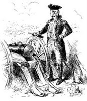
 We don’t usually think of Gen. George Washington’s American army having lots of cannons until Henry Knox brought heavy siege guns from Fort Ticonderoga in early 1776. But in fact the Continental artillery regiment (still under the command of Col. Richard Gridley) was large enough to keep up a steady bombardment of British military positions through the summer and fall of 1775. They were also strengthening their fortifications and moving closer to the British lines.
One of the artillery’s new positions was a spot in northern Roxbury called “Lamb’s Dam.” An 1876 review of the British evacuation stated:
The original line of American fortifications crossed what is now Washington street on the line of division between Boston and Roxbury, near the present Clifton place. On the 23d of August, 1775, the work of fortifying Lamb’s Dam was begun, and upon the completion of that work the line of fortification was advanced to a point a little south of the present Northampton street.In 1796 the creek that Lamb’s Dam sat on was turned into the Roxbury Canal. Today this is the neighborhood slightly west and south of the Boston Medical Center.
Lamb’s Dam extended from about the junction of Hampden and Albany streets to a point near the present Walnut place. It was originally built to keep the tide from overflowing the marshes, and followed very nearly the present line of Northampton street, diverging slightly to the southward as it neared the highway. At the termination of the Dam, on the upland, a strong breastwork was constructed, and from that the intrenchments extended across the highway.
The works were completed September 10, 1775, without opposition from the British, although within musket-shot of their advanced posts.
It took a little less than a month before the artillery battery at Lamb’s Dam started to exact casualties. On 6 October, Boston selectman Timothy Newell recorded:
The Provincials from Lams Dam discharged their cannon at the Regulars, as they relieve guard at the lines—One Corporal killed with a cannon ball.

3 comments:
That is really interesting. I think it gives a very different perspective on the area on general. I think it is generally forgotten that all of Boston has a historical context--not just the buildings and sites we directly label or register as such.
Thank you for sharing this informative information on Richard Gridley. He was a key component to the habitation of the Magdalen Islands and it is without doubt, that you have opened a whole new facet of his personality here on your website.
I appreciate your visit to my own site and leaving this link.
The source for the location of Lamb's Den is http://www.archive.org/stream/cu31924032750006#page/n20/mode/1up
Post a Comment